

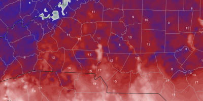
Extreme Cold Weather or as I like to call it #RoCold has returned
Now that we all have enjoyed the snowfall and have had sometime to play in it. The even more serious side of this weather system moves into the county and the area. I coined the phrase #RoCold a few years ago when "Extreme Cold" air moved into the county.

A look at the aftermath of the Snowfall here at the weather center.
One of my favorite things to do is take the #RoCoDrone out and get some great video and photo's of weather. The best time is one of the rarest times for us in Rowan County. That's when there is snow on the ground. As I was forecasting this storm and reporting on conditions during the storm.
Friday 8pm Winter Weather Update
I know that some of you have been a little curious about the lull in the action over the last hour or so here around the county. Well don't worry the snow is about to move back in and things are going to decline pretty quickly once that occurs.
Last Snowfall Accumulation Prediction the winter storm moving through the county
Ok so you've had read my post and updates to this point. So here is my final snowfall prediction for the winter storm moving through the county. I will not make any adjustments to the snowfall prediction totals form here on. We will have to see if I hit the mark after all is said and done.
Friday Afternoon Winter Weather Update
This is my next to last update that will involve accumulation predictions. I will post one more update around 5:30pm with my last call forecast for accumulations. As for now heres my current thinking.
Friday Mid Morning Winter Storm Weather Update
We are within 12 hours of seeing our first snow of the season falling around the county. I am continuing to monitor a lot of fluid and changing information in the models. Here are the latest timeline details as well as updated accumulation totals for the county.
Early Friday Winter Weather Update
We are less than 24 hours out for this winter storm and the models are continuing to show a trend our way with the heavy snow band. Enough so that I am making changes to the accumulations and the snow meter yet again.
Snow Accumulations raised again for Saturday
The models continue to provide more insight on where the heavy snow band is likely to setup with the winter storm coming in late tomorrow and on Saturday. The deformation zone or heavy snow band looks to be trending back our direction even further.
Snowfall Update for Saturday
There is no doubt we are going to get snow on Saturday here in Rowan County. The real question remains on just how much. Once again I am bumping on my snowfall accumulation predictions. I am forecasting 1-3 inches of snowfall for Rowan County on Saturday now.
Update on Snowfall for Saturday
Confidence continues to build for snow here in Rowan County on Saturday. We will go through a brief transition on Friday evening and early Saturday before it becomes all snow. Let's take a look at the latest.