
Friday Mid Morning Winter Storm Weather Update
We are within 12 hours of seeing our first snow of the season falling around the county. I am continuing to monitor a lot of fluid and changing information in the models. Here are the latest timeline details as well as updated accumulation totals for the county.
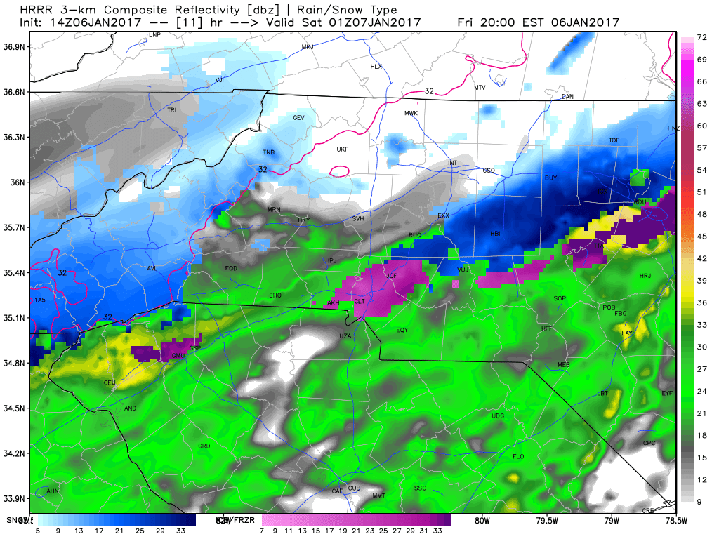
I am expecting rain to start falling around the county this afternoon around 1 - 2 pm. I think we will continue to see light rain fall until around 7 or 8 pm this evening when we could see a brief period of sleets before changing over to all snow.

The ground is warm and it will take a little while for us to get below freezing with those ground temps so I on anticipate around a trace of snow around the county by midnight tonight. It is during the overnight hours where things start to change quickly.
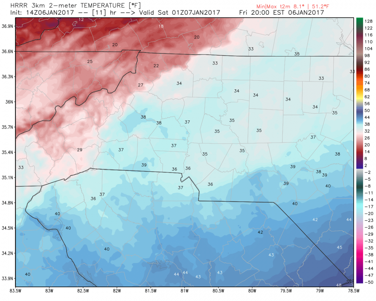
Temperatures will still be in the mid 30's by around 8pm this evening as well. That will certainly have an impact on the snow sticking to the ground by that time. You may see it stick to elevated surfaces but the roadways will simply be wet for the early part of the evening.
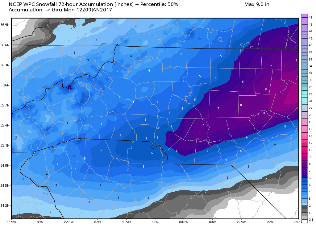
The heavy snow band is continuing to shift our way with the model guidance. If this indeed verifies we stand a 50% chance of seeing 5 - 7 inches around the county.
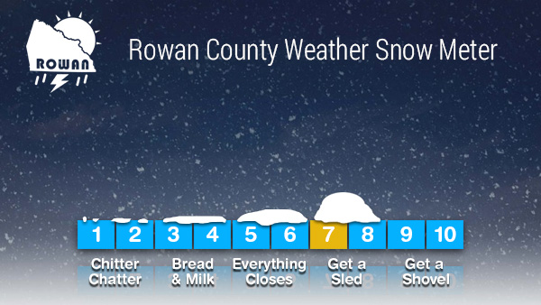
My updated forecast totals are now 4-6 inches of snowfall around the county with most of the snowfall occurring during the overnight hours and tapering off in the morning hours on Saturday. 70% chance of snow and that will likely be raised to 100% before the day is over. Snow Meter will remain at 7 for now but could be bumped up again if the trend for high snow totals continue.
I will provide additional updates throughout the remainder of today and through the duration of this event right here and on my social media outlets
As always thank you for following Rowan County Weather!