
Friday 8pm Winter Weather Update
I know that some of you have been a little curious about the lull in the action over the last hour or so here around the county. Well don't worry the snow is about to move back in and things are going to decline pretty quickly once that occurs. Let's first take a look at the current radar view as of 8pm here in the area.
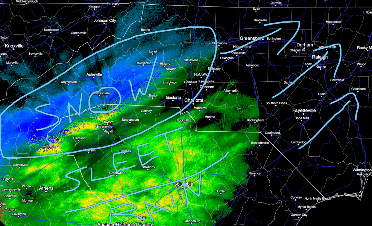
As you can see from the radar image above. There is a mixed bag of precipitation moving into the area. The snow will move back into the county over the next hour or so here in the county. We could see another brief wintry mix as the precipitation starts to pick back up again. As you go south and east of the county things will transition to sleet and eventually rain as you continue to move south and east of the county. This is going to be mainly a snow event for the remainder of the storm here in Rowan County.
Lets take a look at a time frame as we continue into the overnight hours.
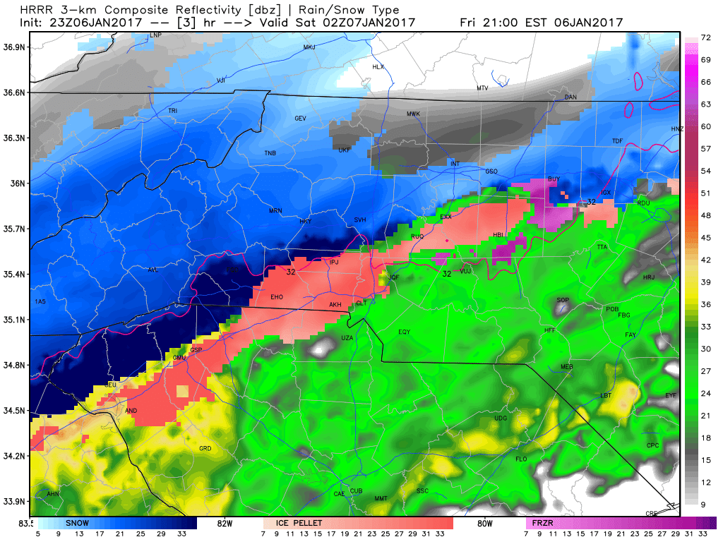
The model image above is showing that brief period that we could see of a wintry mix as the precipitation begins to kick back up again around the county. Don't worry though as we continue to move later into the evening look what happens.
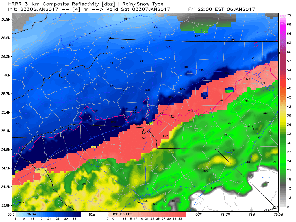
By 10pm things are starting to really get going with the snow around the county as the rain snow line starts to shift south and east.
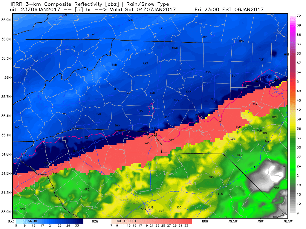
By 11pm we will all be getting a good snow storm moving through the county. I expect the snow to continue right into the lunch time hours of Saturday. Again 5 - 7 inches is what I have forecasted. I will continue to post updates throughout the evening and all the way to the end of this event. As always thank you for following Rowan County Weather!