
Snow Accumulations raised again for Saturday
The models continue to provide more insight on where the heavy snow band is likely to setup with the winter storm coming in late tomorrow and on Saturday. The deformation zone or heavy snow band looks to be trending back our direction even further. That is causing me to raise my snowfall predictions from 1-3 inches to now 2-4 inches around the county. Just so you all see what I am looking at with the models I will share them below. Now you have to consider a few things with the models. One is there will be some rain to start this storm off. So those rain totals in some models calculate into the snowfall total. That will bring you snowfall accumulation down. Additionally the ground is warm. The snow is not going to immediately stick to the ground. It will take a little while for that to occur/ That will also take away from potential accumulations in the models.

The model above is the European Model. This model has been trending to a very tight gradient on snowfall. The European model is leaning toward 2-4 inches around the county. I am in agreement with these totals.
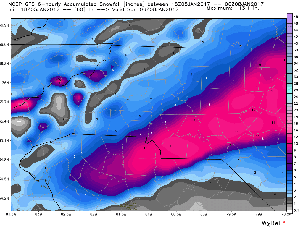
The GFS Model above is predicting 5-7 inches around the county with the heavy snow band or deformation zone just to our south and east. The issue is the model is not really taking count for the rain on the front end and the warm ground temps that will keep the snow from accumulation for a little while after it starts. I think the model is slightly over stated.

The NAM model above is 7-9 inches around the county with the deformation zone and heavy snow band over the county. The problem with this model is deformation zones and heavy snow bands are very tight and do not cover a very large area in terms of width. This model has the heavy snow band and deformation zone covering most of the state. I feel this model is doing a horrible job in that calculation and it also is not accounting for rainfall and ground temps on the front end.
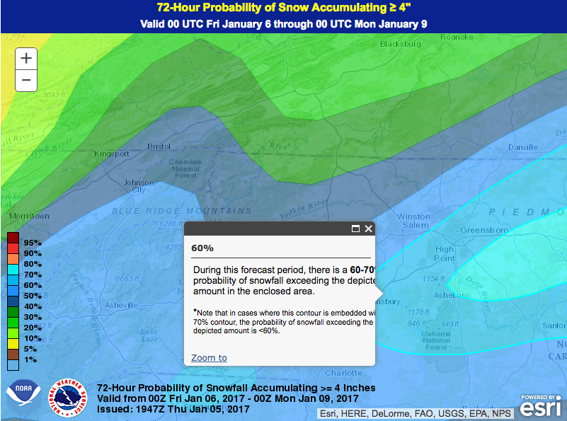
The probabilistic map above is giving us a 60-70% chance of around 4 inches of snowfall around the county. I feel pretty confident in that occurring somewhere in the county. Just not everywhere.
So again my forecast at this point is for snow fall accumulations of around 2-4 inches around the county. Please also take time to remember your outdoor pets this weekend. It is going to be extremely cold especially on the backside of this storm.
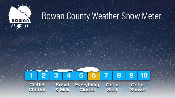
The snow meter is being raised to a 6 since the totals have gone up.
I will continue to monitor the data and provide updates right here and on my social media pages. As always thank you for following Rowan County Weather!