
Friday Afternoon Winter Weather Update
This is my next to last update that will involve accumulation predictions. I will post one more update around 5:30pm with my last call forecast for accumulations. As for now heres my current thinking.
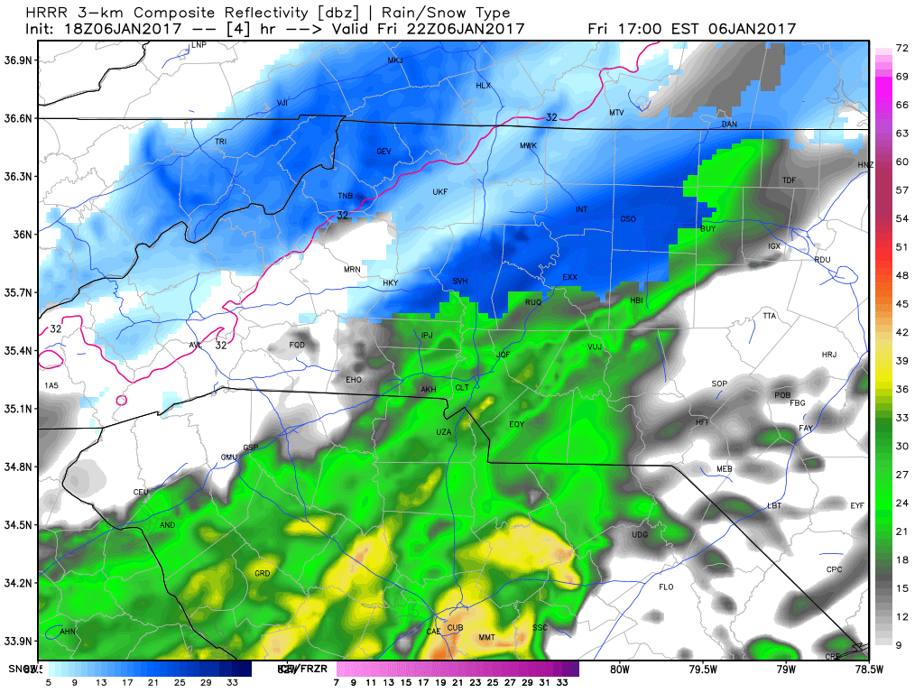
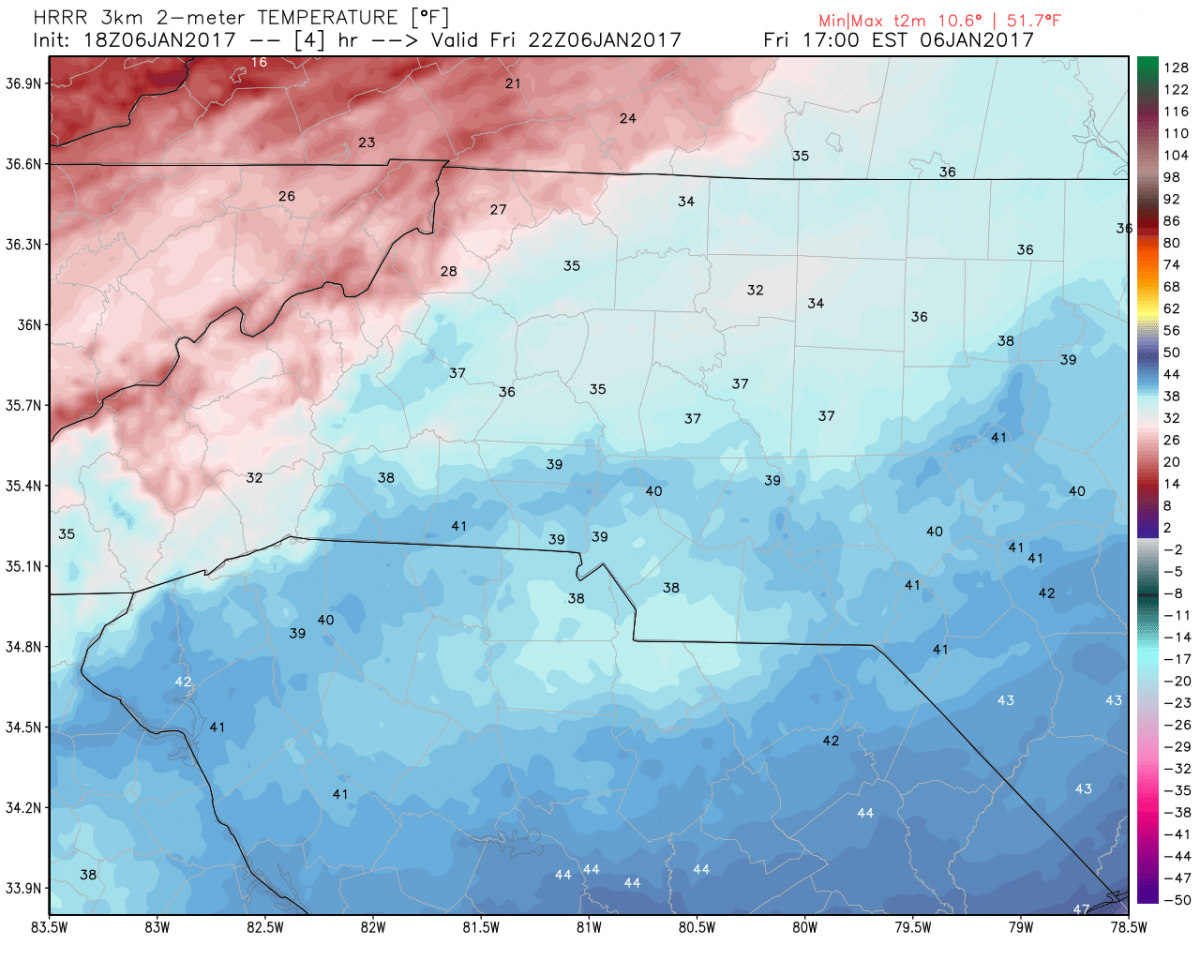
Light rain is expected to move though the county over the next few hours. I am thinking around 5-6 pm we could see a mix of sleet and snow start to occur with the rain. The key factor is that the air temps are still going to be above freezing so that will keep road conditions mainly wet for a few hours.
Around 7-8 pm tonight I am expecting us to start seeing all snow. The real factor here is that it looks like the heavy snow band and deformation zone will be right along the county around the eastern areas of the county. If that continues to verify areas along the eastern border of the county could see as much as 7 inches of snow by the time the snow moves out tomorrow.
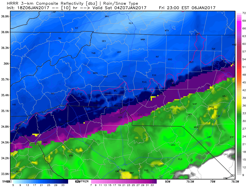
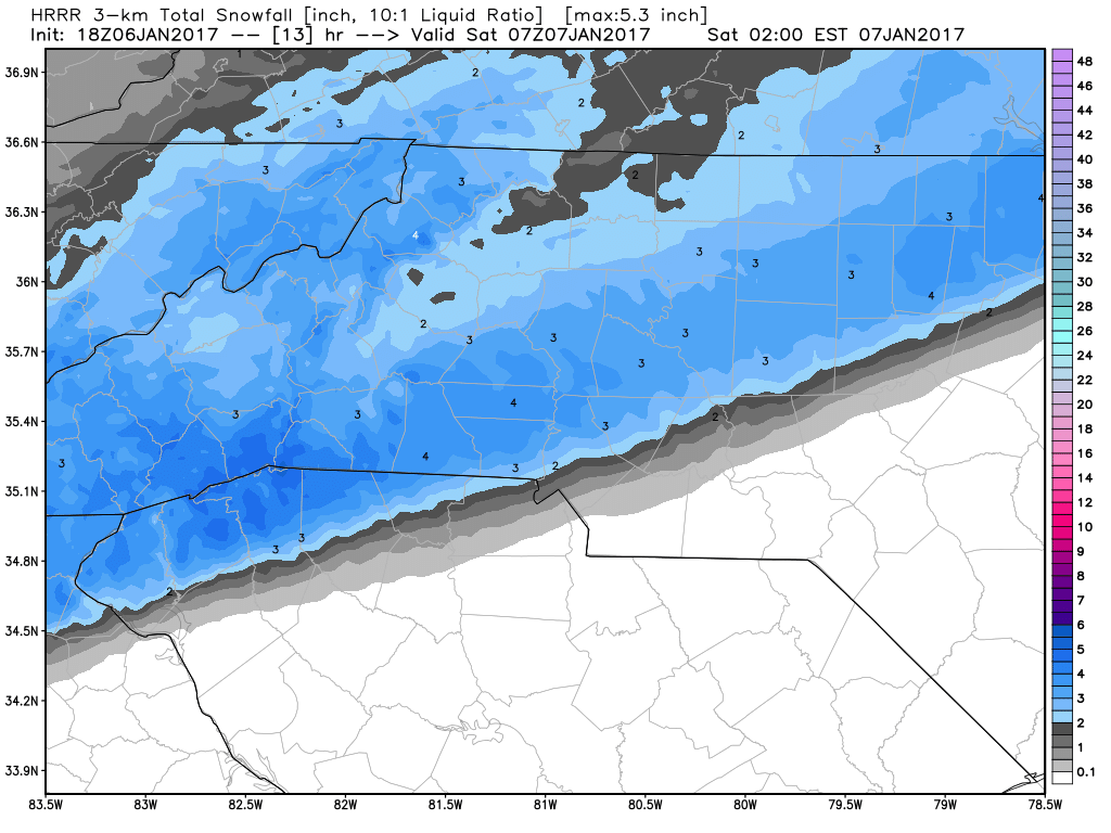
It is likely we will start to see snow accumulate on the roads around midnight or just after the start of the overnight hours of Saturday. 1-3 inches is possible based on the model data below for that time period.
Current Forecast predictions
90% Chance of rain this afternoon and early evening. Transitioning to a brief wintry mix around 5pm. Then all snow will begin to fall later this evening around 7 - 8 pm. More accumulations for areas east of 85. I am bumping up my overall snow totals to 5-7 inches around the county. Again areas right along the eastern edge of the county will see the higher amounts closer to 7 inches. I will provide my last call totals for predictions around 5:30 tonight.
Snow meter is being raised to an 8. We will most likely top out right here with the snow meter.

I will provide updates right here an on my social media outlets throughout this storm. As always thank you for following Rowan County Weather!
Please let our local sponsors know that you appreciate their support of our blog. Take a moment to visit their website linked at the top of this post.
Share this:

Announcements & Events
Check back often for important announcements and events that I'll be involved in!