
Tropical Disturbance Remains Unlikely to Develop Before Moving Into Mexico
The National Hurricane Center continues to monitor a tropical wave moving across the Yucatan Peninsula and into the Bay of Campeche.
Friday Could Be the Hottest Day So Far This Year in Rowan County
ROWAN COUNTY, N.C. — Summer heat is arriving in full force across Rowan County, and Friday is shaping up to be the hottest day of the year so far for many locations.
First Atlantic Disturbance of the 2026 Hurricane Season Appears in National Hurricane Center Outlook
Just 10 days into the 2026 Atlantic Hurricane Season, the National Hurricane Center (NHC) is tracking the first area of potential tropical development of the season.
Heat Builds Across the Carolinas: Near-100° Heat Index Values Expected Thursday and Friday
After a relatively comfortable start to June, much hotter weather is set to arrive across Rowan County and surrounding areas later this week.
First Significant Summer Heat of 2026 Arrives This Week Across Rowan County
After a relatively comfortable start to the week, the first significant stretch of summer heat is set to arrive across Rowan County beginning Wednesday and continuing through the weekend.
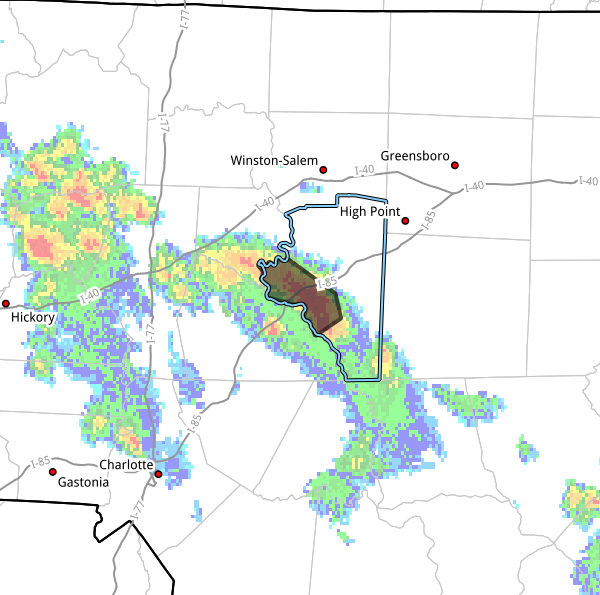
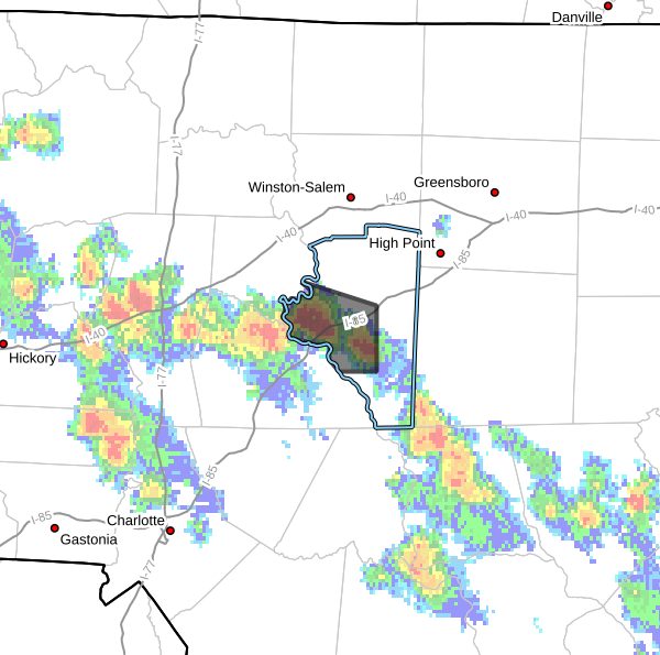
Flood Advisory Issued for Southwestern Davidson County Until 9 PM
The National Weather Service has issued a Flood Advisory for portions of southwestern Davidson County due to heavy rainfall and the threat of minor flooding.
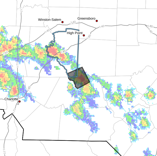
Strong Thunderstorm Moving Through Portions of Davidson, Montgomery, and Randolph Counties
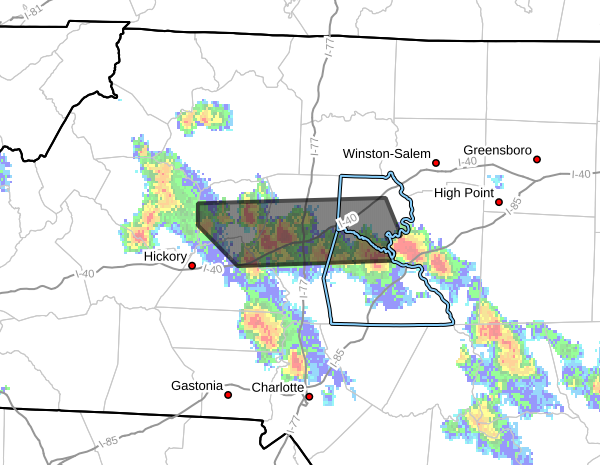
Strong Thunderstorms Impacting Portions of Rowan, Davie, Iredell, Alexander, and Catawba Counties
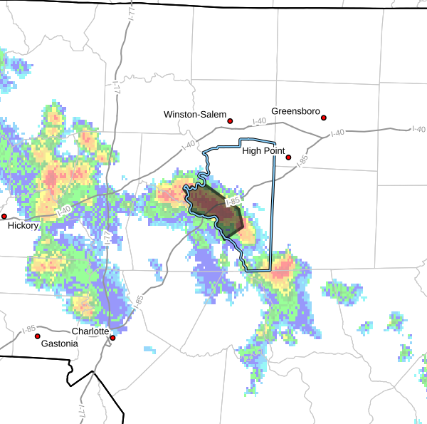
Strong Thunderstorm Moving Through Central Davidson County
A strong thunderstorm is moving across portions of central Davidson County this evening, prompting a Special Weather Statement from the National Weather Service.

Announcements & Events
Check back often for important announcements and events that I'll be involved in!
