
Strong Thunderstorm Moving Through Central Davidson County
A strong thunderstorm is moving across portions of central Davidson County this evening, prompting a Special Weather Statement from the National Weather Service.
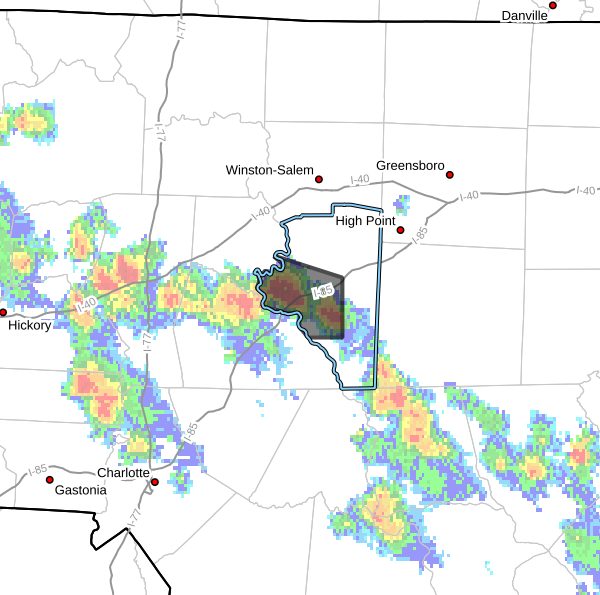
As of 5:27 PM, Doppler radar indicated a strong thunderstorm near Linwood, approximately 8 miles west of Lexington. The storm was moving west at around 10 mph.
Hazards Associated With This Storm
The National Weather Service reports the storm is capable of producing:
- Wind gusts up to 40 mph
- Pea-sized hail
- Frequent lightning
- Heavy rainfall
While this storm is not currently severe warned, it may still produce hazardous conditions for those in its path.
Areas Impacted
Communities and locations that may be affected include:
- Lexington
- Linwood
- High Rock Lake
- High Rock Lake Marina & Campground
- High Rock Boat Dock Marina
Travelers along Interstate 85 between mile markers 83 and 96 should also be prepared for rapidly changing weather conditions, including reduced visibility in heavy rain.
Wind and Hail Threat
Wind gusts approaching 40 mph could knock down small tree limbs and blow around unsecured outdoor objects. Small hail is also possible and may cause minor damage to vegetation and sensitive outdoor plants.
Lightning Safety
Frequent lightning is often one of the most dangerous hazards associated with thunderstorms. Remember that lightning can strike several miles away from the heaviest rainfall.
If you can hear thunder, you are close enough to be struck by lightning and should seek shelter immediately inside a substantial building.
Stay Weather Aware
Residents and visitors in the affected area should continue monitoring weather conditions as additional showers and thunderstorms remain possible through the evening hours.
Rowan County Weather will continue tracking this storm and provide updates if additional statements or warnings are issued for Davidson County.