
Winter weather possible tomorrow but dry and warm air could play a part
We are around 24 hours from potentially seeing winter weather around the county and the area. However, there are some obstacles that we need to cross. Depending on how it plays at some could see what they want while many are disappointed. Let's take a look at what the NAM model is showing. I do want to caution you that other models are indicating dryer air that could give us very little to no precipitation while others are showing a chance for the mix because of warm air.

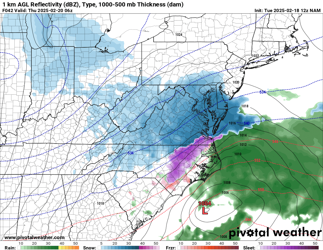
We could see a mixed bag of precipitation early Wednesday morning with a better chance of seeing something reach the ground around 10am. as we progress through the day there could be a tug of war with dry air and warm air along with cold air that could play havoc on the forecast by causing precipitation to change back and forth along with literally nothing potentially happening at times.
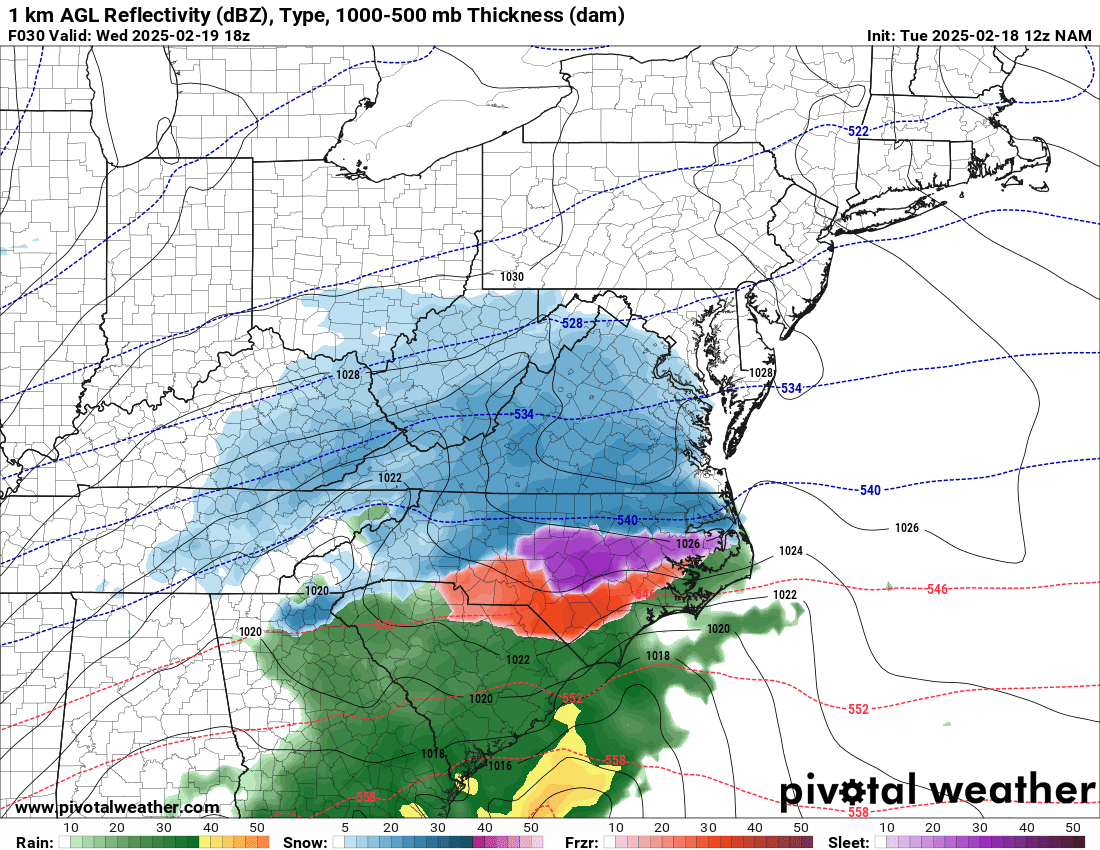
By 1pm we could still be getting a mix of snow/sleet and freezing rain around the county as the warm air is going to be very close to the county for this event. Please remember sleet will bring snow totals down as well.
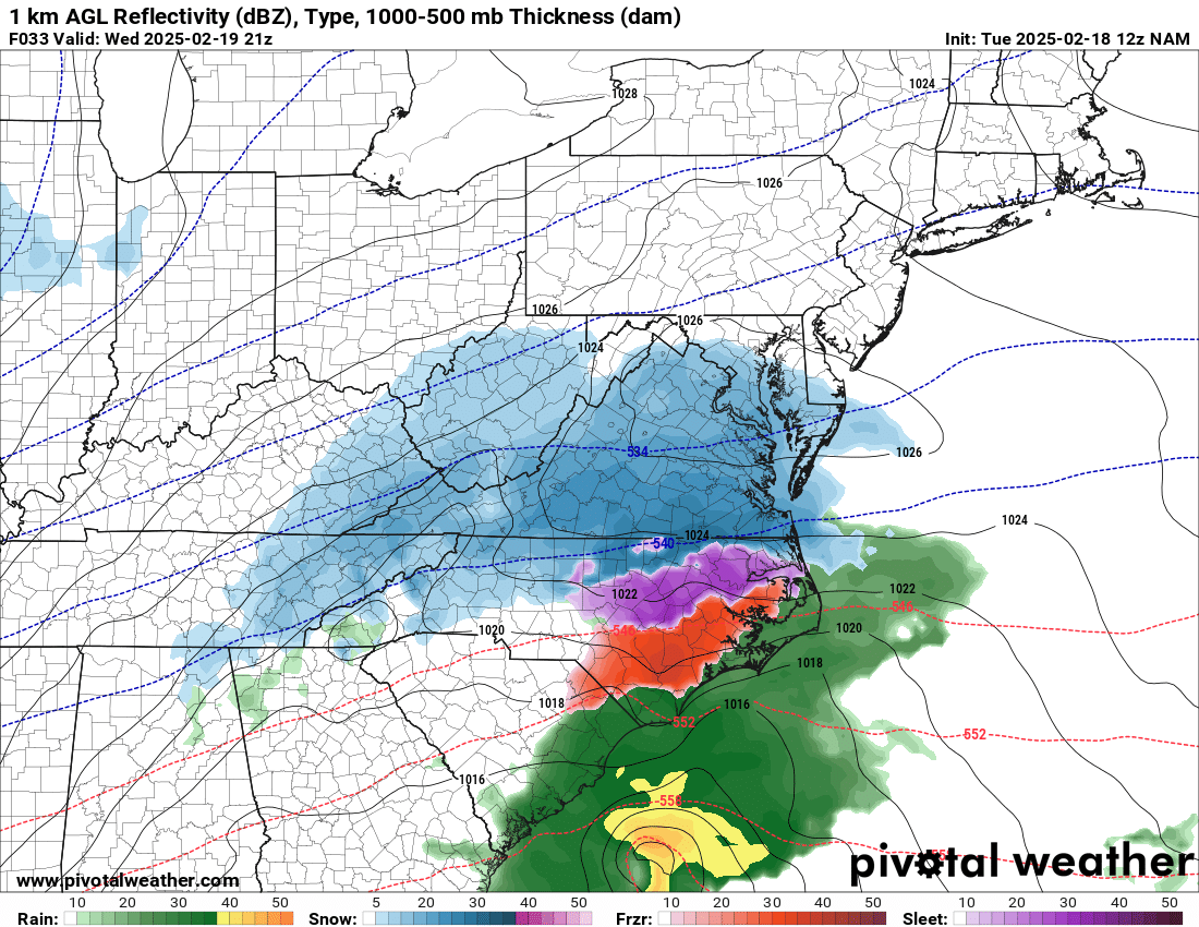
By 4pm dry air could have a big impact on the county and some of the area to our south giving us literally nothing happening in terms of precipitation. Again if this occurs totals drop for any precipitation.
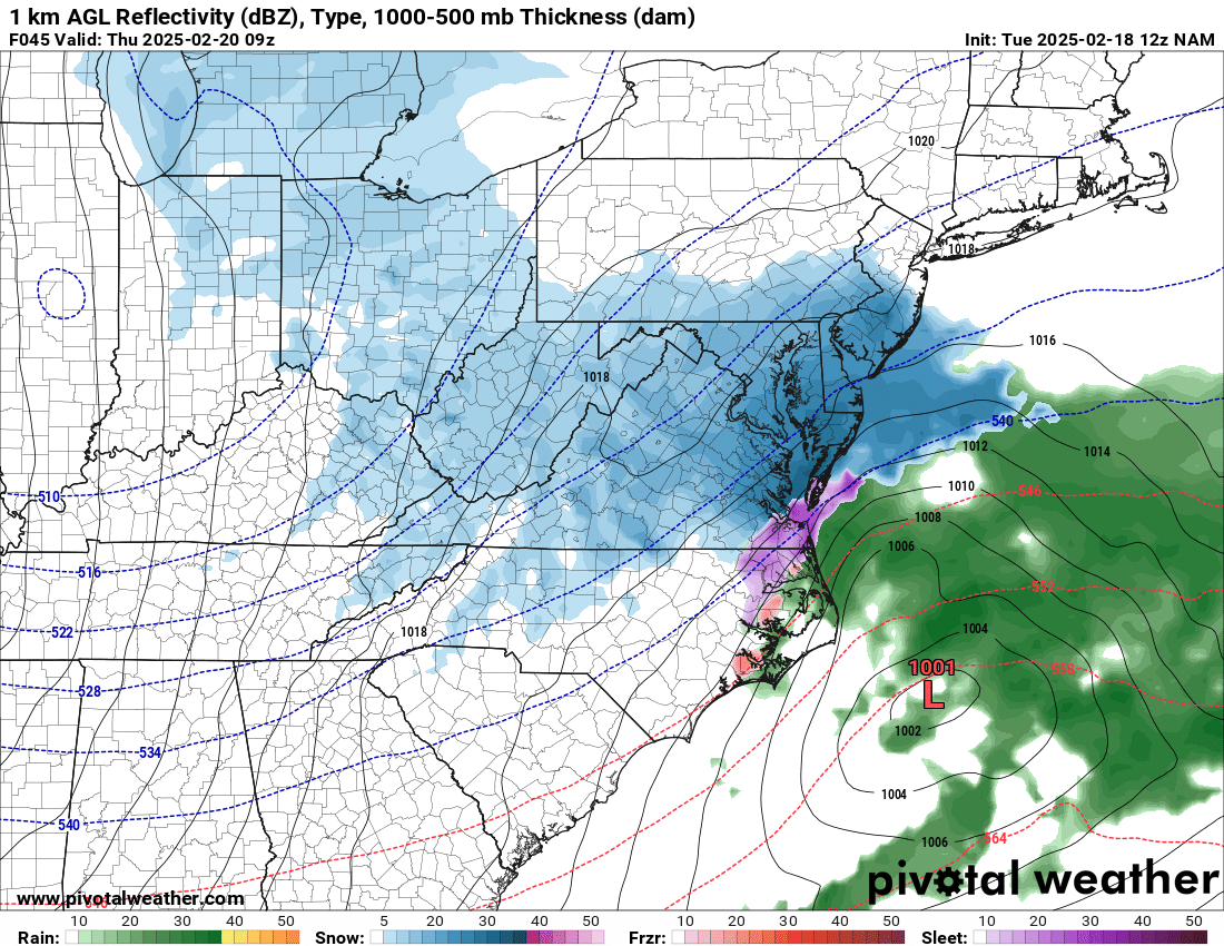
By the evening hours Wednesday we could see the return of precipitation around the county but again it will likely be a mix of snow/sleet and freezing rain along with just a very cold rain.
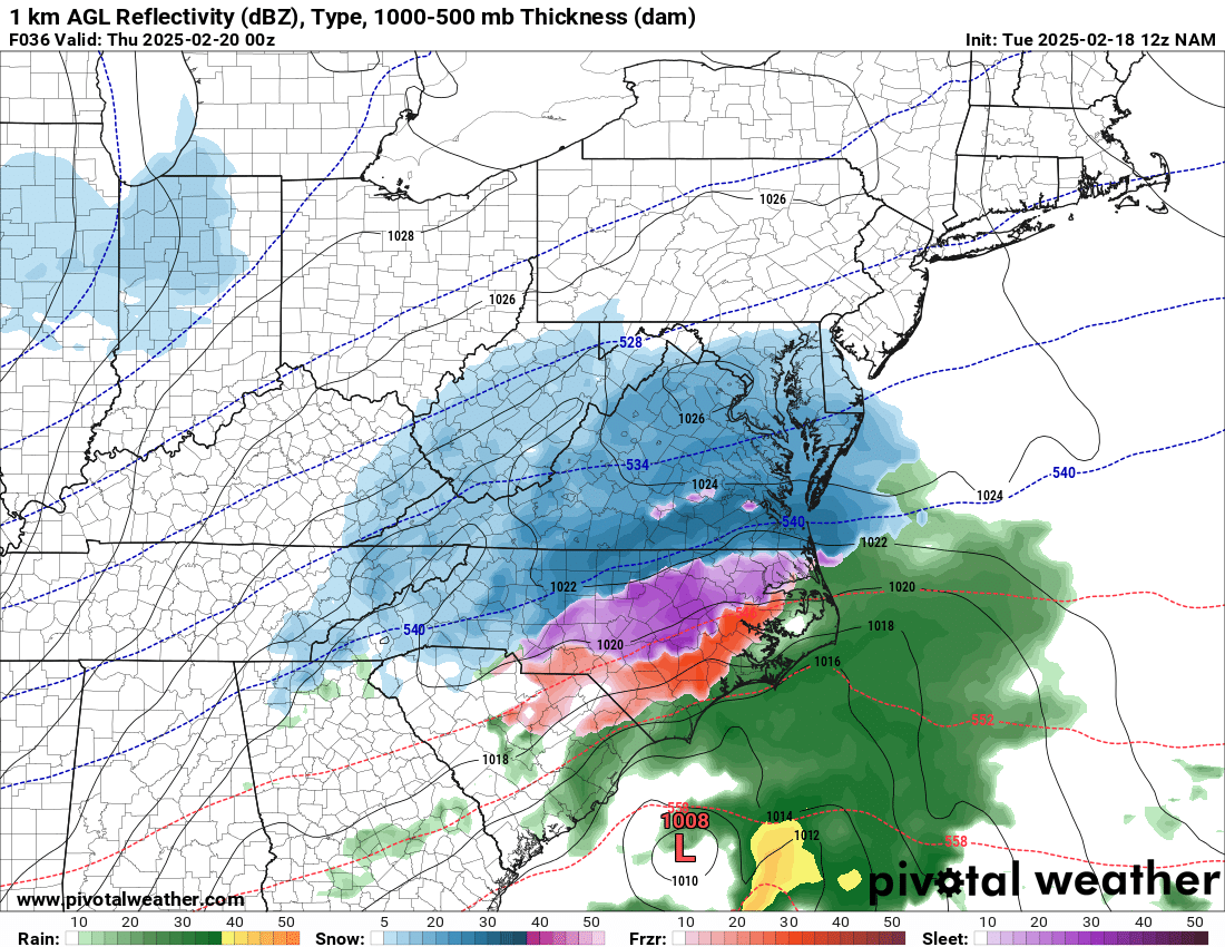
Late Wednesday evening we could see enough cold air come back into play that we could see more snow around the county however, we can't rule out the warm nose being close enough ot create a mix of snow and sleet.
Very early during the overnight hours of Wednesday into Thursday the dry air starts to win out once again and as I stated earlier this will pull away form accumulation totals if it does in fact occur.
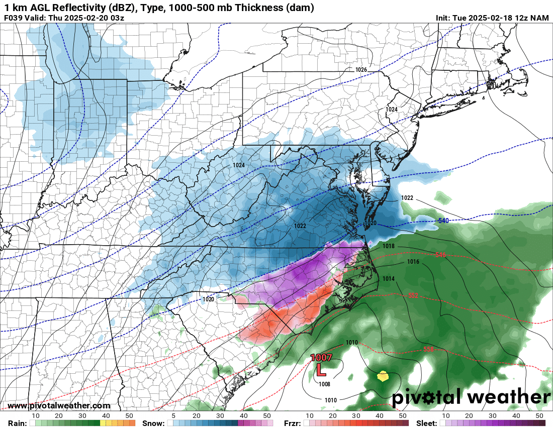
By very early Thursday morning dry air will certainly be the big factor likely bringing any precipitation to an end. I cannot stress this enough. If we get a mix of snow and sleet. You will ot see very high snow accumulation totals. The sleet will take away from it. I know I am beating a dead horse, but many get hung up on snow totals and what they want to see oit may do. I am just giving it to you straight.

Around daybreak Thursday morning we could see one last quick shot of snow around the county and the area. Not enough to get too excited about but certainly something many may want to see.
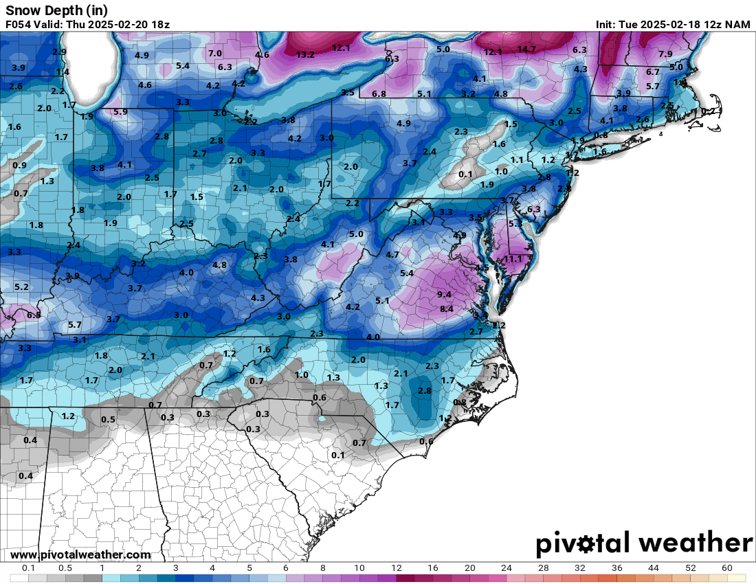
The image above shows potential accumulation from sleet and snow. Keep in mind models do not do a very good job of differentiating from freezing rain and rain that could also be precipitation types we see with this system at times.
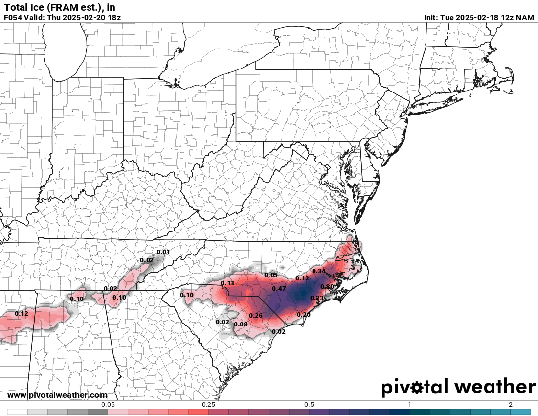
I certainly will not rule out some ice accumulation around the county with the overnight temperatures of Wednesday into Thursday being at or below freezing. Anything laying on the roadways will certainly freeze.
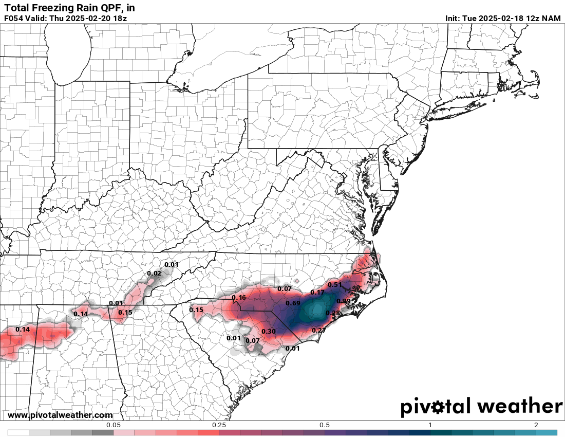
The freezing rain potential is also extremely possible with this system as temperatures at times will be above freezing at the ground level so if any rain is falling it will not freeze on impact but if we get at or below freezing it will fall as rain but freeze on impact/
I am still forecasting around an inch or less of snow and as I have stated repeatedly sleet will take away from those totals.
A glaze to a tenth of an inch of ice accumulation is also possible around the county with warm air in place.
One way or the other some will be happy with the outcome and others will be angry or upset about it. Stick with Rowan County Weather for the latest as we head into our next shot at winter weather around the county over the next 24 to 48 hours.
Please let our local sponsors know that you appreciate their support of our blog. Take a moment to visit their website linked at the top of this post.
Share this:

Announcements & Events
Check back often for important announcements and events that I'll be involved in!