
Bank Of America 500 Weather Update
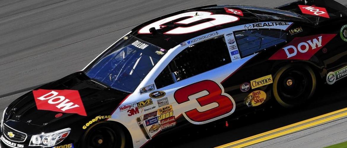
The excitement continues to build for the Bank of America 500 at the Charlotte Motor Speedway this Saturday. At the same time for race fans, the question remains, What about Matthew? The good news is the track has changed quite a bit since yesterdays' update. I will talk about that in a moment. I will be out there picking up my credentials tomorrow and am extremely excited to be joining Slugger Labbe and Austin Dillon for the race to provide in race weather updates to the Dow racing Team as they continue their push for a Championship! First though let's look at how the forecast is for the events taking place at the track starting tomorrow
What is the schedule of NASCAR events at Charlotte?
All times ET
THURSDAY FORECAST 20% CHANCE OF ISOLATED SHOWERS
-- 1:30 p.m.: Sprint Cup Series first practice, NBCSN
-- 3 p.m.: Xfinity Series first practice, NBCSN
-- 5:30 p.m.: Xfinity Series final practice, NBCSN
-- 7:20 p.m.: Sprint Cup Series Coors Light Pole Qualifying, NBCSN
FRIDAY FORECAST 60% CHANCE OF ISOLATED SHOWERS
-- 3:30 p.m.: Sprint Cup Series second practice, NBCSN
-- 4:45 p.m.: Xfinity Series Coors Light Pole Qualifying, NBCSN
-- 6:30 p.m.: Sprint Cup Series final practice, NBCSN
-- 8 p.m.: Xfinity Series Drive for the Cure 300 Presented by Blue Cross and Blue Shield of NC (200 laps, 200 miles), NBCSN
SATURDAY FORECAST 50% CHANCE OF ISOLATED SHOWERS WITH CLEARING BY RACE TIME
-- 6:45 p.m.: Sprint Cup Series Bank of America 500 (334 laps, 501 miles), NBC
The 8am Advisory for Matthew as of this morning has had some drastic changes from impact it may have on the race and other events at the track
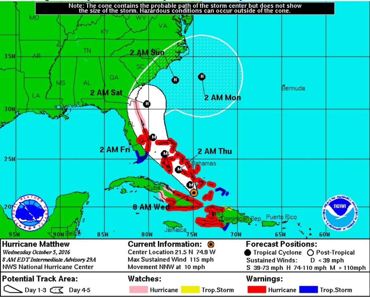
The current forecast track has the storm taking a very sharp northeast turn along the coast and heading back out to sea. Currently Matthew is a Category 3 Hurricane and is expected to re-strengthen to a Category 4 sometime today. With the latest shift in the track several areas of the forecast are changing in favor of a dry race Saturday night.
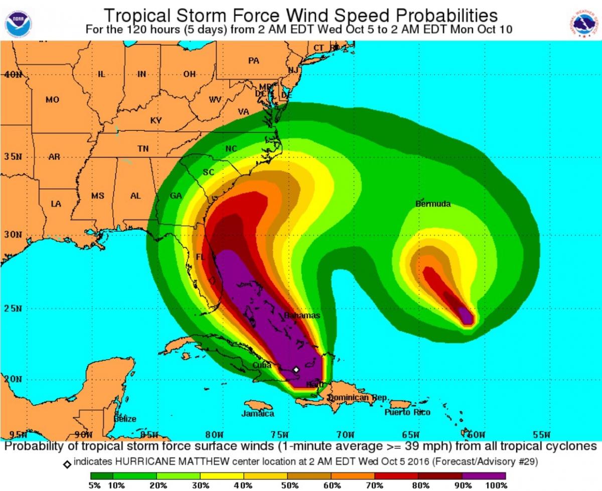
Still looking at about a 5% chance we could see wind gust at the track of around 40mph or more. I believe if the track continues to adjust with the northeast turn we will see that wind chance literally be as close to 0 as you can get.
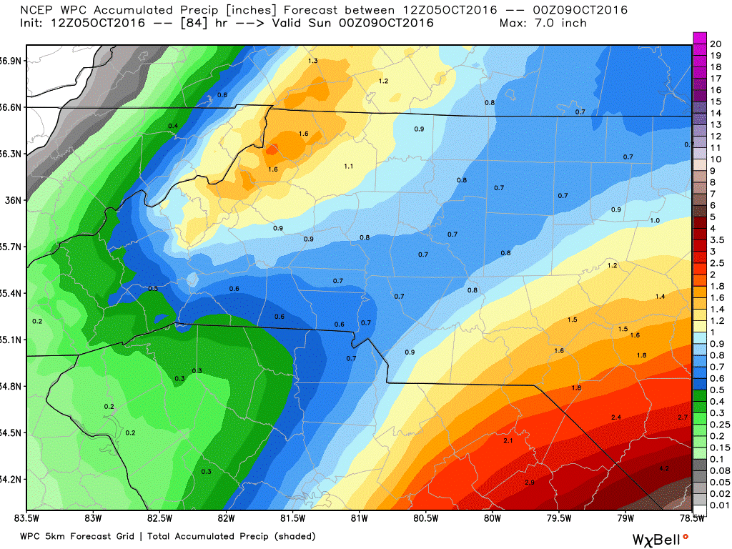
The forecasted rainfall amount that we could see around the track from late Thursday through the midday to afternoon hours on Saturday is only about a half of an inch to three quarters of an inch and I expect those totals will be adjusted lower if the storm continues to show evidence of the northeast turn.
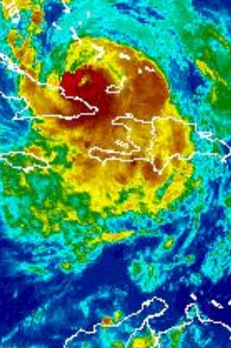
None the less. This storm is still a monster and should not be taken lightly. Continue to prepare. No one ever said "Boy I sure was over prepared" If you are being told to evacuate. Please consider it. Don't put yourself or others in danger. I will continue to provide updates for the remainder of the week. As always thank you for following Rowan County Weather!