

Wednesday Weather Update
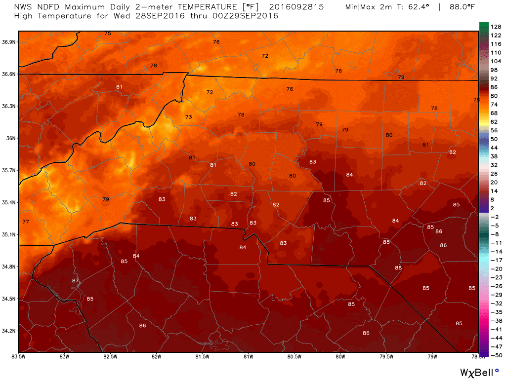
No question we are in a wet pattern here in the county. I honestly can't wait to see the drought reports tomorrow to see if this has changed our current drought stage. Rain and storms are likely again today. I will get to that in a moment. Lets start off with the high temperature today. We are going to top out around 80º
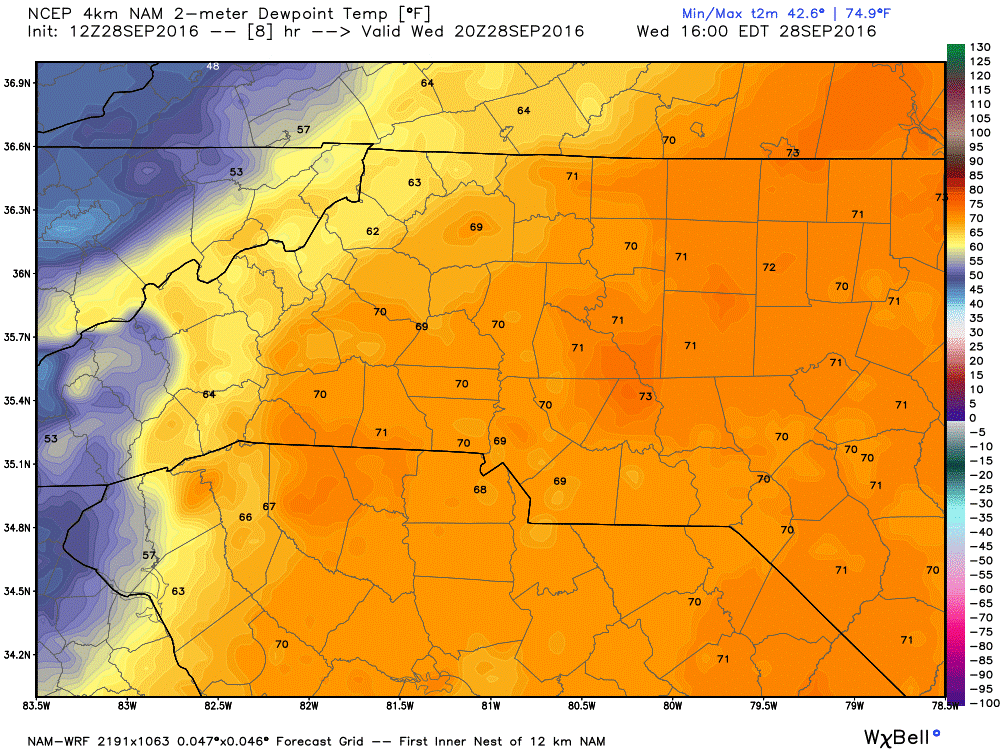
The Dew Points are in the 70's making the air feel a bit oppressive outside today. Much drier air is coming once this slow moving front passes through.
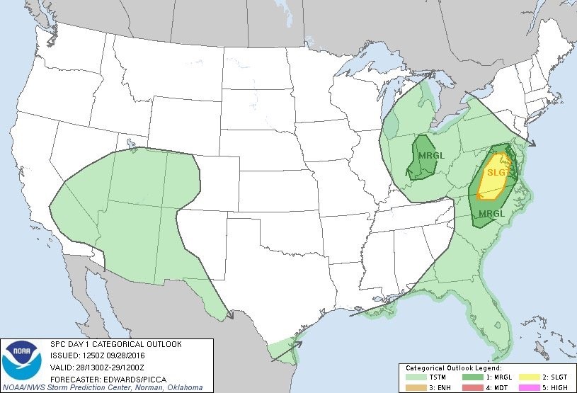
The Storm Predictions Center has us at a marginal risk for severe weather this afternoon and evening. I think if any severe storms develop today they will be east of the county. However, folks living east of 85 in the county might want to stay weather aware today just ion case.
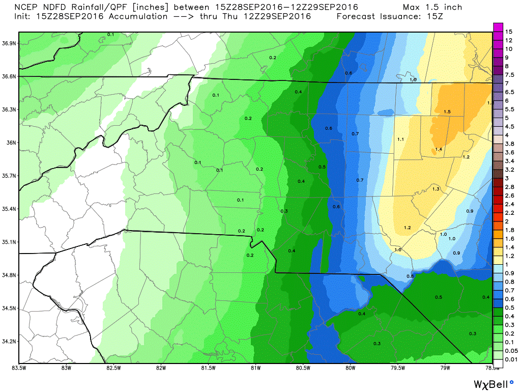
Much like the past few days storms and showers are expected to fire up along the slow moving cold front late afternoon and during the evening. Most of the heavier rainfall amounts will be in the eastern areas of the county today.
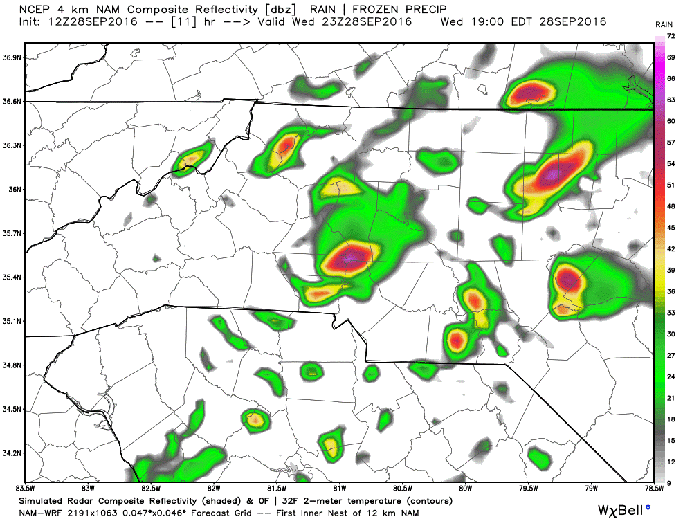
Rainfall accumulations of around a half of an inch or more are possible before the day is done.
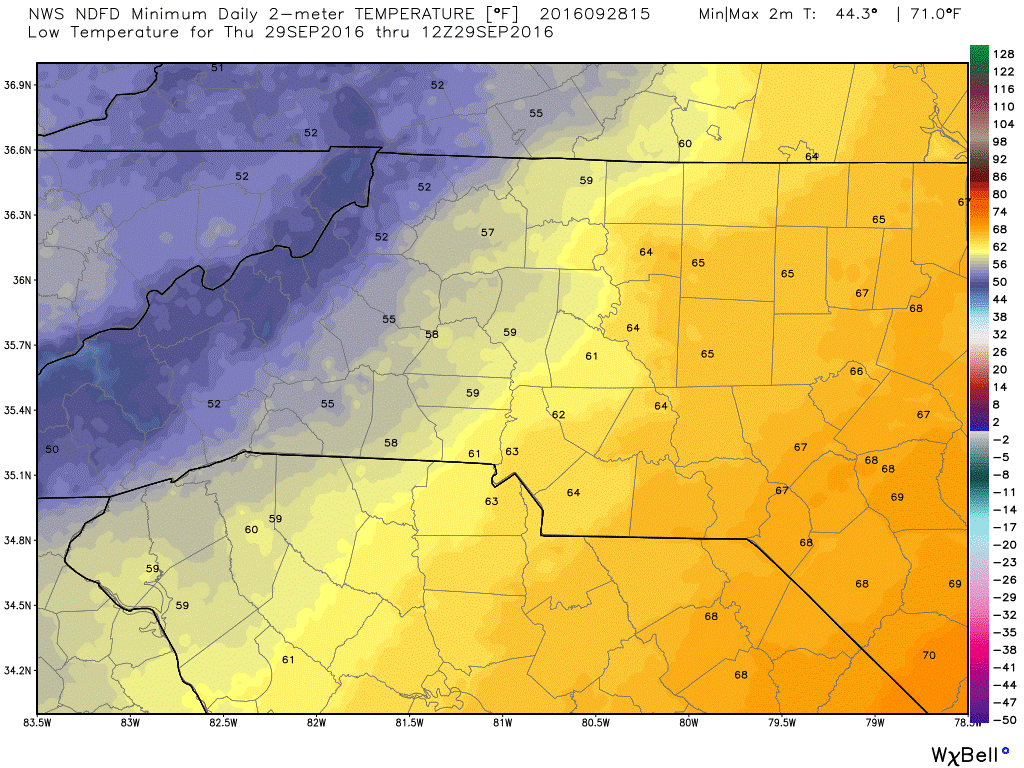
The low tonight will bottom out around 61º I wouldn't be surprised if a few areas in the county hit the upper 50's.
Enjoy your Wednesday everyone! As showers and storms develop today I will provide updates here and on social media. As always thank you for following Rowan County Weather!