

Very Hot with Strong to Severe Storms Monday
We have certainly had our fair share of weather from one extreme to the next over the past few days. Tomorrow will take us to the potential of two of those extremes in the same day. A hot and humid airmass will bring heat index above 105 degrees into portions of northeast Georgia, Upstate South Carolina, and the Charlotte Metro tomorrow. Severe thunderstorm chances uptick on Monday with damaging
winds and large hail as the primary threats. The highest heat indices and best severe weather chances are expected in the afternoon, perhaps lasting into early evening. Hot temperatures and high humidity may cause heat illnesses to occur. Anyone working or spending time outside Monday should have access to water and shade and be alert for the signs of heat exhaustion or heat stroke.
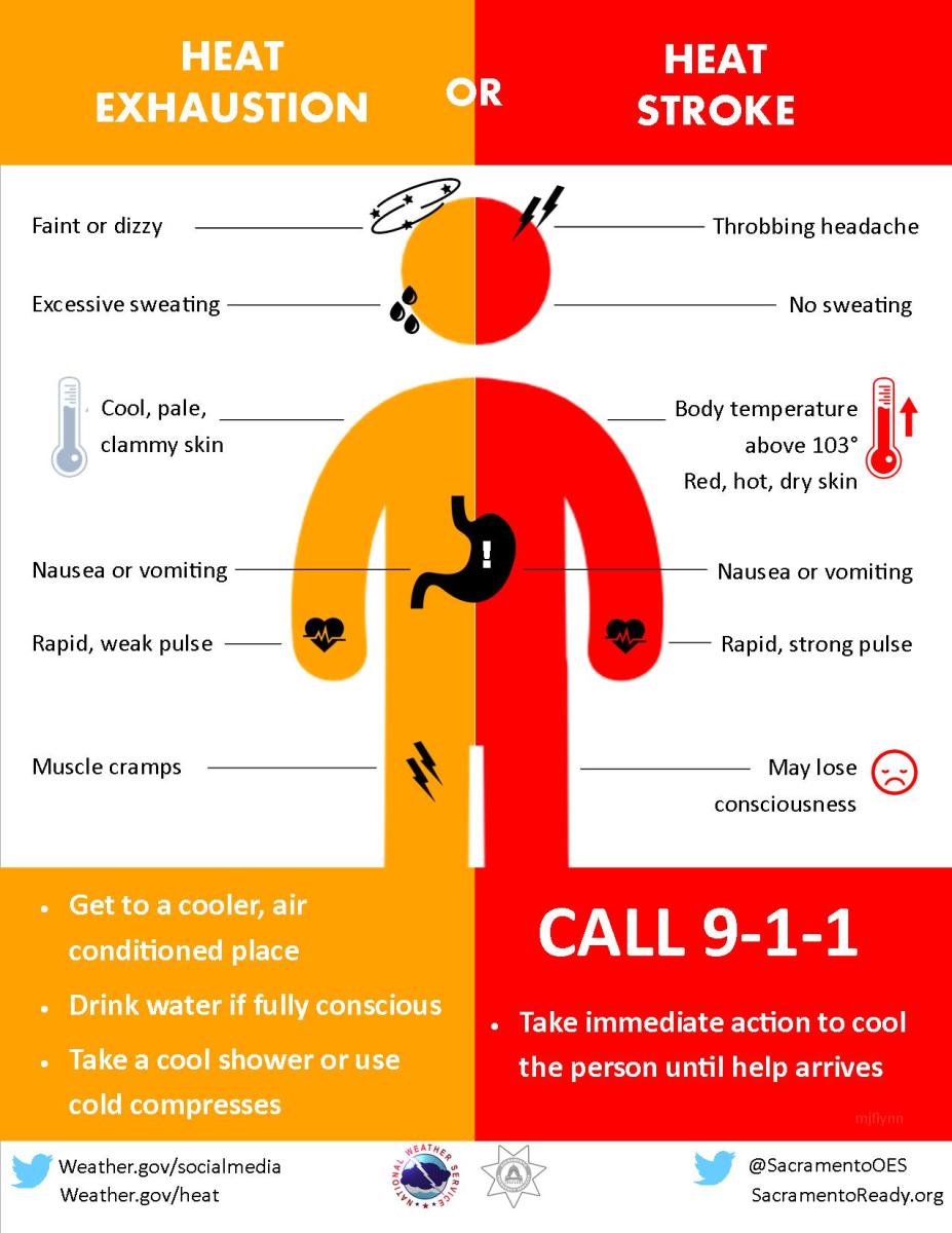
There is a chance that Thunderstorms to the west this evening may bring leftover cloud cover overnight into Monday morning, which could keep temperatures from rising as high as currently expected. Some of the thunderstorms Monday may pose a risk of localized damaging wind gusts and/or large hail, especially in western NC.

A cold front moving through the area Monday night and Tuesday may also lead to the development of another round of strong or even severe thunderstorms Tuesday afternoon, mainly east of the mountains. Cooler and much less humid air will begin to filter into the area late Tuesday and Wednesday behind the front. Rowan County Weather will be here to provide you updates before during and after these conditions move through the area and the county.