

The longer Hermine stays south & east the better things stay for us
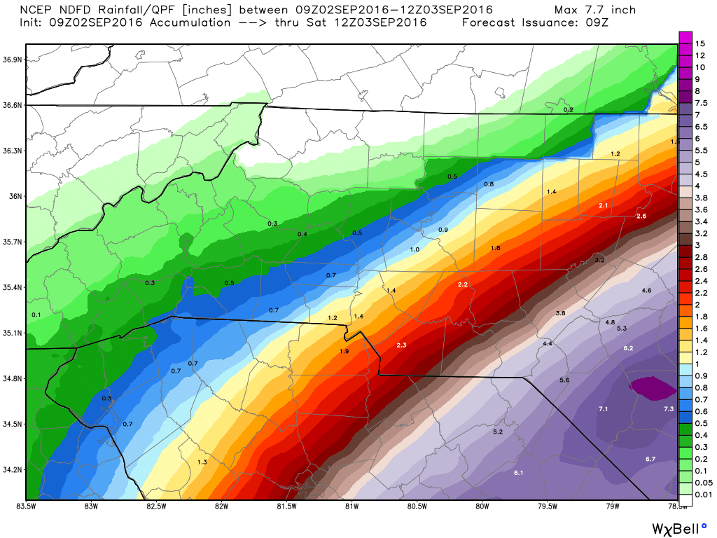
We have certainly had to focus a lot on Hermine and how that storm would interact with the stalled front we have over the area. As of right now Hermine and the stalled front are both staying to our south and east. So much so that rain accumulation forecast are going to stay pretty close to the one inch mark in the county.
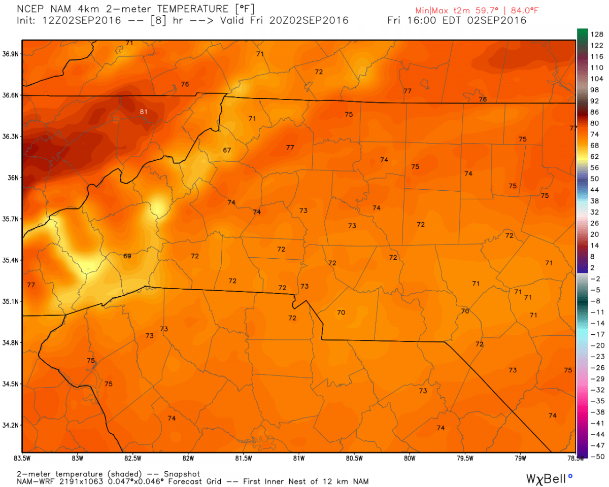
The high today will be the coolest high we have had since May 22nd of this year. Looking for a high around 73º
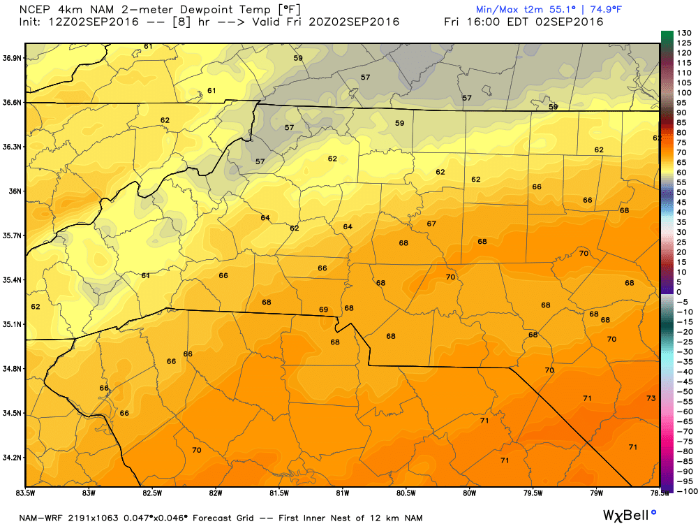
Dew Points will keep things uncomfortable though because of the tropical moisture in the area. Dew Points will be in the upper 60's
This morning when I gave the forecast I said we could see an inch or more of rain from the two systems battling it out in the area today. I am still pretty confident we see at least an inch or more before this system moves out.
I will provide updates throughout the day right here and on social media. Keep the rain gear handy folks. As always thank you for following Rowan County Weather!