

Thursday Weather Update
There are a lot of moving parts that will have an impact on the weather here in the county over the next few days. The big story is Tropical Storm Hermine. The storm should continue to track off to the northeast which will not have much of an impact on us at all. However, don't let your guard down on rainfall. There is a cold front that is going to move through later today and with it the chances for rain increase. Combine that along with the northwest flow from Hermine as that storm moves up the coast moisture will get pulled in from the Atlantic and it is going to be a wet messy Thursday afternoon and evening along with Friday throughout the day here in Rowan County.
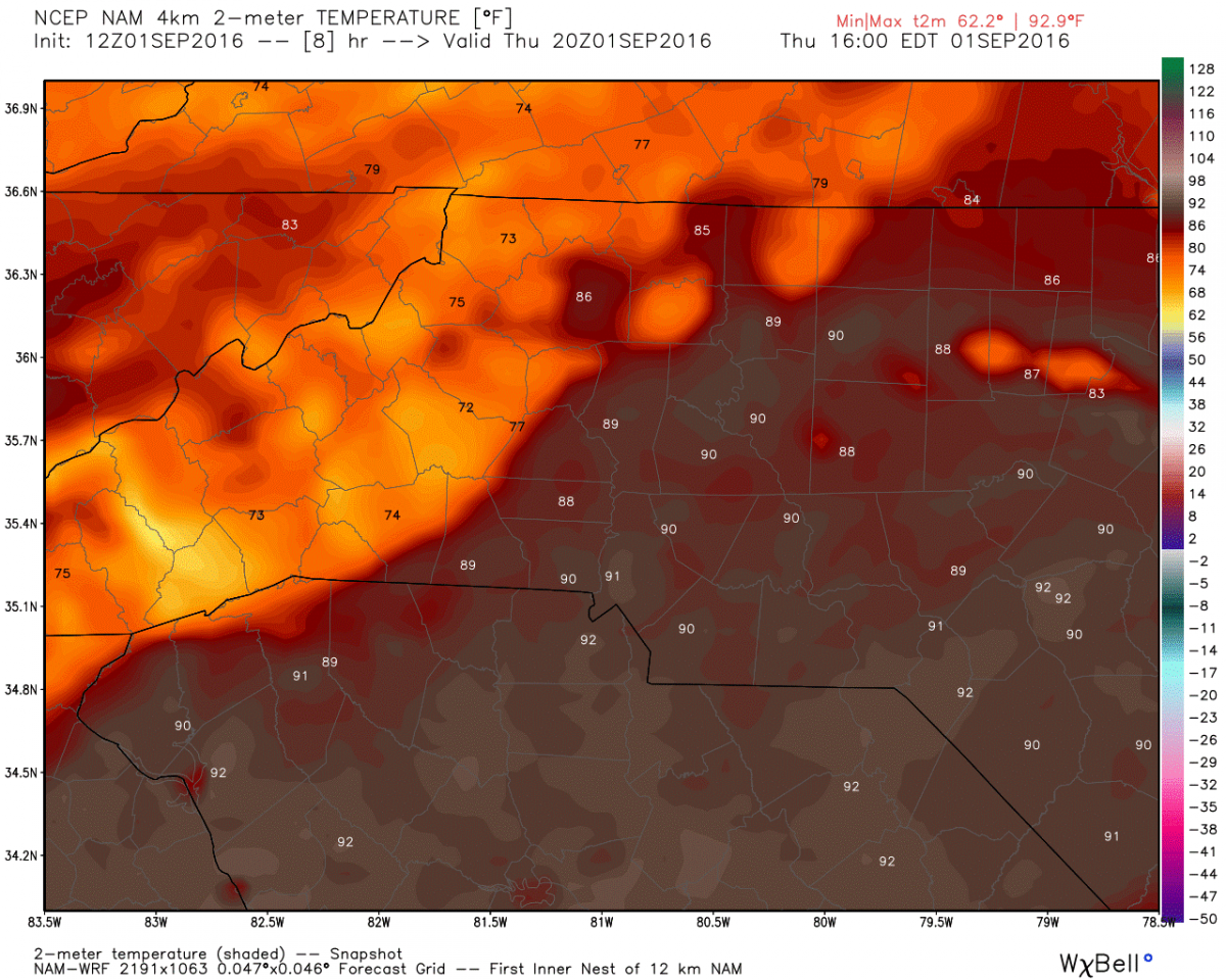
Let's see what to expect today from the weather. The high will top out around 90º
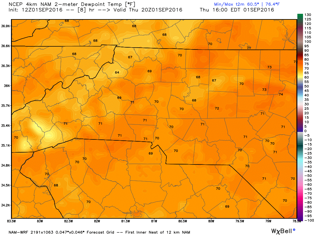
Things are going to feel a bit tropical with the dew points today in the low 70's making the air feel oppressive outside.
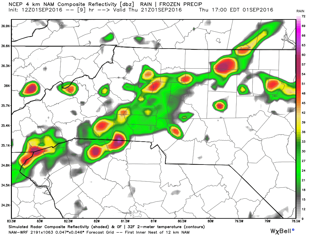
Expect a line of storms and showers to move in with the front later in the afternoon and evening. The rain should become more widespread as we get later in the day.
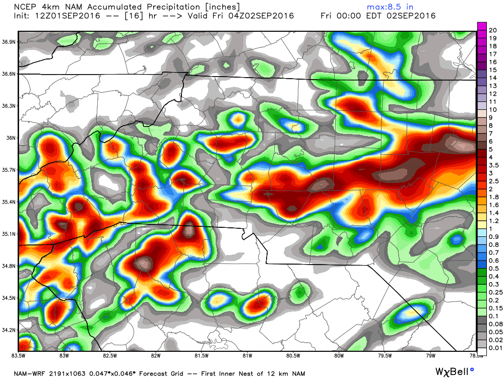
You can expect accumulations from rain today to be between 1 & 2 inches or more in isolated areas around the county.
I will continue to post updates right here and on social media throughout the day and evening. It's going to be a busy 36-48 hours for me so be patient if I don't respond right away to questions you have. As always thank you for following Rowan County Weather!