
Tuesday Weather Update
The weather today is going to be a roller coaster ride in some ways. The real concern for most of the day will be the heat index. It is likely we will see the heat index in the upper 90's today. It is possible we could see the heat index hit 100º The most important thing you can do is stay hydrated and please if you have outdoor pets keep their water bowls filled with cold water throughout the day.
The temperatures will reach 92º for the high today in the county.
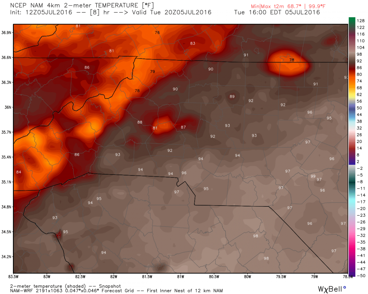
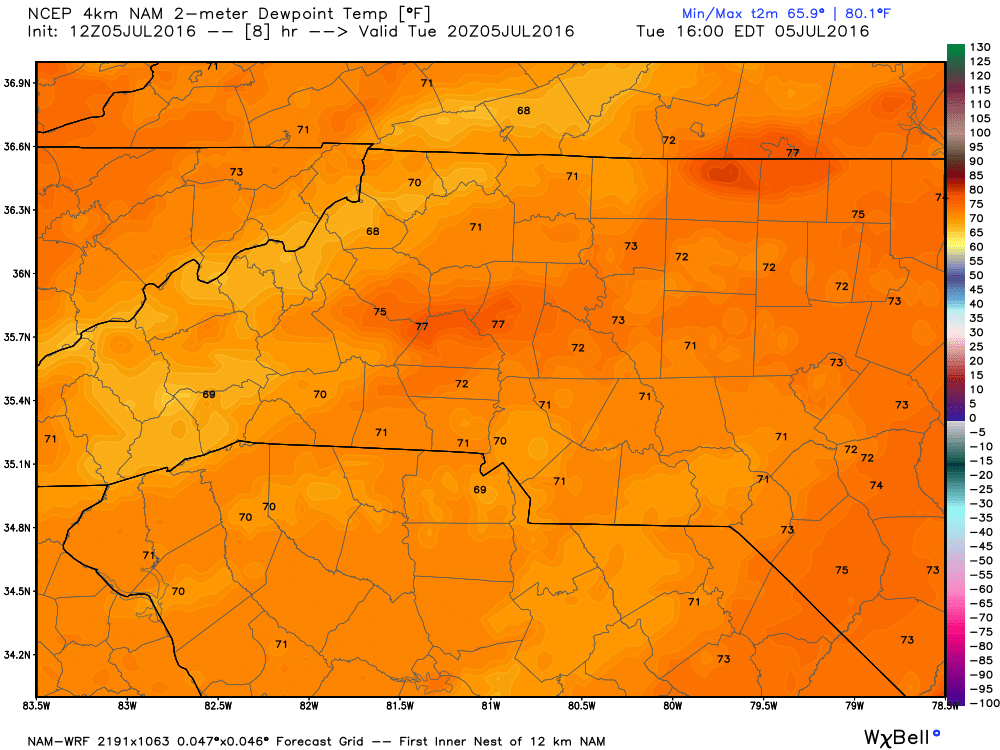
The dew points will be in the low 70's making the air feel oppressive. Combine that with the heat index and things are just nasty feeling!
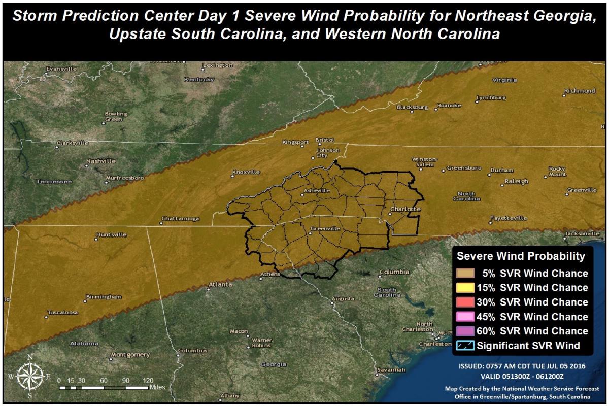
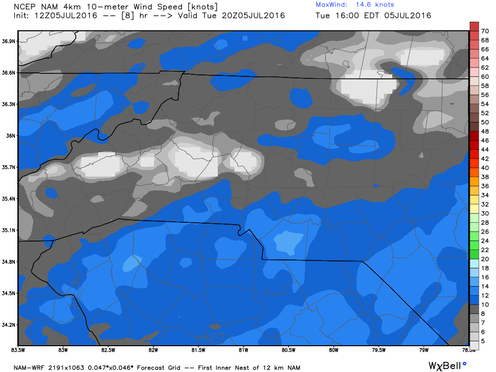
If any storms develop today they will be isolated. However, if you are unfortunate enough to be under one of those storms it may come at a price. The winds and chance for microburst are the main threat from storms today. The microburst potential and wind damage potential is at 5% right now. That may not seem like a big number. Trust me its big enough to bear watching.
I think our biggest chance for these storms comes around 5pm and after.
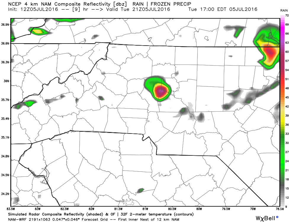
The image above is just a model but the key point I want to make with it is how isolated these storms may be. Even if the radar looks clear or the storm looks small. Don't let the chance of damaging winds and small hail sneak up on you this afternoon and evening.
 \
\
Wind gust will not be constant but the wind threat today will be when the bottom falls out and the pressure in a storm drops slamming a ball of wind toward the ground. This can occur out of nowhere so stay weather aware today.
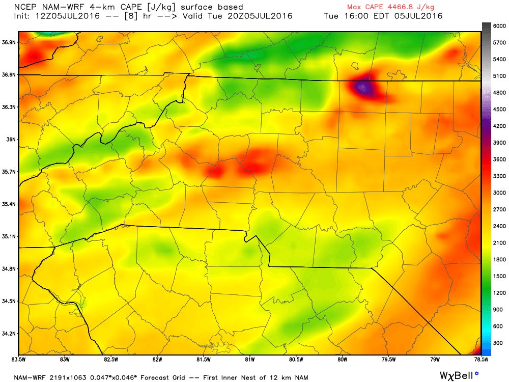
The C.A.P.E or Thunderstorm Fuel putting it in simple terms could reach some high levels this afternoon and evening. That will be the key to helping these storms get fired up. I will of course monitor the situation throughout the day and keep you updated here on the website as well as on social media.
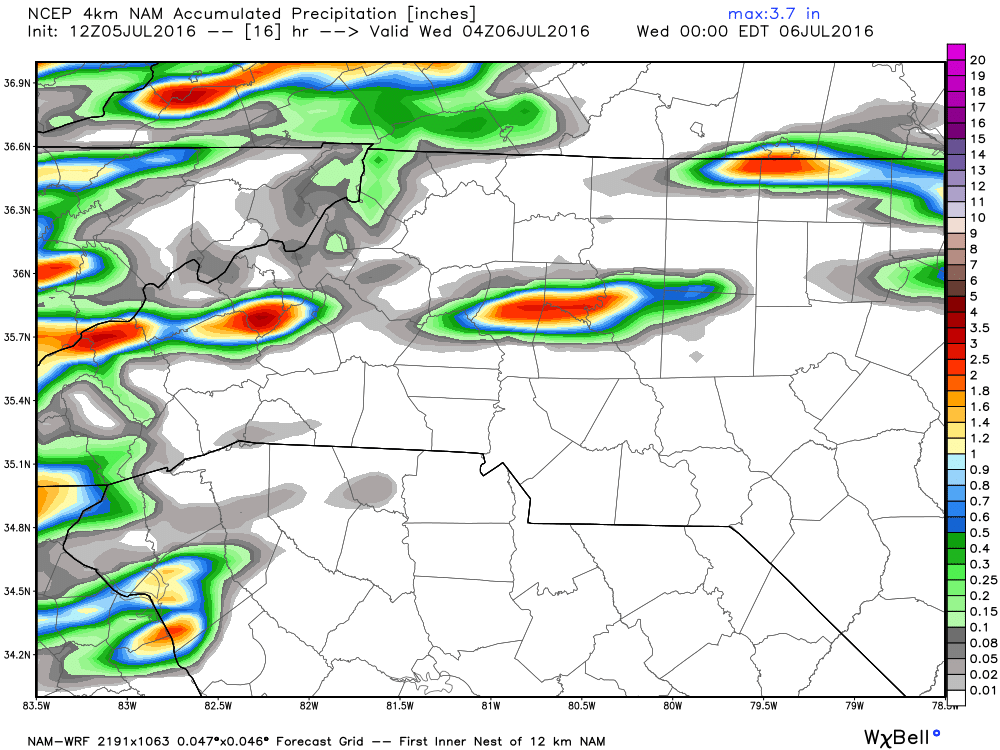
Rain totals with the most accumulation today will be concentrated only to the areas that actually get one of these isolated storms. You could literally see nothing to over an inch of rain if a storm passes over where you are. Again be more concerned about the wind threat and the hail potential.
Tornadoes are not likely as that chances is extremely low. Straight line winds will be the issue today.
Before I go one quick reminder. Do not leave children or pets unattended in your car. The outside temperatures today will heat the inside of a car up to over 100º in less than 10 minutes.
As always thank you for following Rowan County Weather!