

Monday Weather Update
I hope you enjoyed your weekend and are settling back into the work week. Quick update on the weather for today. Looking at the possibility of a wet commute home for the work crowd and rain lasting into the evening. Let's start off with how warm it will get today and how those outside air temps are going to feel.
The high today will top out in the upper 70's.
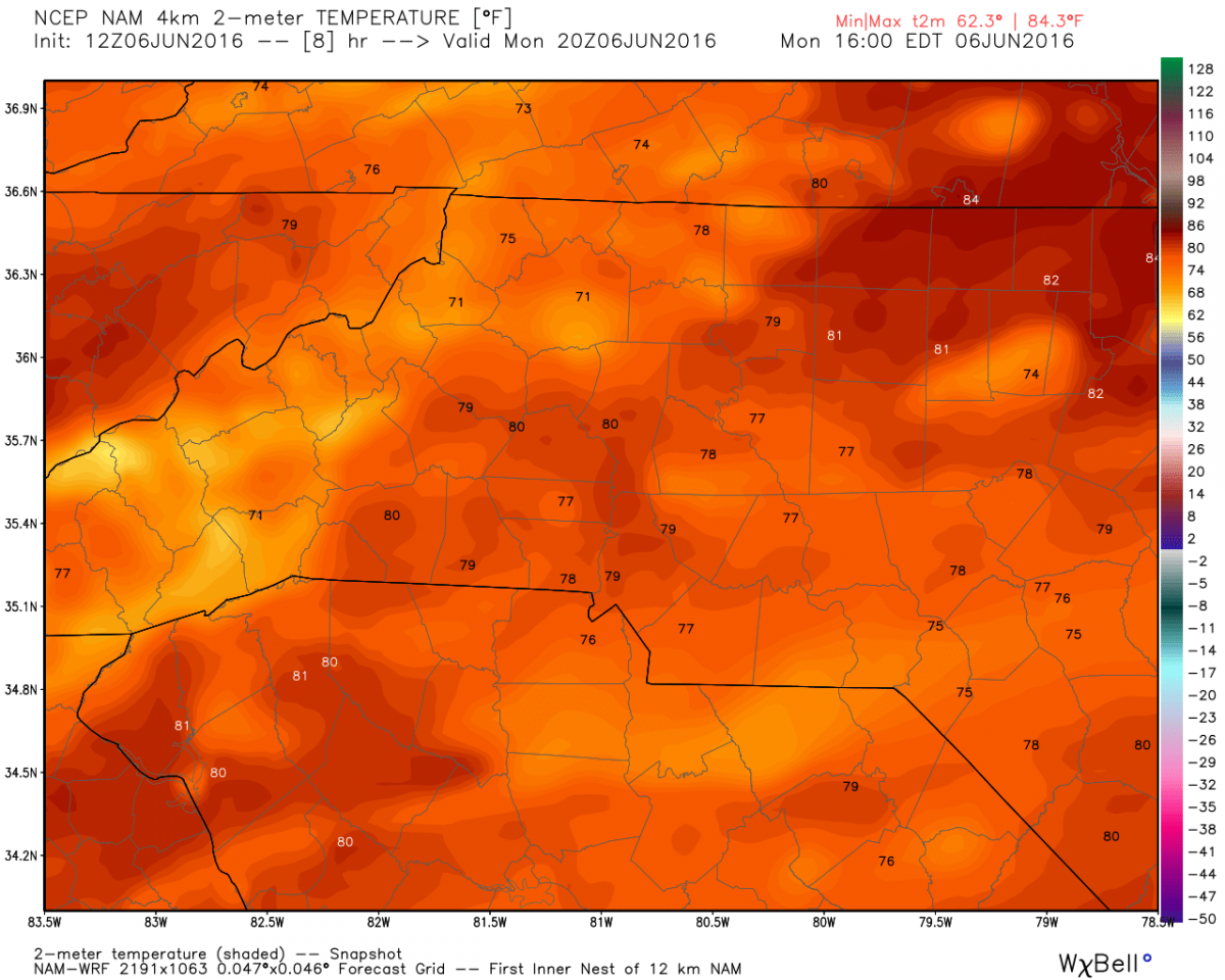
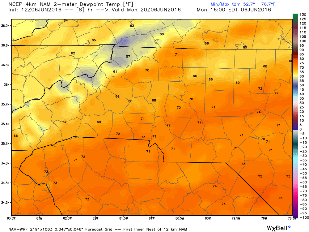
Normally that would not feel to bad. However, today will not be normal. The dew points are going to be around 70º very tropical and uncomfortable feeling. A strong case of the Muggies!
Isolated showers are possible starting in the early afternoon hours and will lead to the potential for more widespread rain later today and into the evening. Below is an hour by hour of what you could see occurring throughout the evening with rainfall.
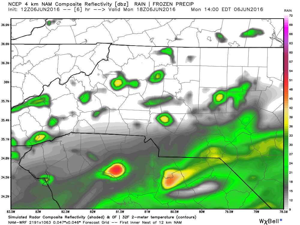
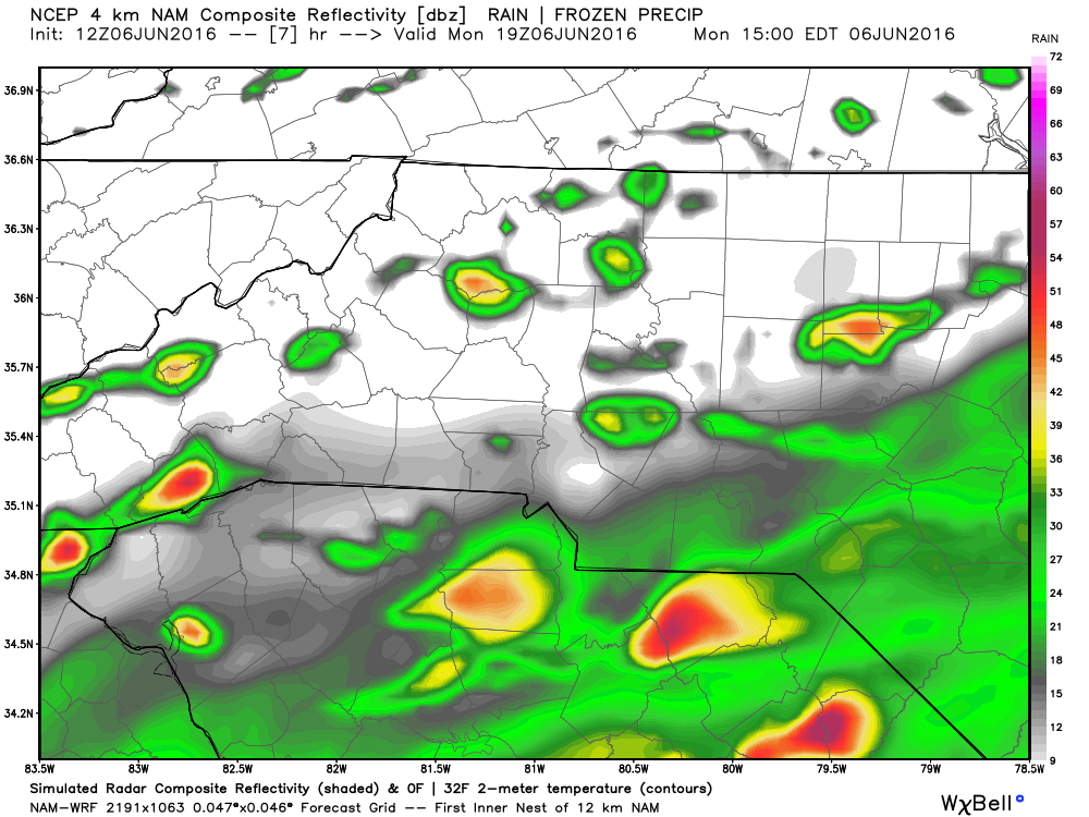
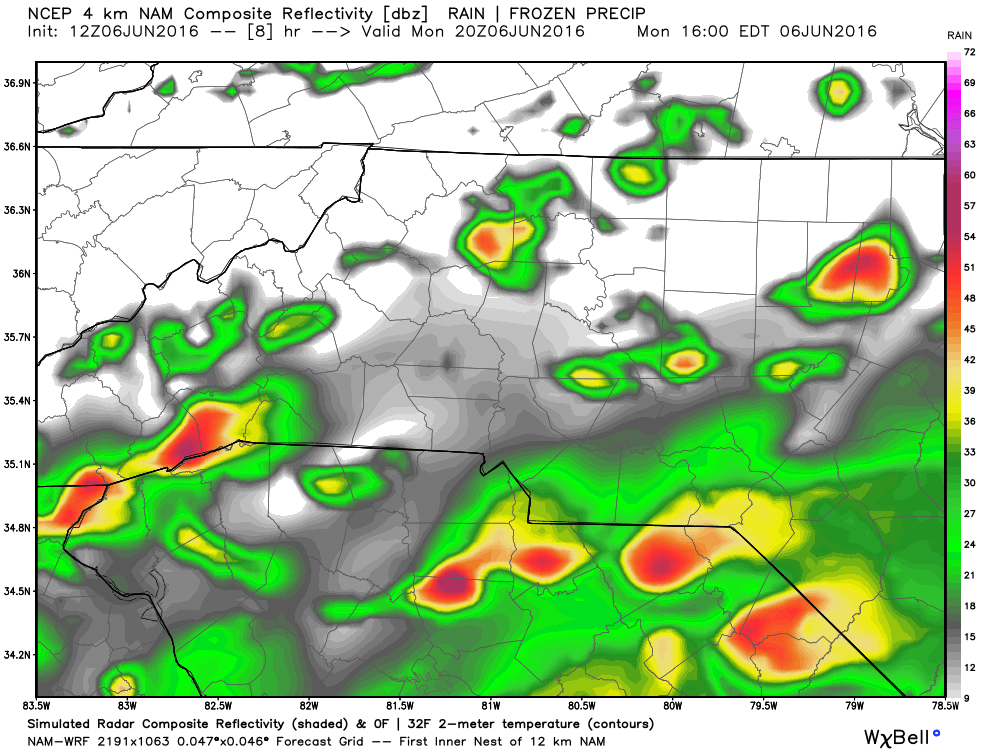
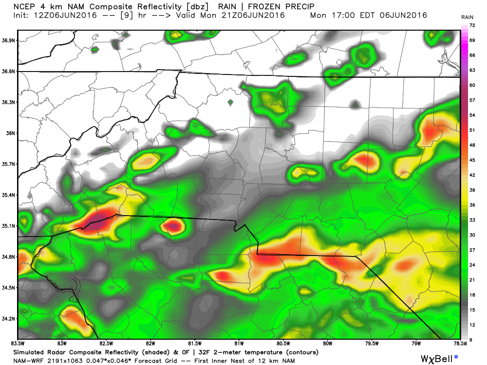
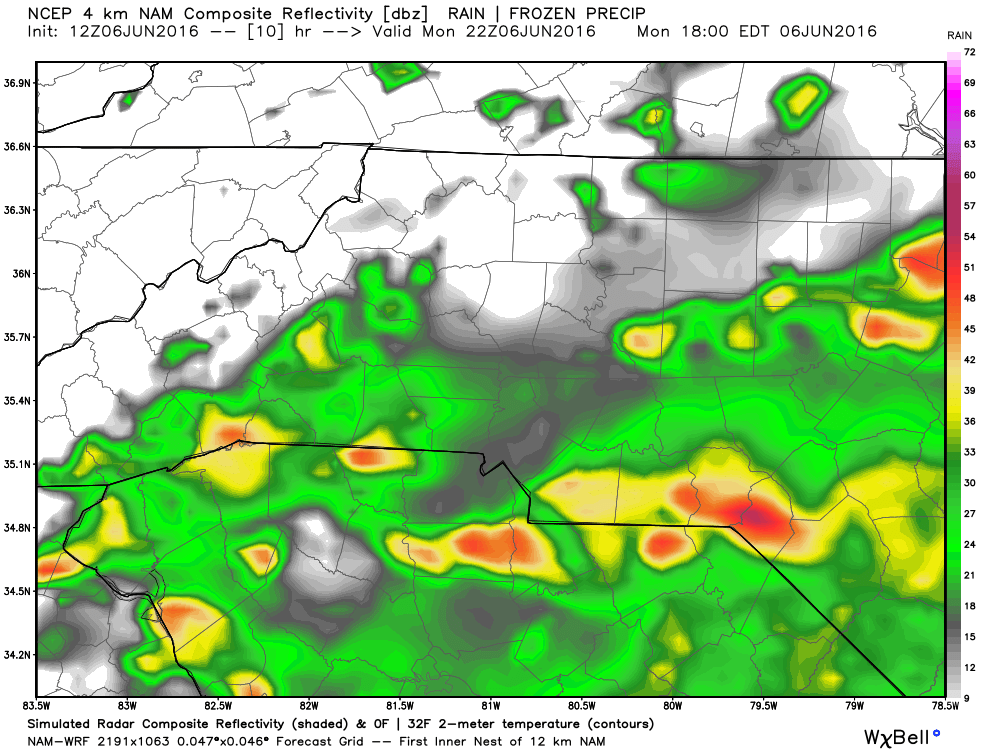
The photos above show the models depicting what would be mostly isolated showers around the county with the chance of a few rumbles of thunder. This is from 2pm to around 6pm.
The model images below are depicting more widespread rainfall possibilities from after 6pm through the remainder of the evening.
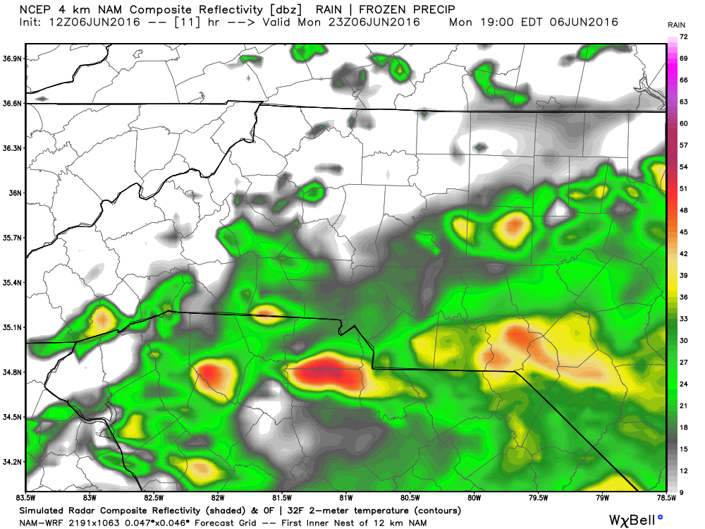
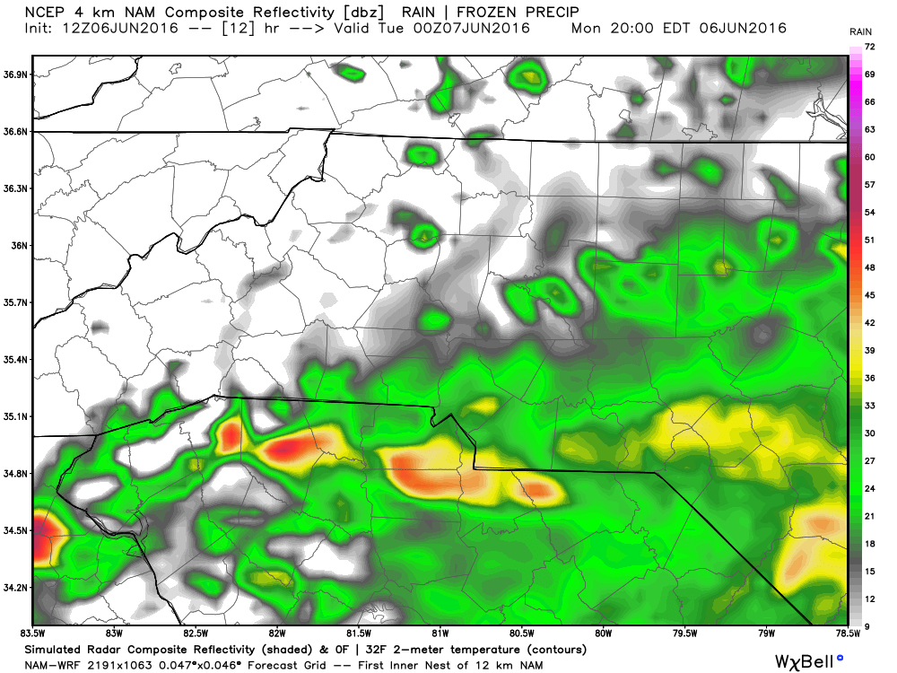
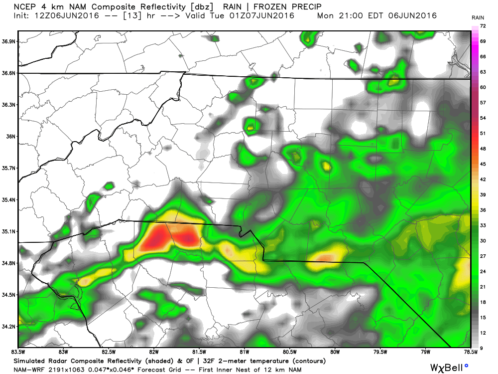
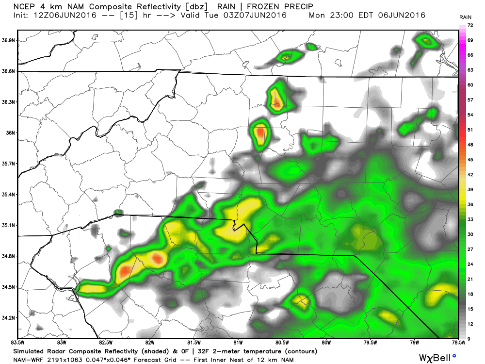
As far as over all accumulation goes, I think most of the higher amounts will be to our eastern areas of the county but below is what we could see.
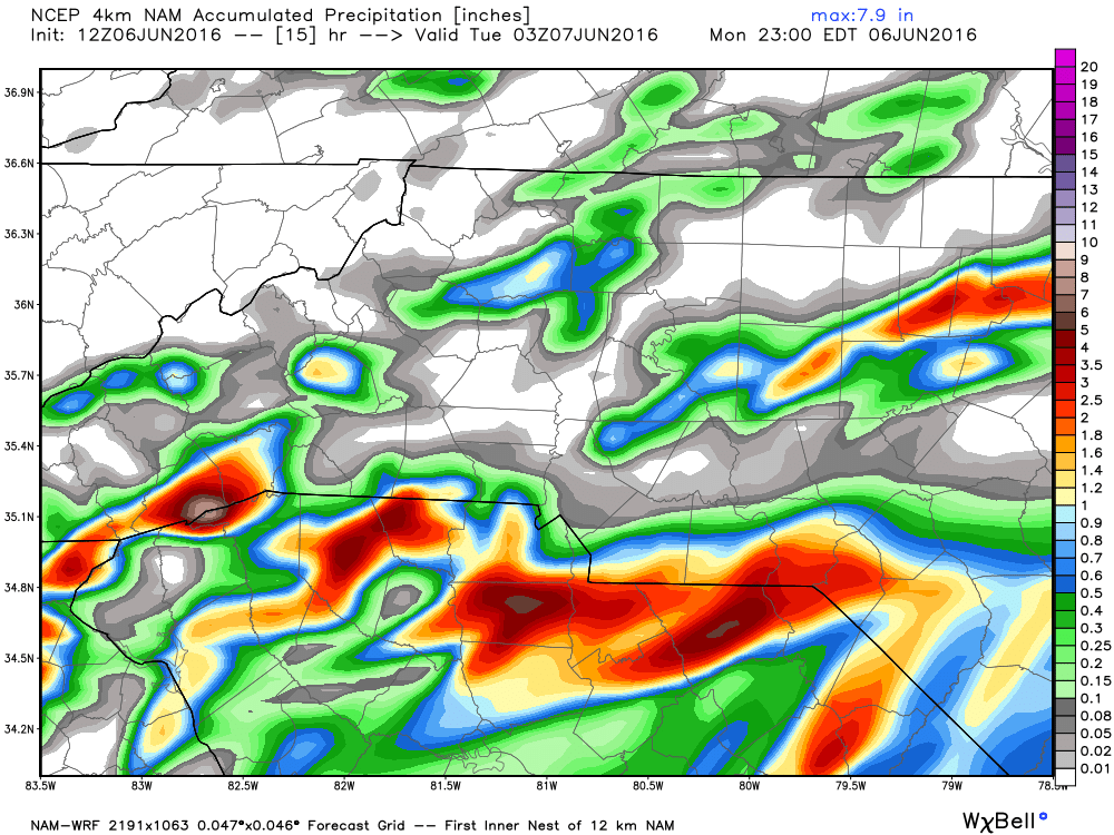
I think a safe bet is anywhere from a quarter to a half of an inch of rainfall with the slight possibility of some areas getting around an inch.
Enjoy your Monday everyone and I will continue to post updates throughout the day. As always thank you for following Rowan County Weather!