
Localized flooding could become an issue
We are moving into yet another day and evening of rainfall around the county. The concern will certainly start to focus on flooding as the ground is becoming quite saturated. We have already had around an inch and a half of rainfall since the system started bringing rain to the county late Monday evening. Let's take a quick look at what to expect today and when the bulk of the rainfall will arrive.
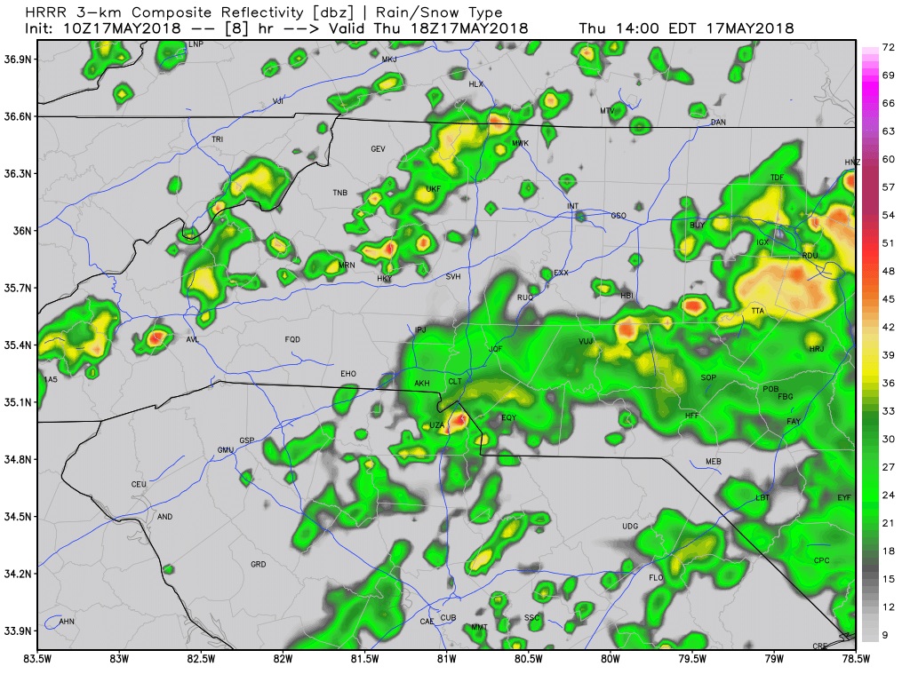
Based on model data the bulk of todays rainfall will start to move into the county around 1-2pm. We will see isolated spotty showers and storms through the morning and early afternoon. The main threat form these storms will be what we have observed over the past 24-36 hours.

Just looking for general thunderstorms again today as CAPE levels are elevated but other factors like Helicity and Updraft potentials along with the development of supercells remains low. The big threats will be frequent lightning and thunder along with localized flooding around the county.
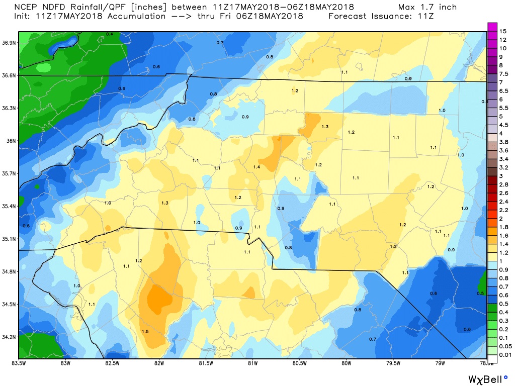
We could see anywhere from an inch to an inch and inch and a quarter of rainfall on top of what we have already had around the county. I do have a concern with the ground getting this saturated we could see some tress come down around the county as well. Please stay weather aware and alert on the roadways as we move through the day. Please allow at least 120 feet of room between you and the vehicle in front of you. If you see a flooded roadway. Please turn around. There is a video below that will show you what can happen if you try to drive your vehicle through a flooded roadway. I will post updates right here and on social media throughout the day and evening. As always thank you for following Rowan County Weather!
Please let our local sponsors know that you appreciate their support of our blog. Take a moment to visit their website linked at the top of this post.
Share this:

Announcements & Events
Check back often for important announcements and events that I'll be involved in!