
Early Monday morning weather update
The question on everyone's mind this morning is when is the snow going to start. We will continue to see rain over the next few hours this morning but a transition to sleet and snow will occur as we move through the midmorning and early afternoon hours. Let's take a look at the timeline.
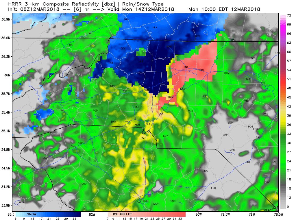
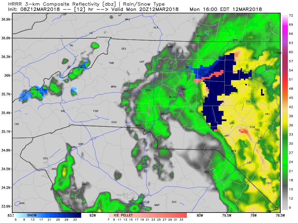
Around 10am this morning the northwest portion of the county around the Cleveland area will see a transition from rain to sleet and snow. This will begin to spread south and east as we continue through the mid-morning hours.

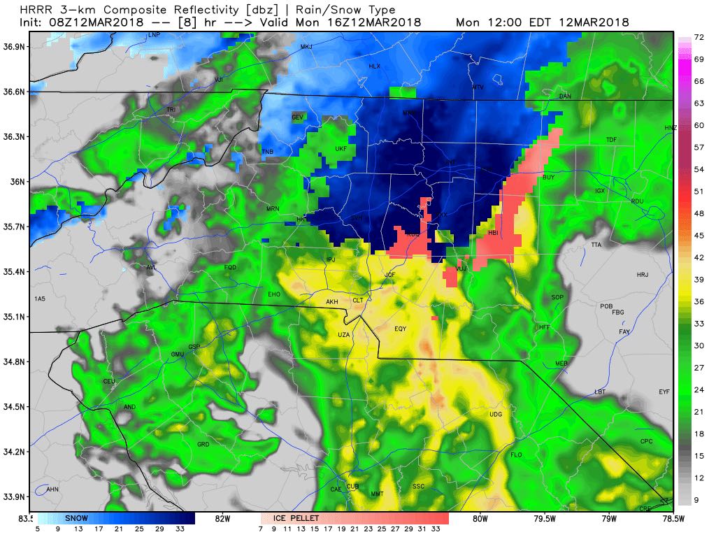
By 11am areas west of i-85 will be seeing the transition from all rain to sleet and snow. Road conditions by this point should continue to be all wet because all of the rain we have been having up front will likely cause accumulation of snowfall to be delayed at first.
Around midday we could see a battle taking place between the warm and cold air over the county that could have a brief blast of sleet through the county. Not to concerned with ice accumulation as we will be above freezing while the precipitation is falling.

Around 1pm the cold air may start to win back out changing the precipitation from sleet back to snow this will likely be the beginning of the last surge of snow as we head into the early afternoon hours.
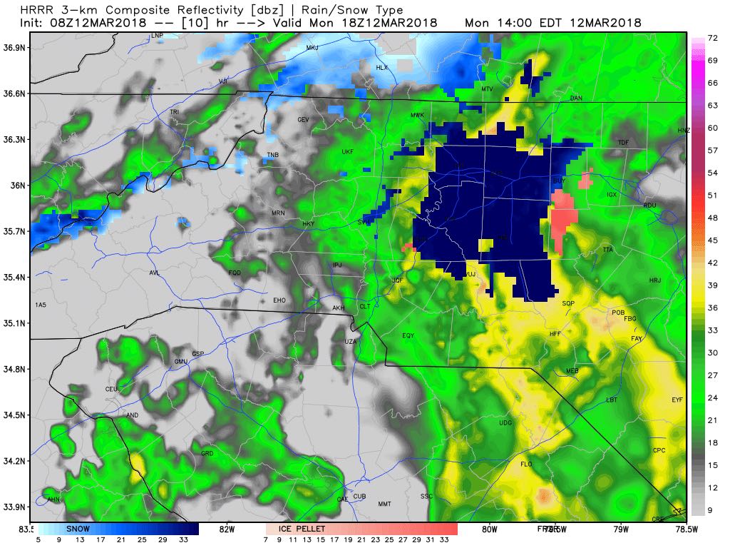
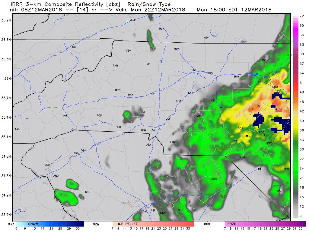
At around 2pm areas on the western side of the county will likely be seeing all rain once again as warm air starts to surge back to the north and east. This will begin the transition back to rain for the entire county as we move through the rest of the afternoon.
At around 3pm. the majority of the county will be back to all rain with a few isolated areas getting sleet and snow. This should be the last full hour of anything but rain around the county. The moisture will actually start to pull out of the county in the early evening hours.
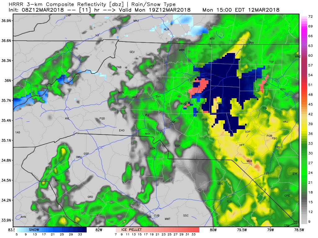
Around 4pm the only area in the county that could continue to see some snow or sleet but that should come to an end pretty quickly around the 4pm hour and transition back to all rain.
By around 5pm we should begin to dry out as the moisture will begin to move out of the county. Conditions on the roadways could be slick around this timeframe due to the mix of rain sleet and snow. As we move through the afternoon and evening hours. I would begin to treat all roadways as they are icy just to be safe. Crews are going to have a hard time treating the roadways with the rain we are having on the front end of this system.
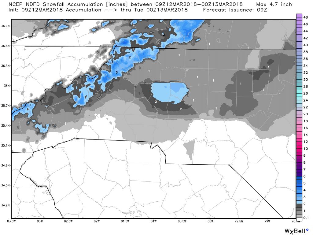
As far as accumulation for snowfall we could see anywhere from a trace to an inch around the county. depending on location. I would not rule out some areas in the north and west of the county seeing over an inch. If a quick burst of snow occurs it is likely it could accumulate quickly in a certain area. That is going to be very difficult to predict. I will continue to provide updates right here and on social media as we move through the day. As always thank you for following Rowan County Weather!