
Rain today and a chance for some snow Monday
We have been talking about it for the past few days now. Snow has been in the forecast and as we begin to end the weekend we are about 36 hours away from seeing the chance for snow mixing in early Monday . Let's take a look at what to expect for today and then get into what to expect for tomorrow morning with the snow. Today will will see a miserable day weather wise. The high will only top out at around 48º
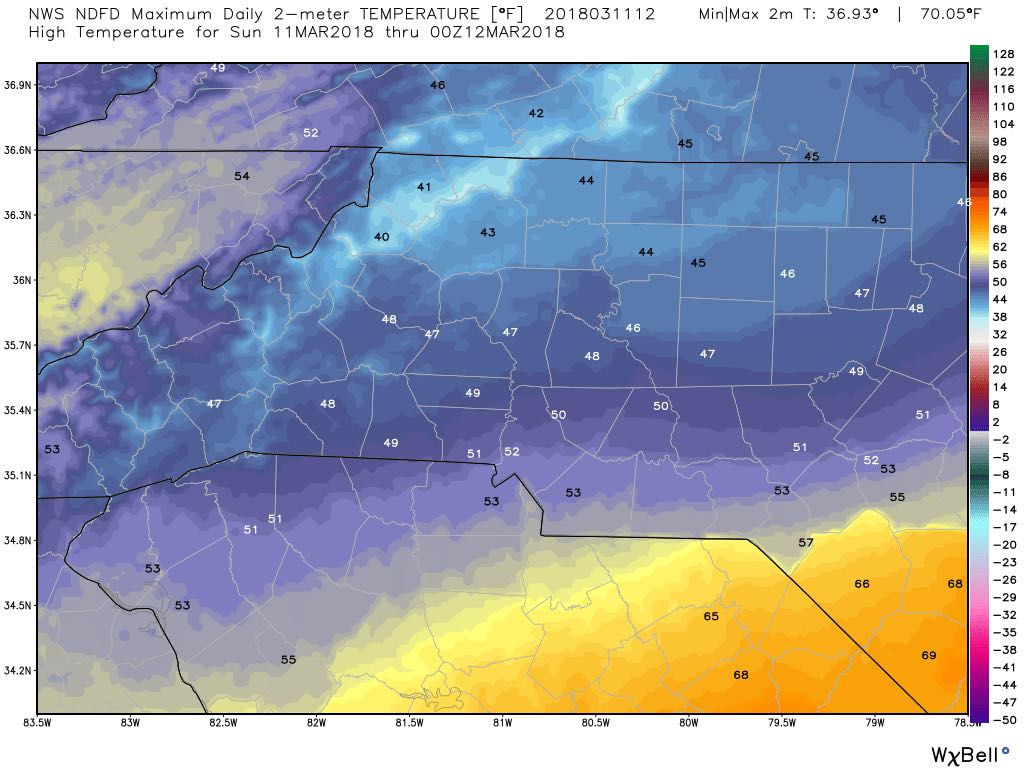
This evening we will drop back to to a low of around 37º

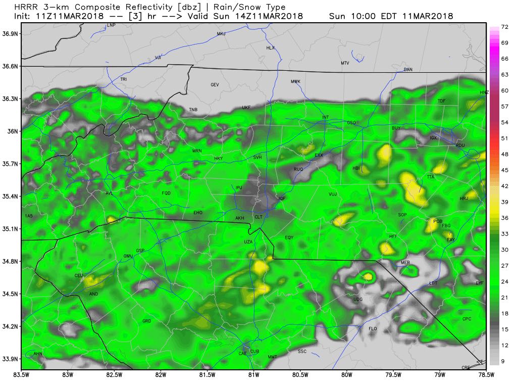
Today will be a washout once the rain gets started. Moisture will take over and literally rain out your Sunday right into the evening.
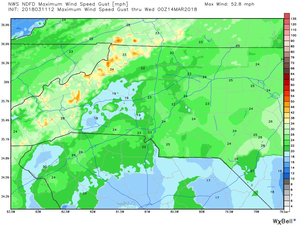
Winds will also become an issue as we move through the day as we will see gust of around 20 - 20 miles per hour around the county. This will of course raise the concern a bit for tress coming down as the ground saturates.
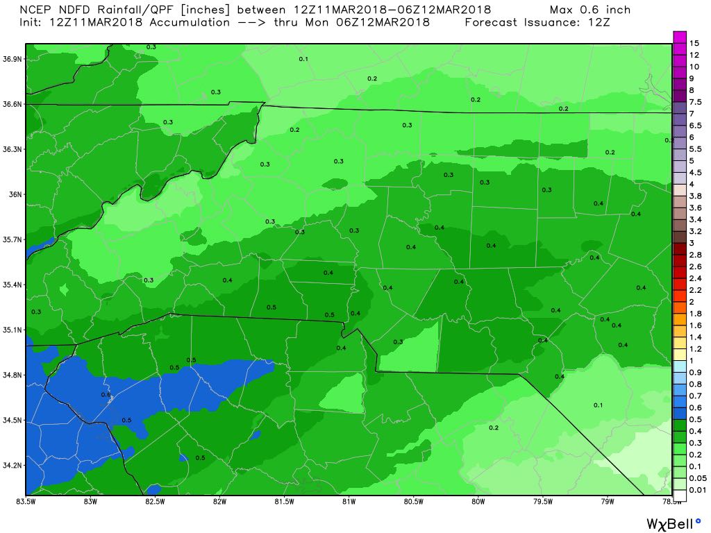
As far as rainfall accumulations go we will see around a half an inch of rainfall or more around the county. So if you are heading out today and tonight. Keep the rain gear handy.
Now let's take a look at what to expect for your Monday. Snow has been the topic of discussion for the past few days. The timing has changed a bit for us as the track of the system has shifted a bit. The snow had the potential of mixing in early Monday morning. The timeframe has shifted to the late afternoon and evening hours based on the latest data. Let's take a look.
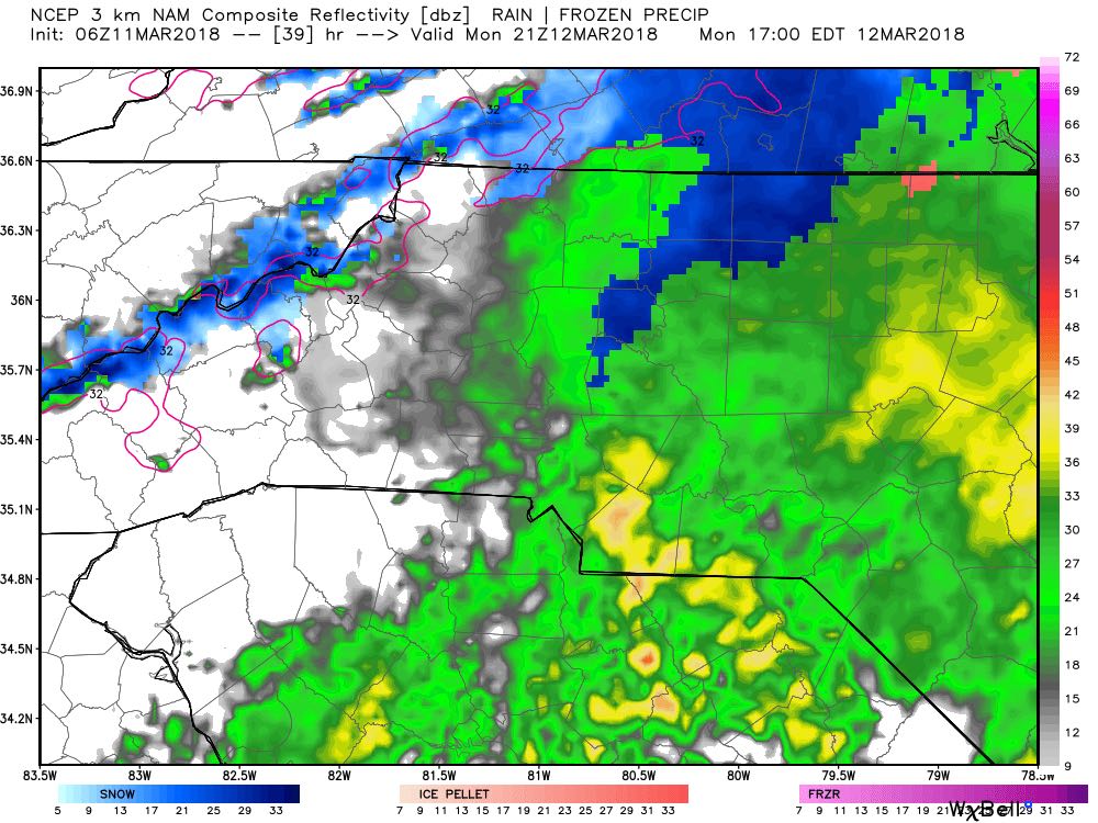
We will continue to see rainfall as we move through the overnight hours tonight and into the day on Monday. Cold air will slowly make its way into the county but this will now likely occur late on Monday afternoon and evening. As you begin your commute home you could start to see some snow mixing in with the rainfall around the county. I am not expecting to much accumulation with the rainfall occurring so long before the snow blends in. Roadways and bridges should be fine. If you see snow accumulate it will likely be on decks and vehicles.
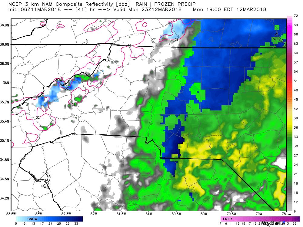
As we move into the early evening hours on Monday we could see a brief transition to all snow for a very short period of time. Little accumulation is expected at this point as well. The roadways will be pretty wet and temperatures will be above freezing.
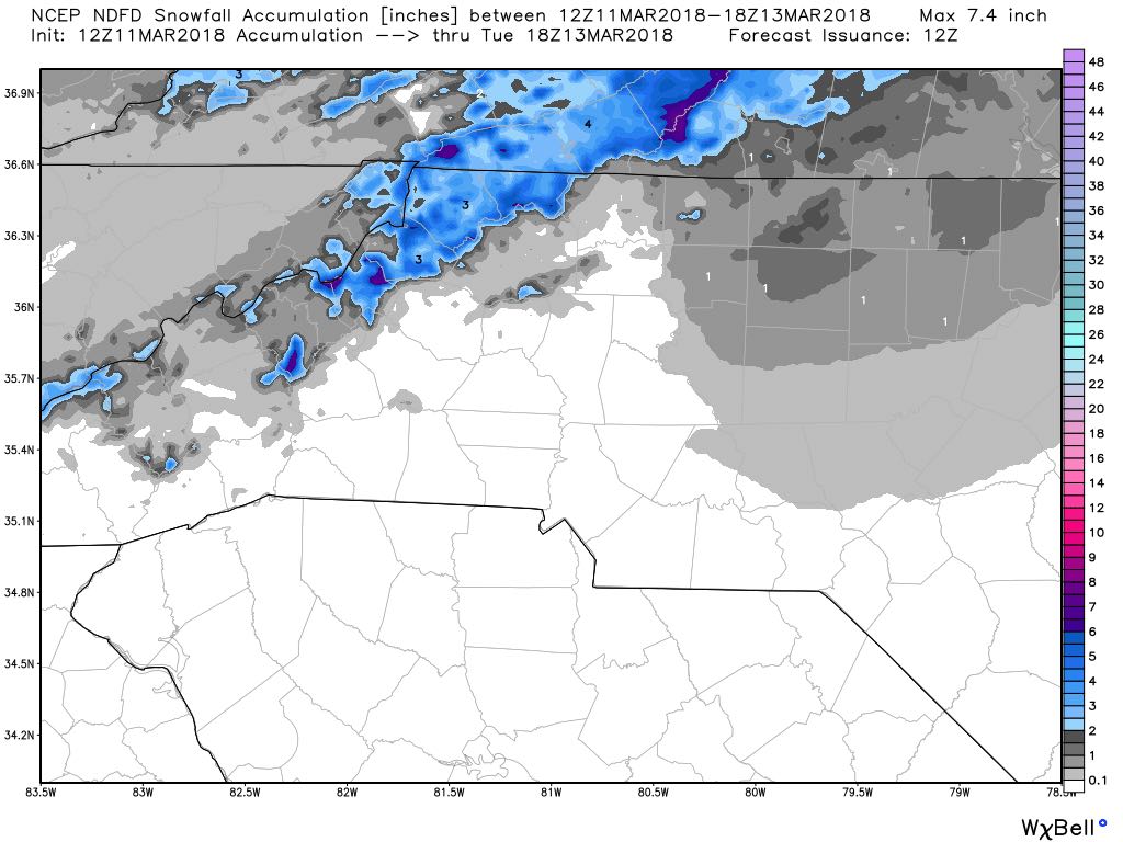
As far as snowfall accumulations goes for the county. I would only expect a trace to maybe a half of an inch as I have been forecasting. The best chances for snowfall accumulation will occur in the northern portions of the county. Especially along the i-40 corridor. I will of course keep you updated throughout the day and evening. Updates will be provided right here and on social media. As always thank you for following Rowan County Weather!