

Rain for Saturday and what about snow early Monday?
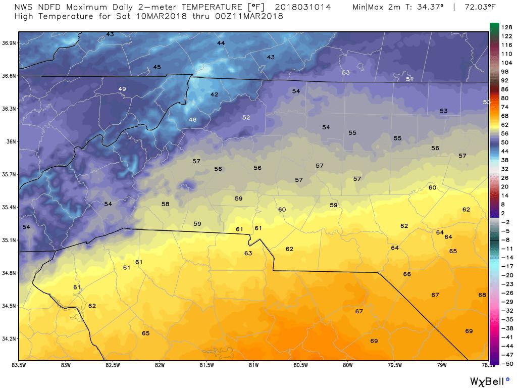
As we enter the weekend there are a lot of questions surrounding the precipitation we are going to see around the county. Let's start off with your Saturday and then we will take a look right into Monday. Today we are going to see a high of around 57º
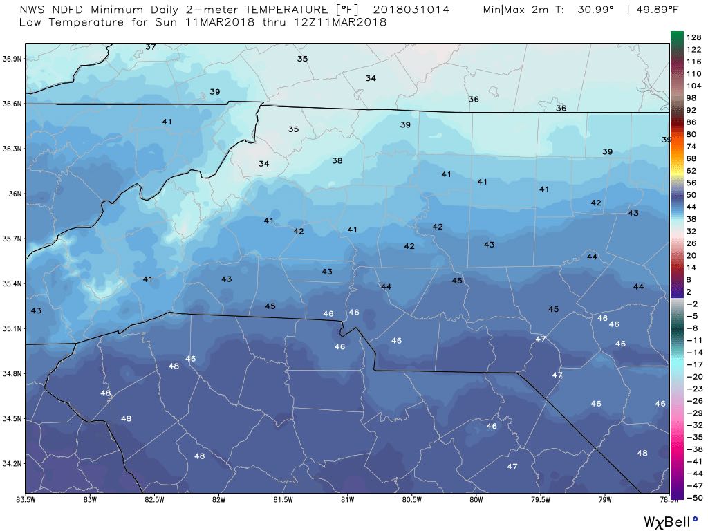
The low this evening will drop down to around 42º
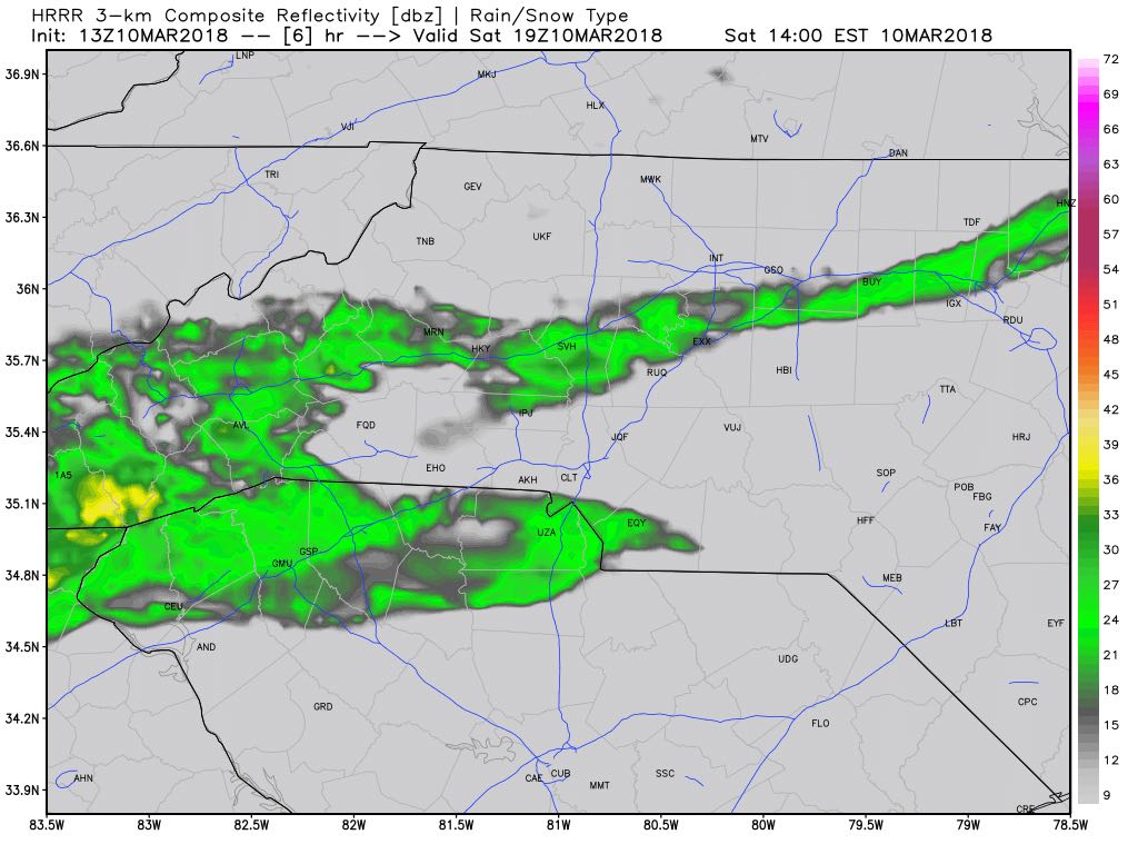
The rain will continue to be isolated throughout the day. Not looking for a washout. It just going to be a cold overcast Saturday. with a few isolated showers.
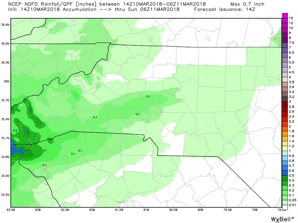
Accumulations of around a tenth of an inch is likely by the end of day today.
Now let's take a look at what Sunday is going to look like for us. To give you an overall quick forecast. It's going to be miserable. Washout and very cold rain. Rain will transition from isolated to widespread by the time you head out for church services in the morning.
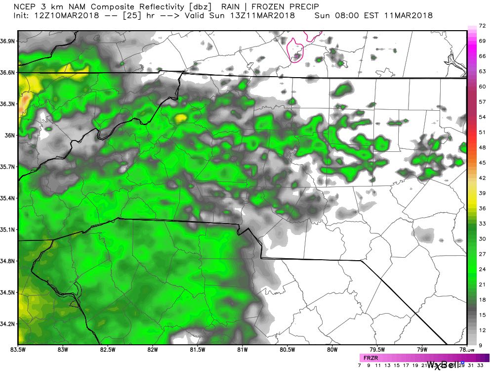
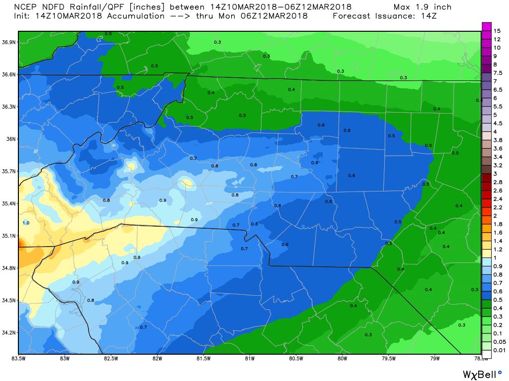
Rain will continue throughout the day on Sunday right into Sunday evening. We will see some isolated showers once again late Sunday and then as we begin to move through the overnight hours and into the early morning hours on Monday is where we could see the snow move in. More on that momentarily. As far as accumulations for rainfall by end of day Sunday we could see three quarters of an inch to an inch around the county.
Now let's get to those early morning hours on Monday. The transition from rain to a rain/snow mix and possibly all snow for a very brief period. The biggest challenge will be when the cold air moves in and how much moisture will still be in place to give us snow and how much we could get. We will see rain showers continue during the overnight from Sunday into Monday. As we get into Monday morning we start to see the cold air arrive and help transition the rain over. Here's how it should breakdown.
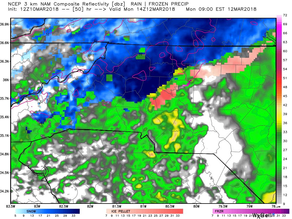
By 9am Monday morning we will start to see rain mixing in with possibly sleet and as we move into the 9am hour towards 10am we could see a transition to all sleet for a brief period. As we march into the 10am hour we will begin to see a transition from sleet to a mix of snow and sleet.
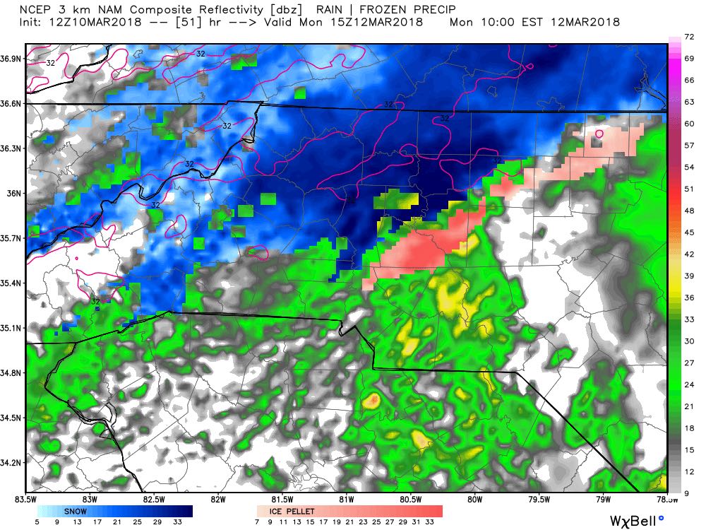
The snow sleet mix will continue as we head toward the noon hour on Monday. We could see a brief change to all snow for a very limited amount of time. The as we head into the early afternoon toward 1pm the warm air will start to nudge its way back in and we will begin to see everything change back over to rain.
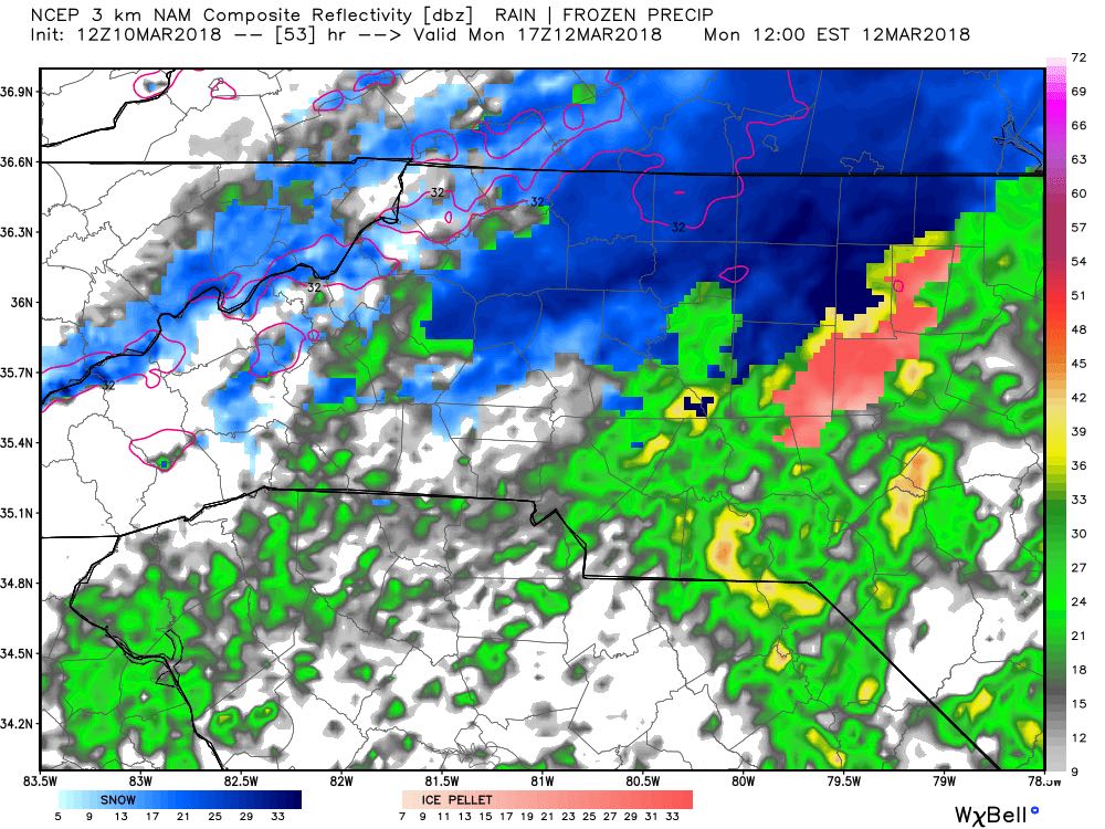
This will be a tricky forecast to nail down based on possible accumulations. The biggest reason is the warm nose that will work its way back in. The warm nose will transition the precipitation and it will have a big influence on how much snowfall accumulation we get. As of right now I think we are looking at a trace to around a half of an inch of snowfall for the county. We could see some areas in northwest Rowan County along the 1-40 corridor that could sneak up to an inch. There will be a very tight gradient along that area that could make all of the difference in the word on accumulations.
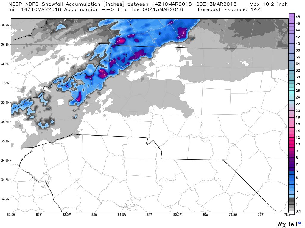
This event on Monday will mainly be an event for the mountains and areas along and north of i-40. We will see some of the rain, sleet and snow but for a much shorter timeframe than the folks living in those areas. I will continue to keep you updated right here and on social media throughout the weekend. As always thank you for following Rowan County Weather!