
System showing signs of slowing down but still bringing snow
Just a quick update as we move into the evening hours. The system is showing signs of slowing down in the mountians. That does impact a few things for us. Especially the timing. As of now models show the system moving in around 4 - 5am as what could be a very quick rain event to start but transitioning to all snow pretty quickly.
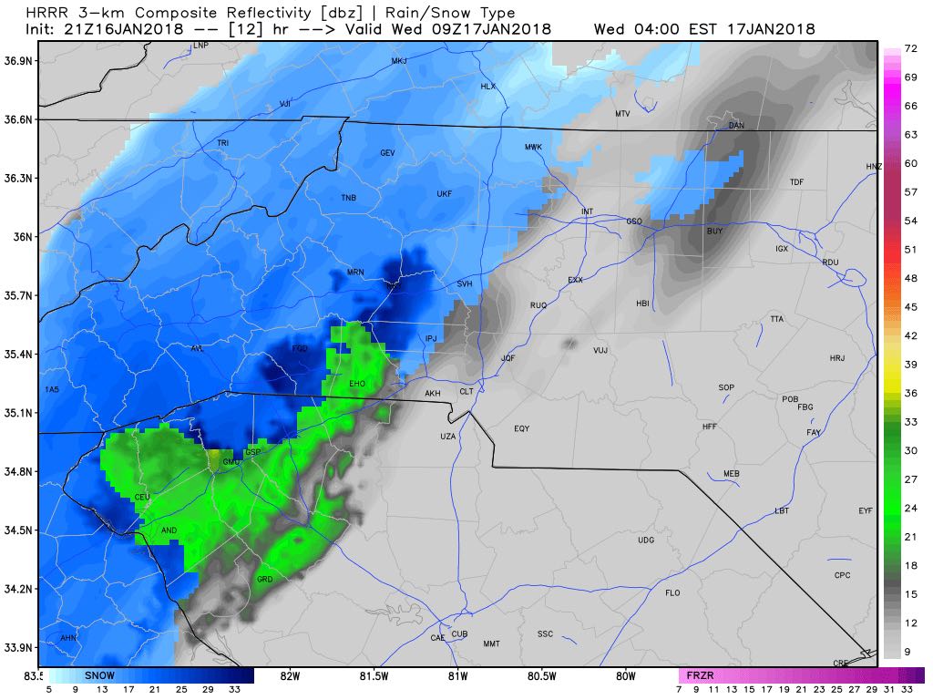
As far as accumulations go we could see based on model data (NOT A FORECAST) a rainge of 1-3 inches around the county with most of the accumulation coming in the eastern portions of the county. Basically East of I-85
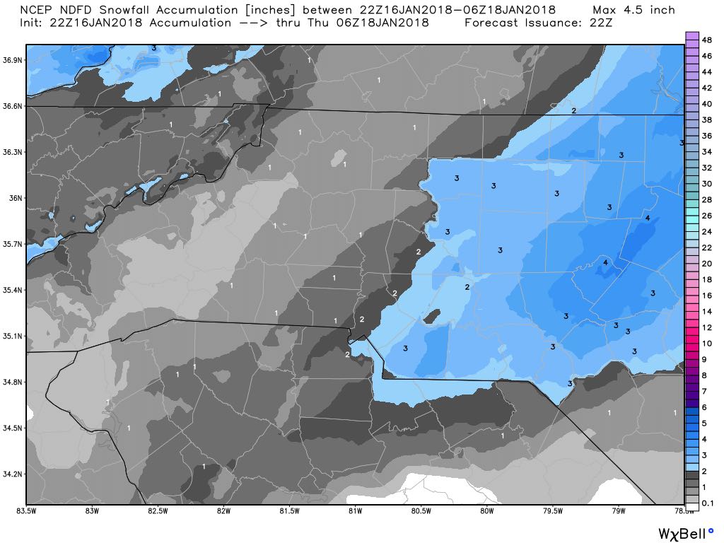
Now to be clear! I am not chaning my accumulation toals yet. I still feel pretty solid with a trace to an inch of accumulation. However, I may bump the totals up later tonight if the trend continues in the models. I will keep you updated right here and on social media as we move through the eviening. As always thank you for followinf Rowan County Weather!