
Latest on snow chances
Please take a moment to visit our local sponsors to let them know that you appreciate their support of our blog.
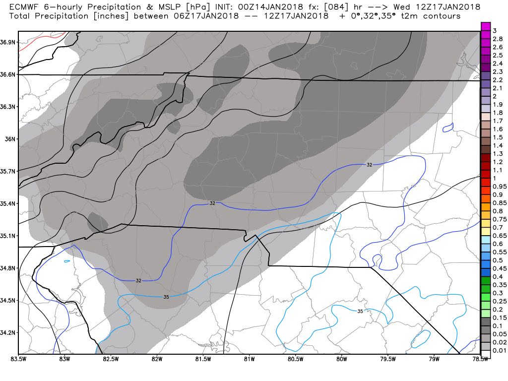
advertise your local business here »As we move closer to late Tuesday & early Wednesday snow chances continue to remain in the forecast. However, I am seeing some difference in the models. There is a difference in track and possible accumulation between the models. There is still a decent chance for us to get snow here in the county. The question continues to remain how much.

The GFS Model above shows most of the accumulation moving just north of the county during the overnight hours on Wednesday morning. the real key is that little area of green in the model. That would be the freezing line where the air will be warm enough from rain to the south and east. While snow just to the north and west. The area just north and west of that line will get the most snowfall accumulation out of anyone in the area. Right now that line is to the north of the county in the model meaning this would be all snow.

As far as accumulation for the GFS model it is showing the vast majority of the county with rainfall accumulation and no accumulation in terms of snow. except for that tiny little area in gray in the northern point of the county. That would be around the Cleveland area.
The European Model is showing the snowfall coming right through the entire county with a much more favorable accumulation listed below of 2-3 inches around the county with the majority occurring east of I-85
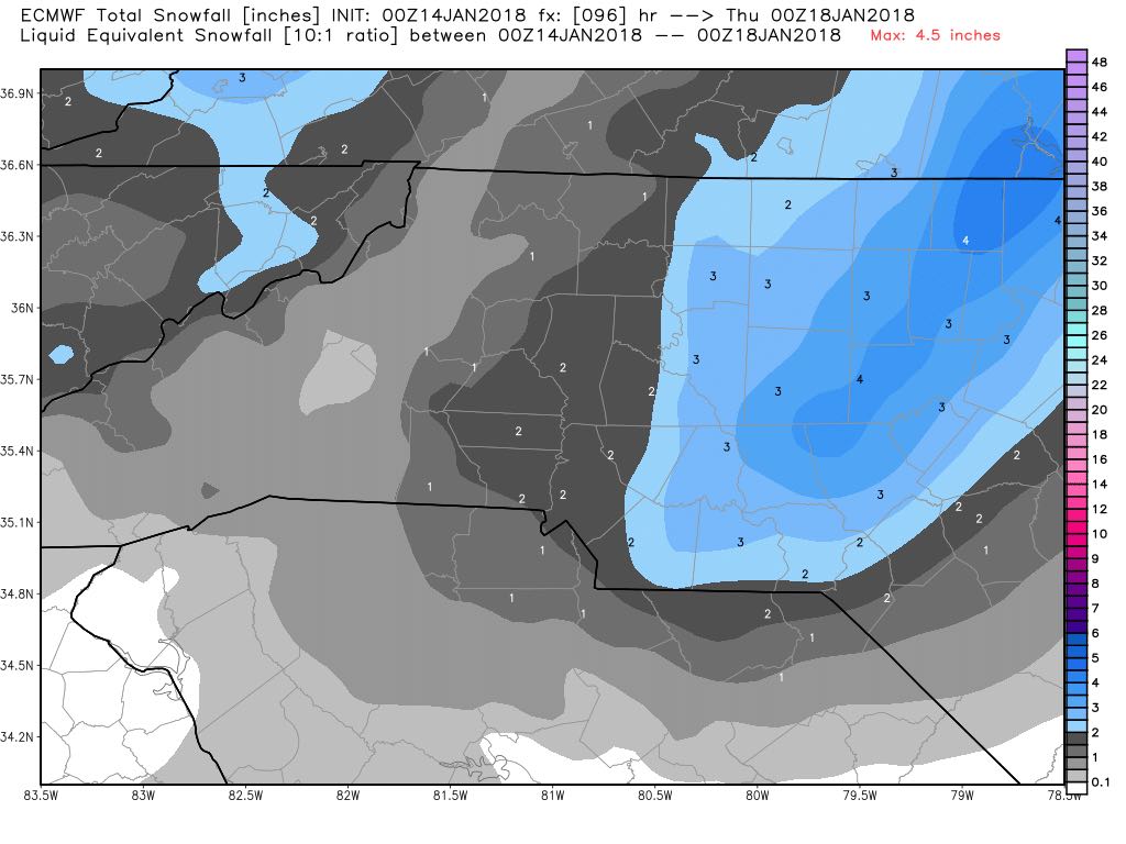
Based on the data I am still keeping us at a 40% chance of snow occurring late Tuesday into the early morning hours of Wednesday. I am only calling for accumulations of a trace to an inch at this point. The next few model runs are really going to dictate how much we can and if it ends up being rain or snow. I will of course keep you updated right here and on social media. As always thank you for following Rowan County Weather!
Please let our local sponsors know that you appreciate their support of our blog. Take a moment to visit their website linked at the top of this post.
Share this:

Announcements & Events
Check back often for important announcements and events that I'll be involved in!