
Thunderstorms possible Thursday and Friday
We could see our first thunderstorms of the year tomorrow night and during the day on Friday. The setup is being delivered to us from the transition of the warm air we have enjoyed yesterday and today moving out and cold air moving in behind it. The transition makes the atmosphere unstable and provides some of the necessary ingredients to get some thunderstorms going. Per the Storm Predictions Center we are under a General Thunderstorm Risk for Thursday and Friday. I am not expecting anything severe. We could get some gusty winds but the real story will be the much needed rainfall. Lets take a look at what you can expect.
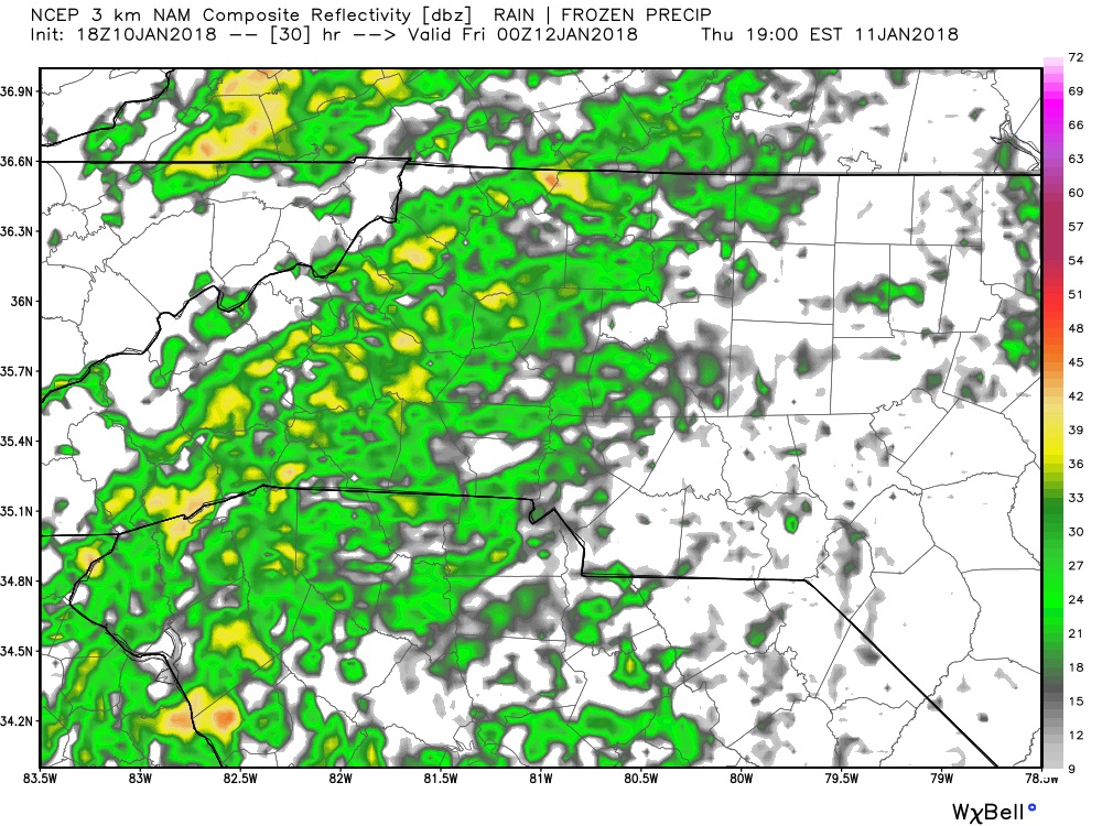
Rain will begin to move into the county around 6 or 7 pm on Thursday evening. We will see showers linger off and on as we move through the overnight and into the day on Friday. I believe as we move through the afternoon hours on Friday we will see most of the rainfall occur.
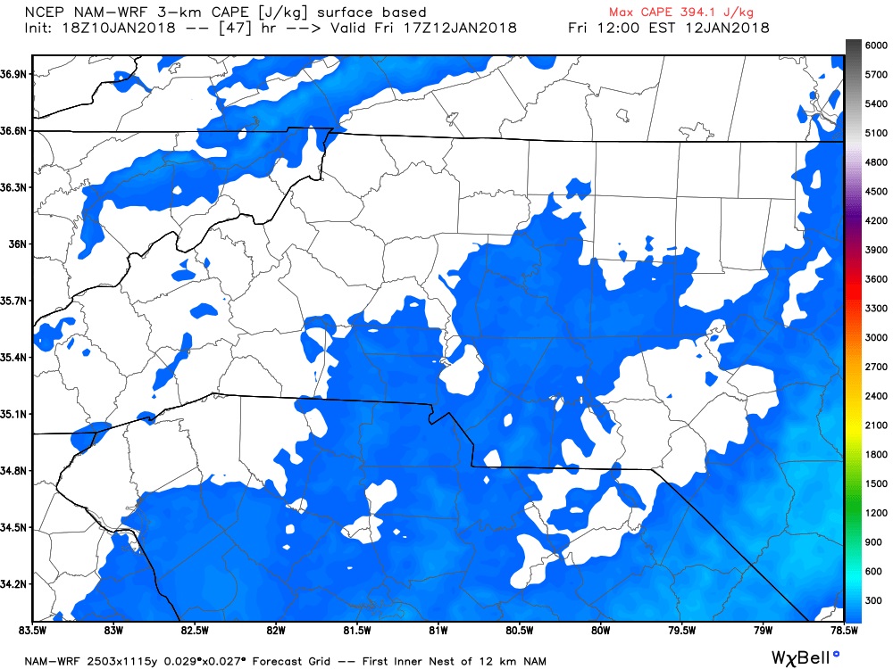
CAPE levels or Thunderstorm Fuel remain low for most of the event with a few spikes here and there. I feel our best chance for thunderstorms will come after mid day on Friday and into the evening hours on Friday. Again not expecting anything severe but the thunder will get some attention I am sure. (Don't forget the winter myth of thunder. I am sure someone will call that out as well)
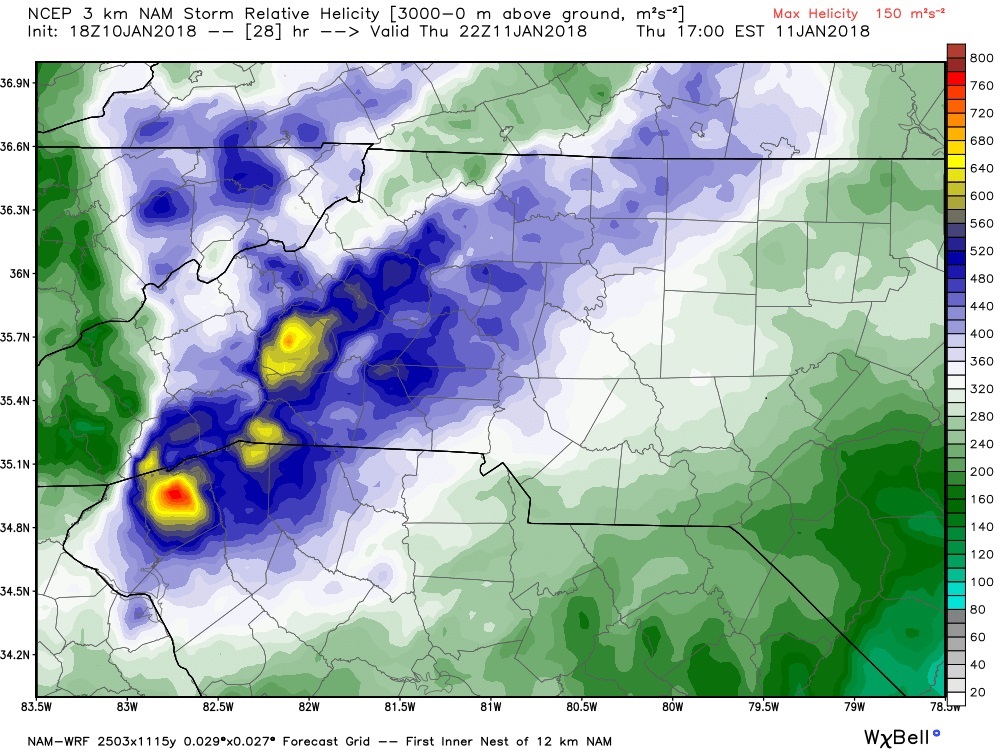
Helicity values look to stay a little elevated to our west. I think that will be the area that we could hear more about gusty winds based on upper and lower level values. These values are just to our west so I will certainly keep an eye on them as we move through the day on Thursday to ensure we don't have any issues with potential wind damage. The above values are upper level and the below values are at ground level. I currently have low confidence in any wind concerns for the next two days.

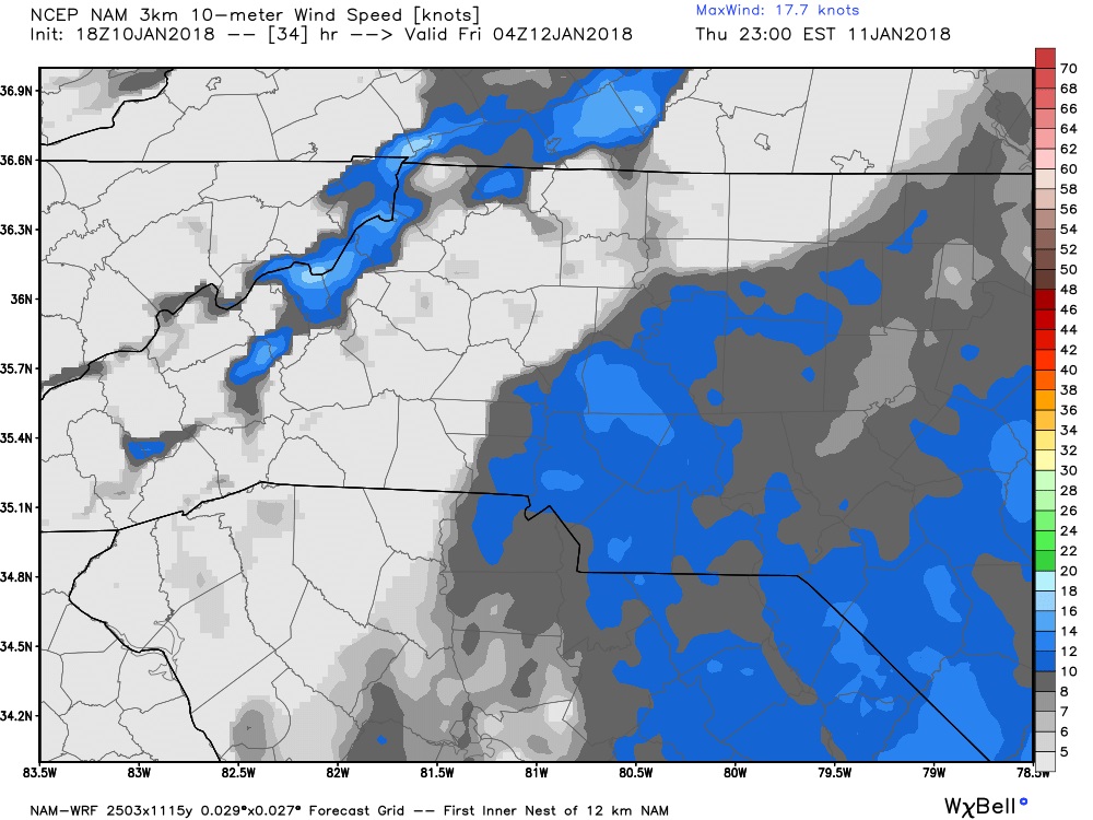
Our highest winds will likely come late on Thursday but again not much of a concern with damaging winds at this point. Please keep in mind the winds will be driven by the pressure change in the atmosphere from the cooler air moving in.
The real story will be the much needed rainfall we will get over the next 2 days. As we head into Saturday morning we could be looking at accumulation totals around the county ranging anywhere form an inch to an inch and a half before all is said and done.

I will of course keep you updated right here and on social media as we move through the next 24-48 hours with any potential severe weather that could head this way. As always thank you for following Rowan County Weather!