
Its been 2 weeks since Rowan County has had measurable rainfall
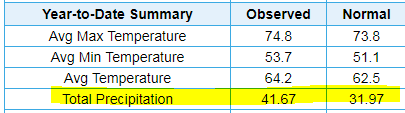
It's been a while since it has rained. As a matter of fact you have to go back to September 12th when we got 1.15 inches of rainfall. We have officially not had a drop of rain since that time. In the forecast I do not have rain coming at all for the period. It's nothing to panic about yet but something we need to monitor. For the month we are at a surplus of 3.34 inches above normal. and for the year we are at a surplus of 9.7 inches above normal.
Why are we not seeing rain?
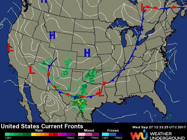
A combination of factors but the main drivers are the position of a high pressure and a cold front. On the map below you see the cold front approaching the western portions of Tennessee. Currently on the east side of that we have a High Pressure system in place for our region. That High has been doing just that. Keeping us High and dry with these warmer temperatures and dry conditions.
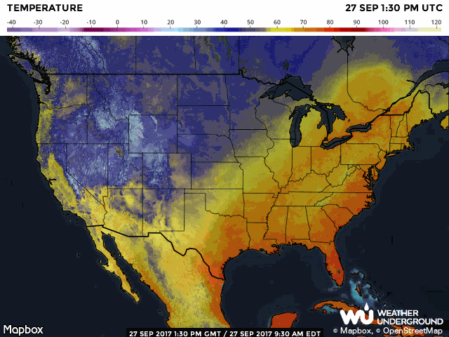
The image below further clarifies where the cool air is on the west of the cold front and where the warm air is on our side the east side of the front. The cool air indicated in Blue over the northwest portions of the country while the south and east are warm.
The good news is cooler air is on the way. the bad news is there is no moisture associated with that cooler air. High pressure will setup over the northeast keeping the air dry. The model data below shows how we may not see rain until the second full week of October.

So its important we keep an eye on the length of time between our last rainfall and our next one. New Drought Monitor information will be released form the Climate Center tomorrow. I would not be surprised to see the county under abnormally dry conditions. I will of course continue to keep you updated throughout the upcoming days as the forecast continues to change. As always thank you for following Rowan County Weather!