
La Nina hinting at a return for winter?
As we start to march closer to the cooler months of the last half of 2017 and the first half of 2018. Thoughts begin to resonate on what kind of winter weather we will have. I don't officially release my Long Range Winter Update until Halloween but I did want to give you some insight on what could be a driving factor for the upcoming winter season. There is some evidence that La Nina could develop during the fall and winter months. If this occurs this will have an impact on what type of weather we get for the upcoming winter season.
What is La Nina?
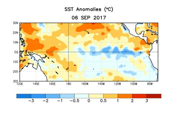
La Nina refers to the periodic cooling of ocean surface temperatures in the central and east-central equatorial Pacific. Typically, La Nina events occur every 3 to 5 years or so, but on occasion can occur over successive years. La Nina represents the cool phase of the El Nino/Southern Oscillation (ENSO) cycle.
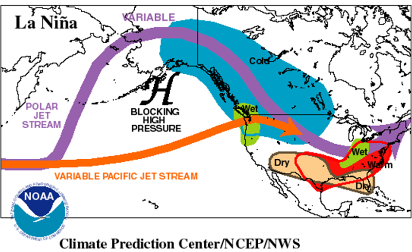
During a La Nina event, the changes in Pacific Ocean temperatures affect the patterns of tropical rainfall from Indonesia to the west coast of South America. These changes in tropical rainfall patterns affect weather patterns throughout the world. These effects are usually strongest during the winter months when the jet stream is strongest over the United States. As shown in the image below, La Nina episodes in the winter months feature a wave-like jet stream flow across the United States and Canada, which causes colder and stormier than average conditions across the North, and warmer and less stormier conditions across the south. Historically for this part of the country, fall tends to be warmer and drier than normal while winters tend to be wetter than normal. However, there are also many other complicated factors in the atmosphere and oceans that can also impact our weather patterns.
I am not a big fan of long range outlooks because there are always many uncertainties that typically change the outcome of a forecast beyond 4 and 5 days out. Perfect example. Look back at Hurricane Irma last week. There were storm tracks that were focused beyond that 4 and 5 day period and the storm did not even track to where those long range tracks were indicating. As far as our long range models going into the next 45 days. Starting as early as next week we are looking to head into a warming trend that appears to last the remainder of September right into early October. See below.
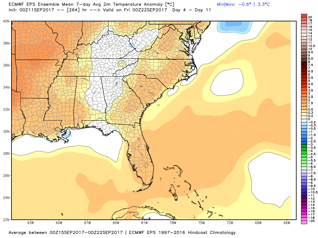
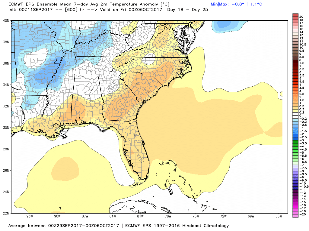
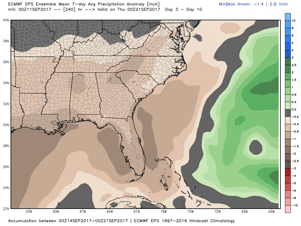
Now there could be a few times over this forecast period where we see some weak cold fronts come through that cool us down but there is nothing overall that is showing that occurring. As far as rainfall it also looks like we maybe heading into a very dry period for the remainder of September as of right now there is not much in the long range forecast that jumps out as any kind of significant rainfall event.
Now as I said earlier and I will reiterate right now. These long range forecast are not the best advise to follow so you have to take them with a city bus grain of salt. However, if La Nina does indeed return these could become pretty viable models for the overall long range winter forecast. I will release that information on Halloween Day. For now this is something for us to be watching to see how the pattern does indeed play out. As always thank you for following Rowan County Weather!