
Sunday Weather Update and latest on Hurricane Irma
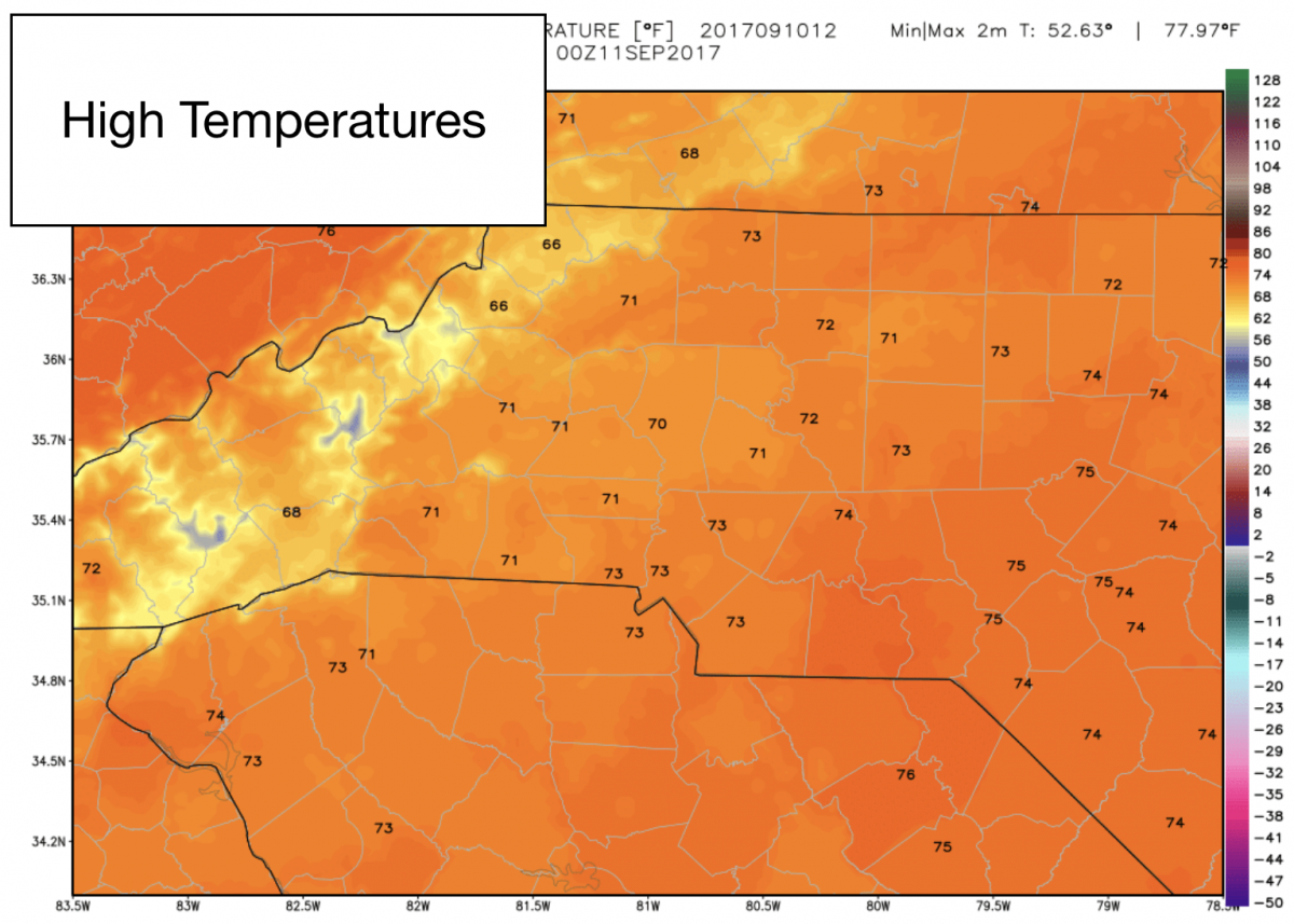
Good Sunday Morning! We are in for another very nice day around the county before we start to see impacts from Hurricane Irma starting tomorrow. The good news is there has been a little reduction in those impacts. I will talk about Irma in just a moment. Here is what you can expect today. The skies will be sunny with a high of around 71º
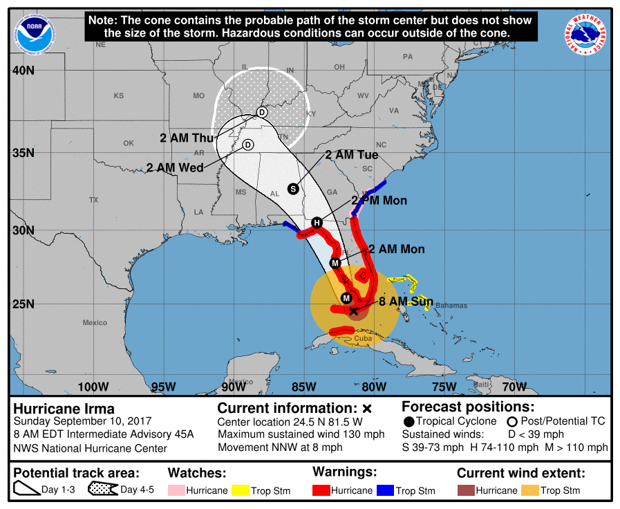
Now the latest on Irma first lest start with the advisories from the National Hurricane Center. As of 8am Irma has become a Category 4 storm and the eye is currently near the Florida Keys.
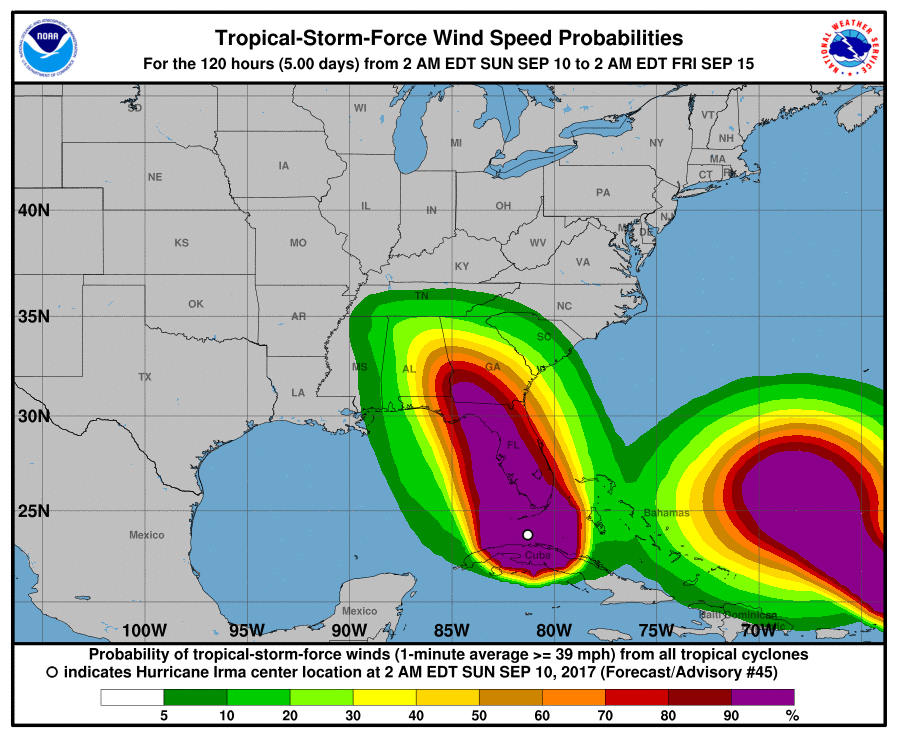
The latest look at the Tropical Storm Force Wind Potential with the shift has taken us out of the sustained wind area. That is a big plus for us. Now we are looking at sustained winds around the county of around 20-30 miles per hour.
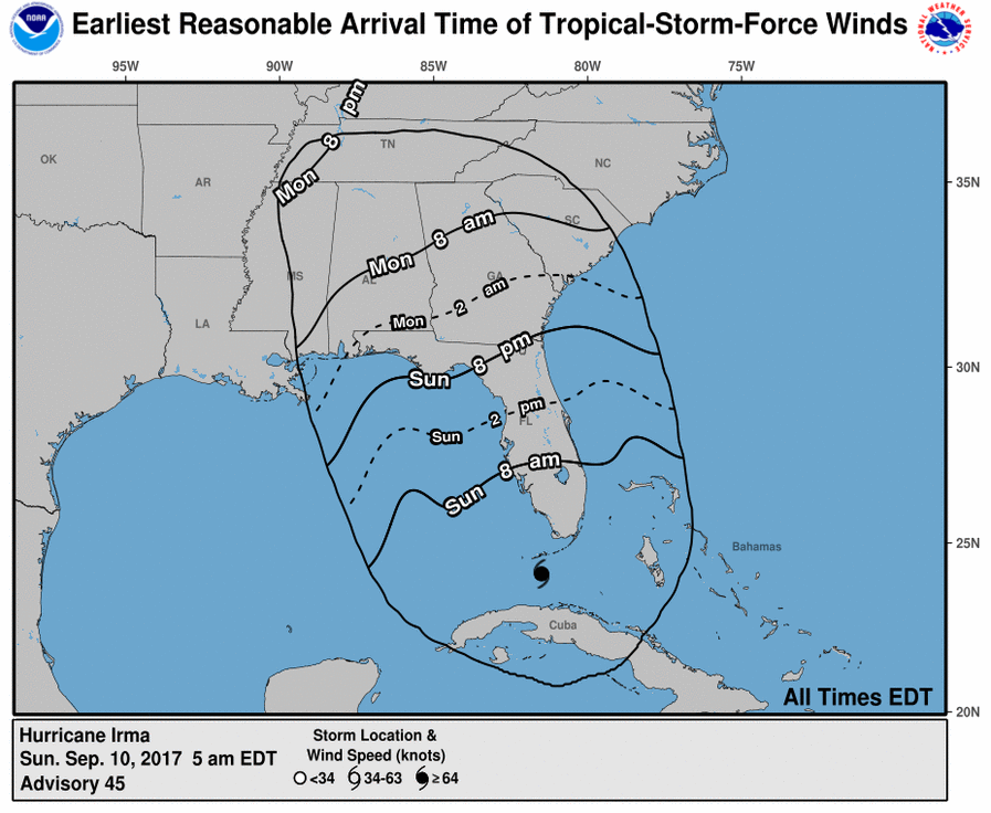
Even from an earliest reasonable arrive of Tropical Storm Force Winds we are out of that coverage area.This does not mean we will not have strong winds. This just means they will not be sustained at over 39 miles per hour or more.
The amount of rainfall expected per the National Hurricane Center is also down just a bit from the 2+ inches of rain to more of 1-2 inches of rainfall now. This is a positive for us.

Now lets take a look at the models and how they compare to each other. Plenty of agreement with the models and today since we are closer to the forecast period I am able to include the NAM as well.
Lets start with the wind gust potential.
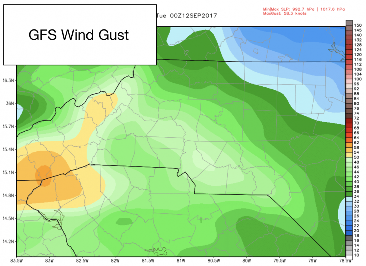
The GFS Pictured above still has us with a chance of seeing gust of around 50 miles per hour. This is an improvement from the 60 mile an hour gust potential we have been seeing.
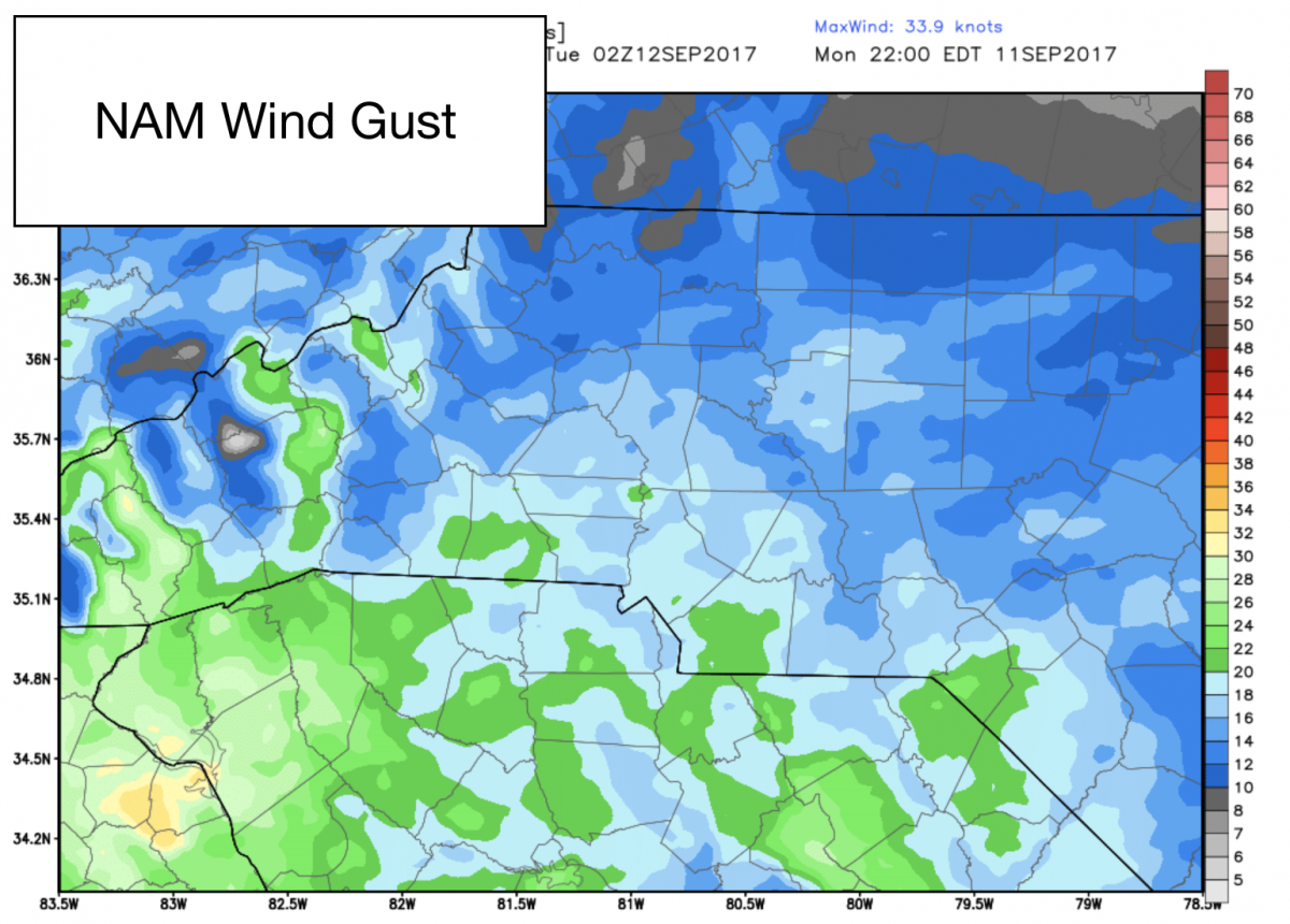
The NAM pictured above shows the potential wind gust around 30 miles per hour for the county. This could be a little understated. I am going to watch for consistency over the next few model runs.
Now lets take a look at the rainfall accumulation potential in the models below.
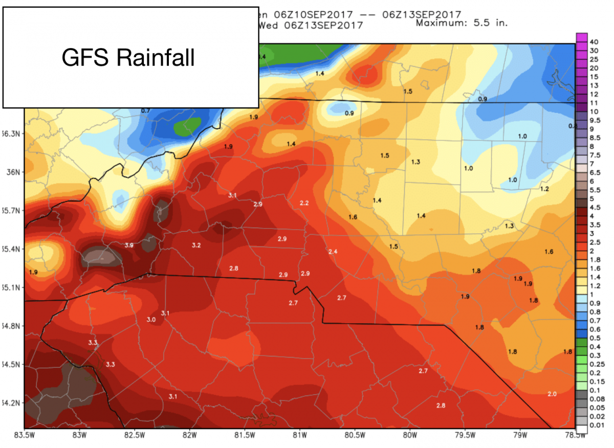
The GFS model pictured above has us looking at around 1.5 - 2 inches of rainfall around the county for Monday and Tuesday.
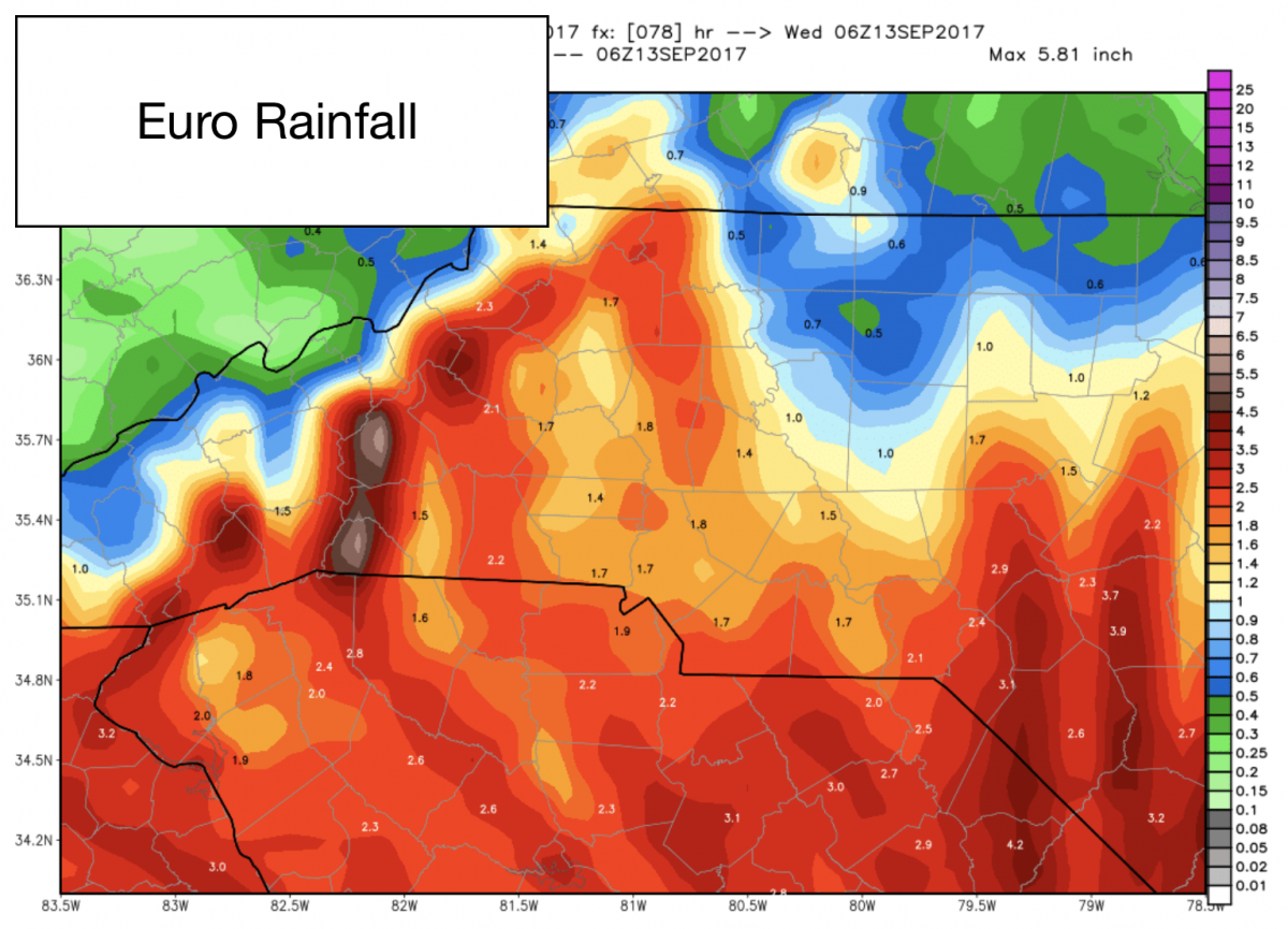
The European Model shows the range being 1-2 inches of rainfall around the county.
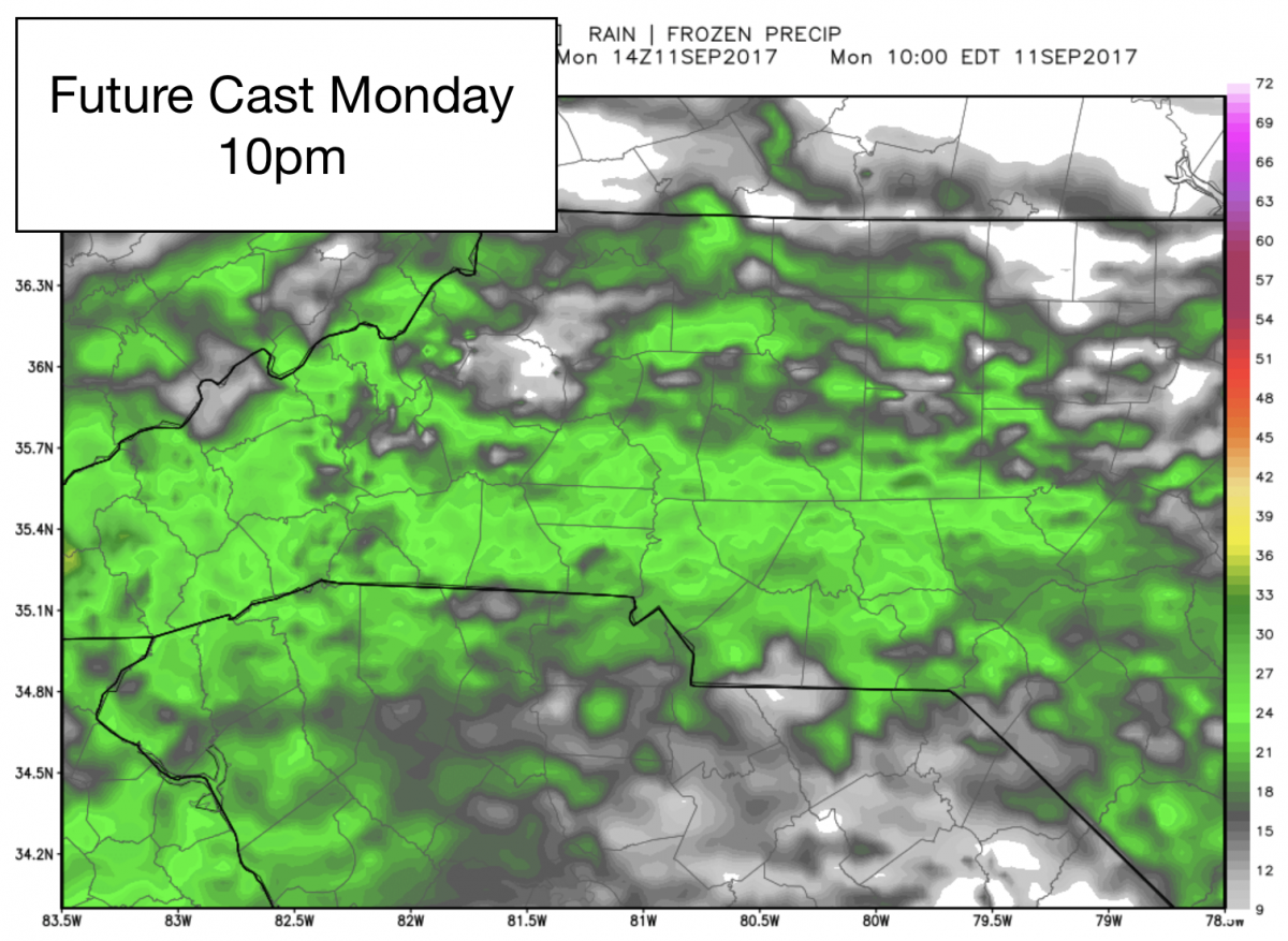
I know many want to know when the impacts will start here in the county. I am looking for conditions to begin to deteriorate for us beginning in the afternoon hours on Monday around 3pm and we will see rain pickup throughout the afternoon and into the evening with winds continuing to be more sustained and gusty as we get later in the afternoon and evening on Monday.
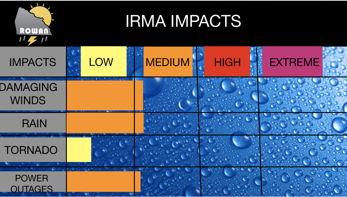
So here are my current thoughts. I still see areas in the county getting at least 2 inches of rainfall. We could see more if a heavy rain band moves through the county. Winds will be sustained between 20-30 miles per hour with the potential for some gust being around 40-50 miles per hour. This will feel more like a prolonged strong thunderstorm event at this point. If you want the positive that's better than a Tropical Storm event. Below is my current thoughts on the level of impacts we could see here in the county.
I will continue to keep you updated right here and on social media throughout the day as updates and advisories for Irma continue to be available. As always thank you for following Rowan County Weather.