
Today's Weather and The Latest on Hurricane Irma
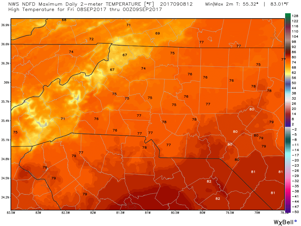
Good Friday Morning! I hope you are ready for another nice day of weather around the county. We will be looking at a high of around 75º If you are heading out to the football games tonight you may need a light jacket as it gets later in the game. Things will start to cool down.
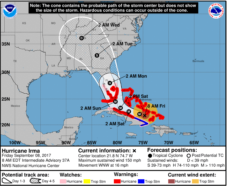
The latest on Hurricane Irma as of the 8am Advisory. Irma continues to slowly weaken as a Category 4 storm. The impacts will still be devastating for anything in the path of this storm over the next 24-36 hours. The latest track has the center of the storm to our west and that has helped to improve our weather forecast for the impacts form Irma here in the county.
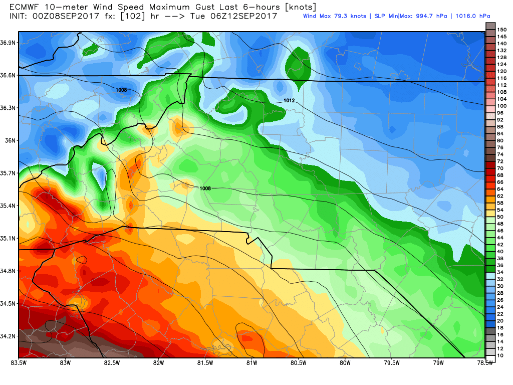
I want to show you how the models are really starting to come into agreement with Irma and that is helping to build confidence in the forecast and where the storm looks to be going. Lets start with the GFS Model.
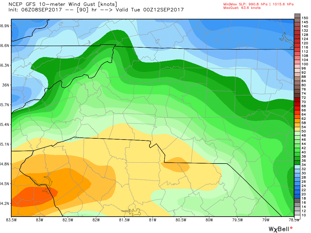
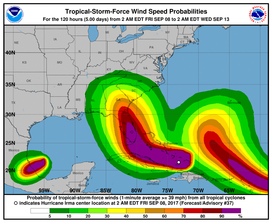
Based on current Data both the GFS pictured above and The European pictured below still shows us with decent chances of seeing wind gust in the area of around 60 miles per hour. The sustained winds could be 35-40 miles per hour as the center of the storm moves closer to our west.
The Rainfall totals are also in alignment lets take a look at that.
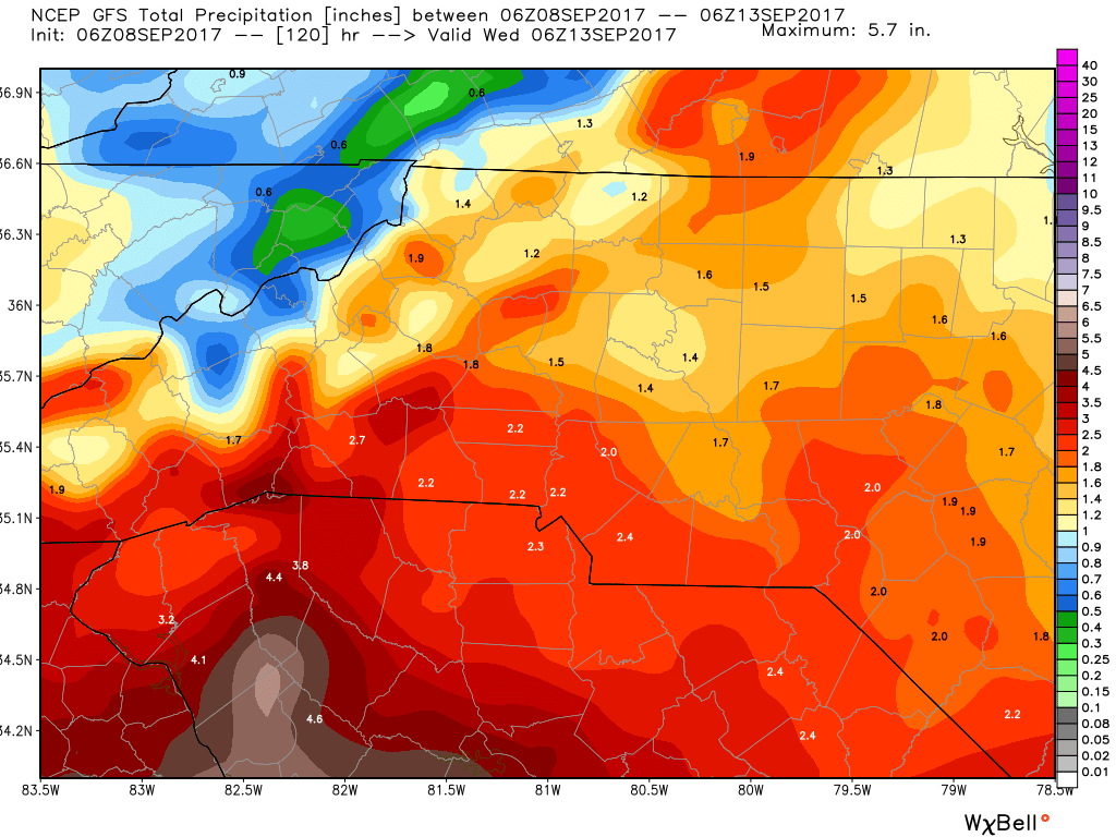
The GFS above has us getting anywhere from 1.5 to 2 inches of rainfall around the county. Now this could be on the low end if some heavy rain bands move through. The European model below I believe is really on the low side of rainfall totals but is still pretty close to agreement with the GFS. Showing anywhere form an inch to 2 inches of rainfall around the county.

As far as our probability of getting Tropical Storm Force Winds. That has dropped a bit to 20% however, don't let your guard down that is still high and with some soggy ground sustained winds and gust could bring some trees and power lines down.
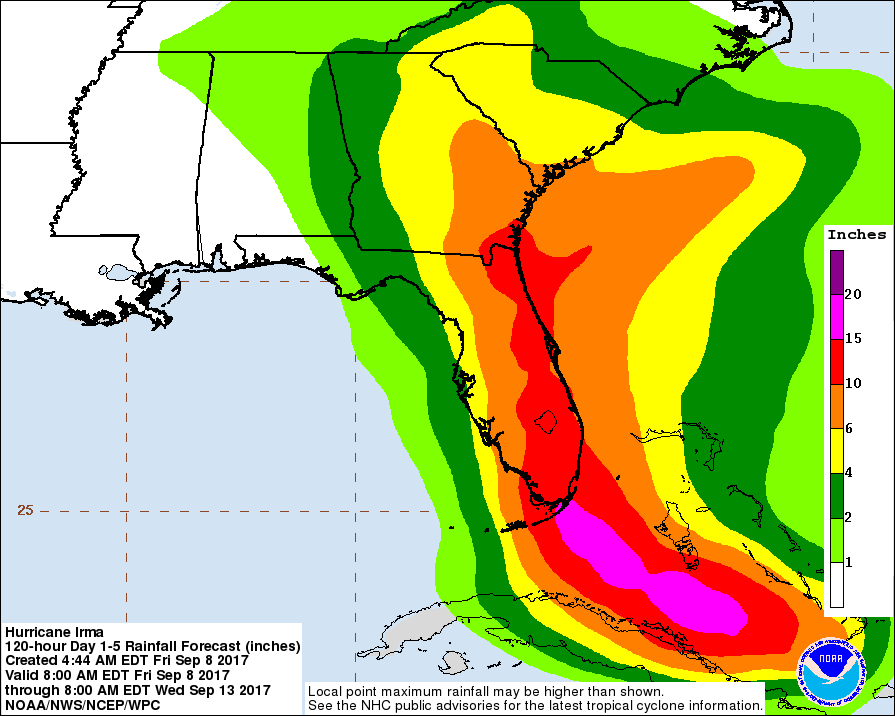
The Current rainfall possibilities given by the National Hurricane Center are also in agreement with the forecast models of around 2 inches of rainfall here in the county and the area.
I will continue to keep you updated right here and on social media throughout the day as updates continue to come in on Irma.Tomorrow I will start to provide information on the specific impact levels we could see from the storm as it moves through the area. As always thank you for following Rowan County Weather!