Todays Weather and the latest on Hurricane Irma
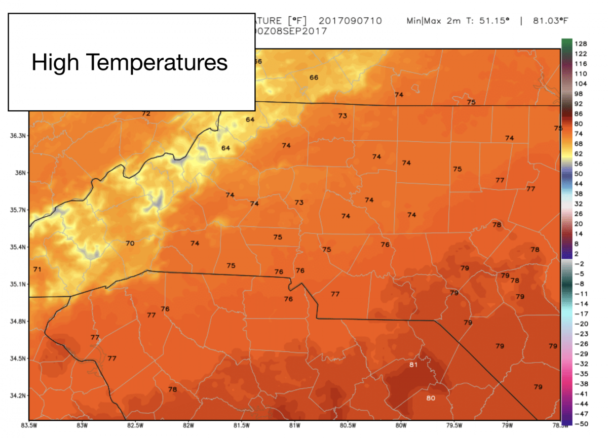
Good Thursday Morning. Today is going to be perfect. So my update for todays weather will be brief. The news we need to start to focus on is Hurricane Irma. So heres what to expect today. Sunny skies with a high of 74º
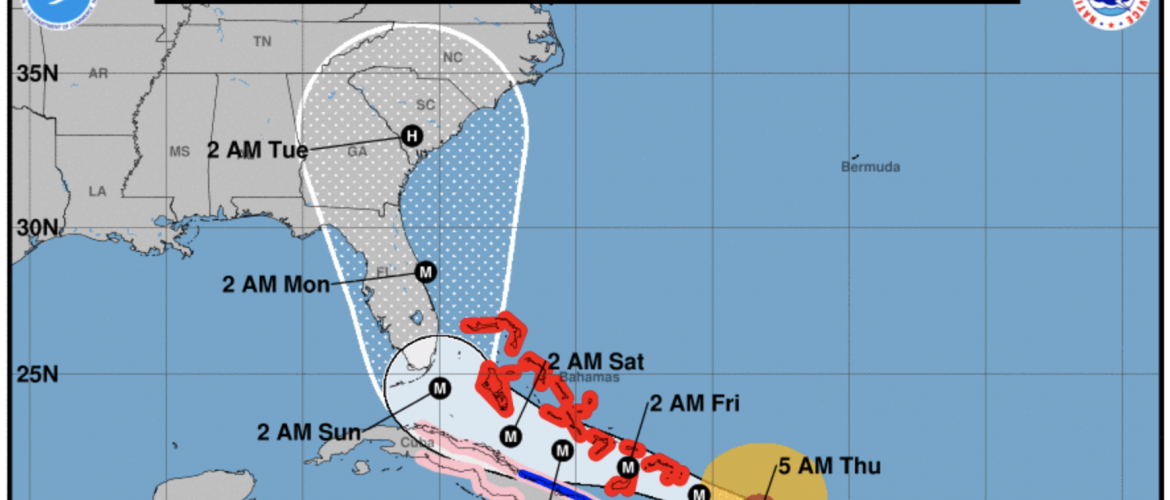
Now on to the latest with Hurricane Irma. Lets first start by taking a look at the latest advisory from the National Hurricane Center. This is the 5am Advisory as of this morning.
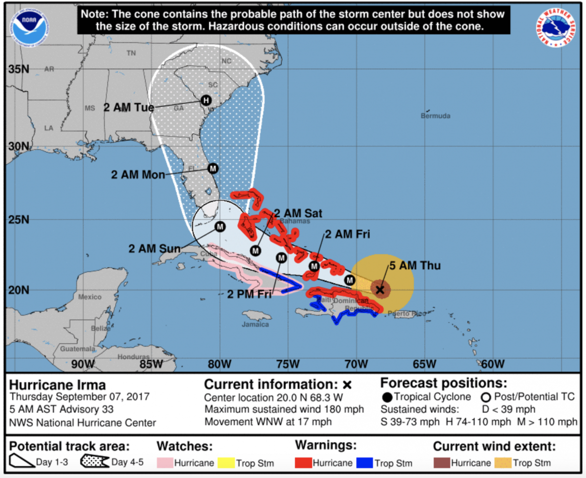
The storm is expected to make landfall somewhere south of Charleston South Carolina during the early morning hours on Tuesday. The storm is forecast to be a Category 1 storm by its landfall in SC. (Now I keep fielding questions about Hugo and similarities. Please know this storm is not the same as Hugo. Hugo took a more direct line toward Charleston. It was moving at around 40 miles per hour and was a Category 4 storm. Irma will be moving in with some of the storm over land before it makes landfall in SC. The storm will only be moving at around 9 miles per hour and wind speeds will be around 110 miles per hour. There is no comparison)
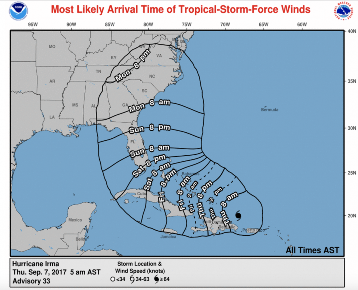
We can expect Tropical Storm force winds to arrive to the county sometime during the day on Monday. These gust will reach speeds of around 45 miles per hour as they increase on Monday.
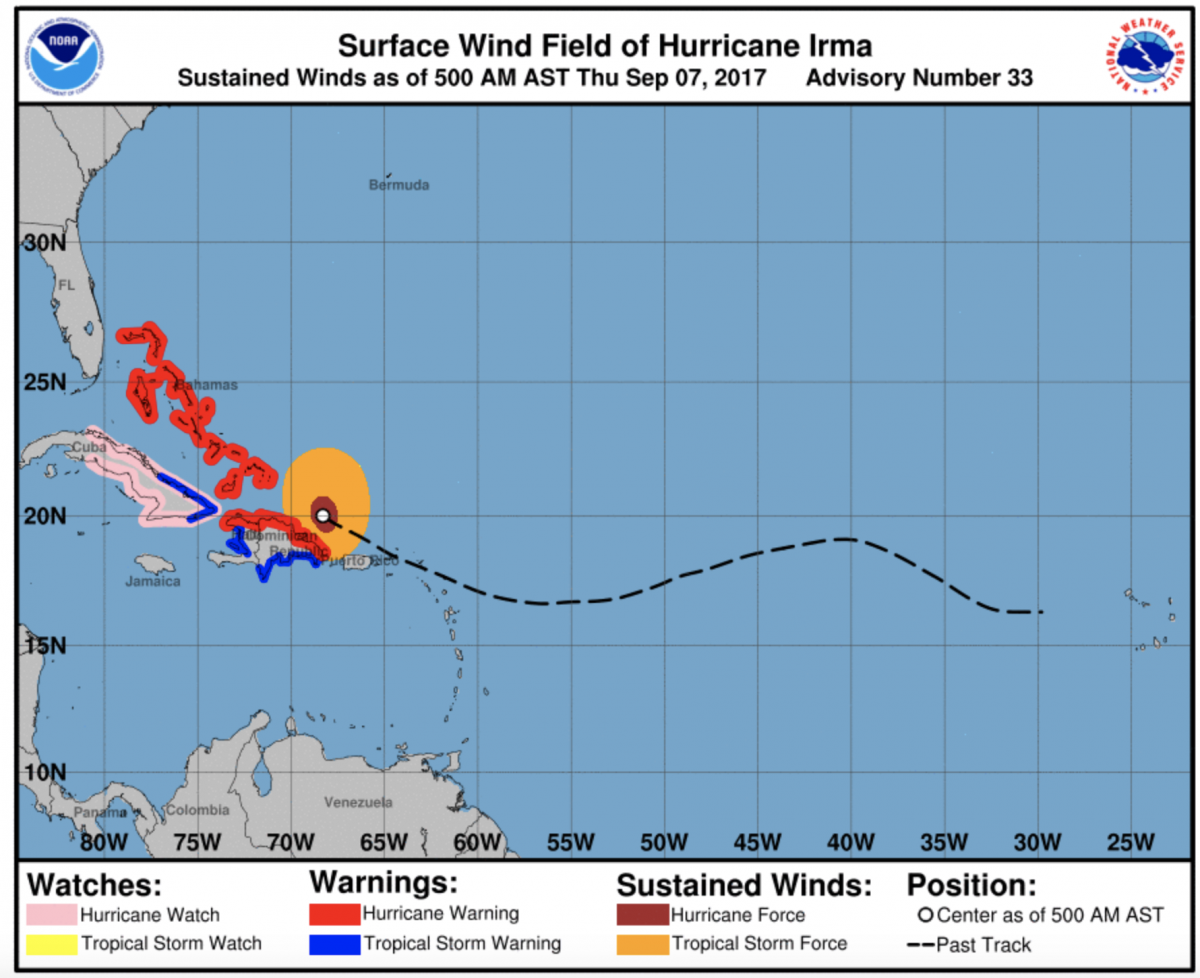
Watches and Warnings are currently out for the Bahamas, Cuba and the Dominican Republic. We will start to see watches and warnings issued along the East Coast over the next 24-48 hours as the storm continues to move closer to the United States mainland.
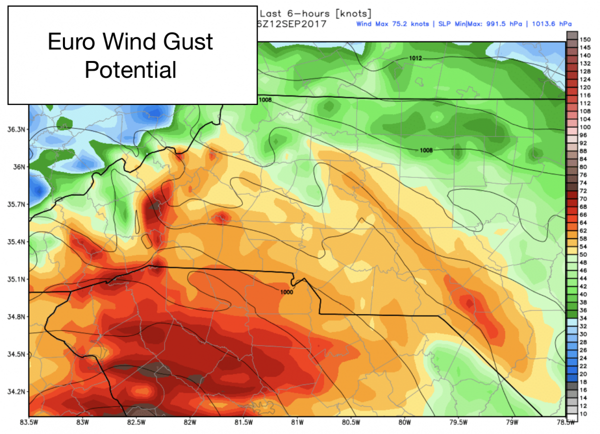
Here are my latest thoughts on what we could see here in the county from the storm. I am using the two main models the GFS and the European. Things are similar with these models and there are some slight variations. I will explain as we go through the images and data. Lets start with the Wind Gust.
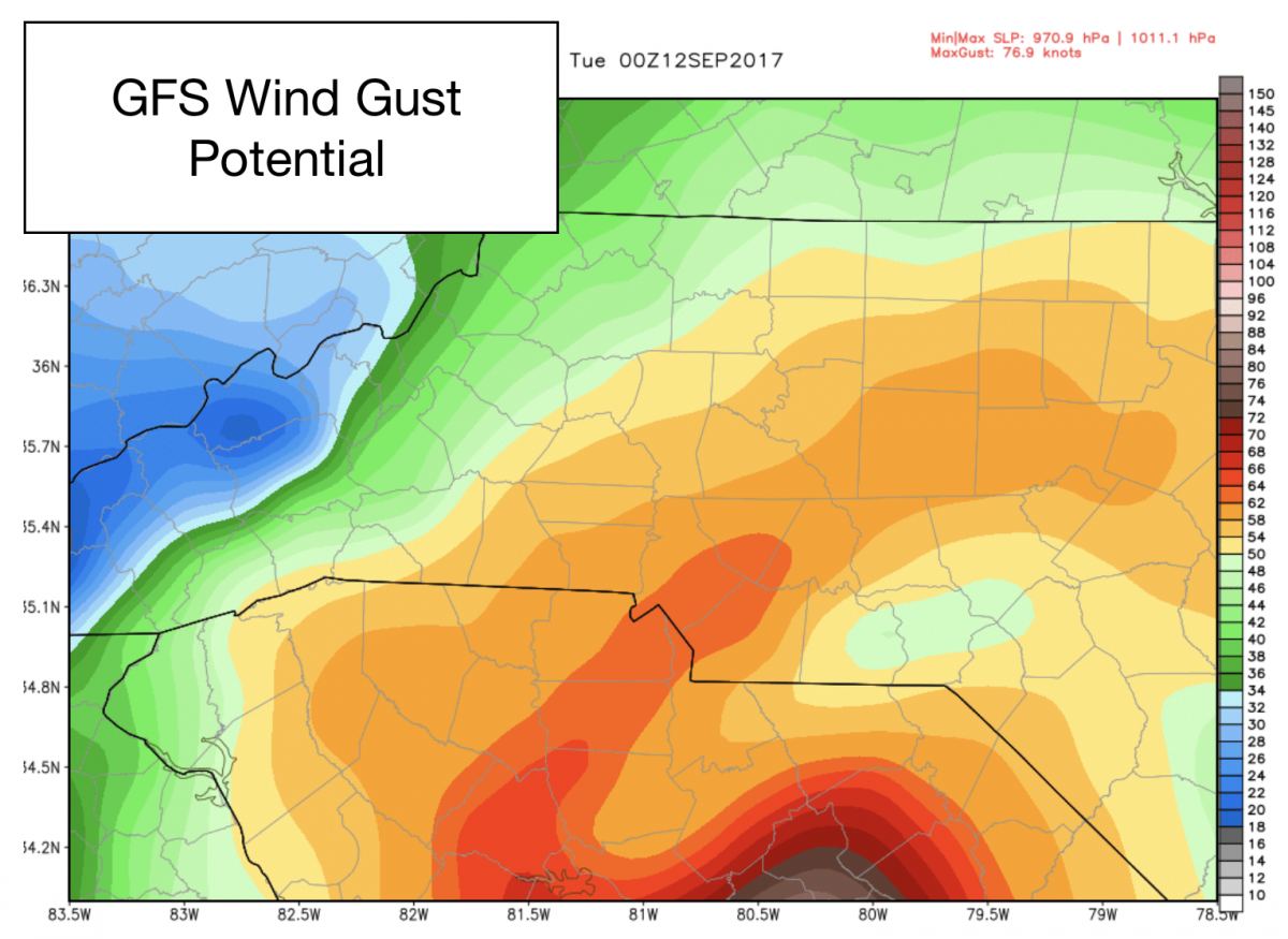
Based on the GFS the wind gust in the county could reach as high as 60 miles per hour around the county. The European image below is also in agreement.
The rain fall potential will be the difference. The GFS has the storm making its way throughout area. most likely by that point it would be a Tropical Storm or Depression. The European has the storm taking a more easterly track. This has a difference in the rain fall totals. Lets take a look.
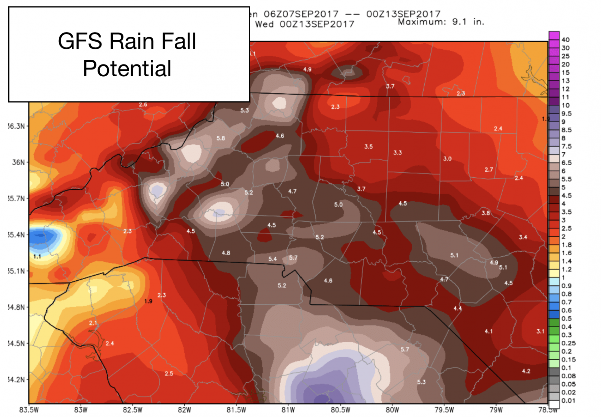
So with the GFS brining the storm right through this area. Heavy rainfall bands are possible. So we could see somewhere around 5 inches of rain fall on Monday & Tuesday. This would certainly cause some localized flooding that may have effect on roads in the area that are prone to flooding.
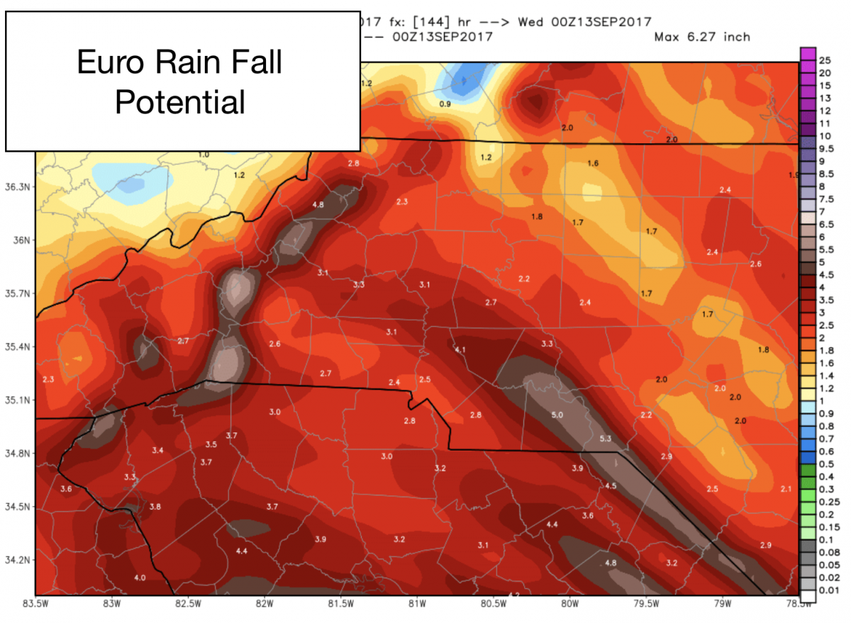
The European brining the storm to the east does lower the rainfall totals a bit to around 3 inches of rainfall Monday & Tuesday. Localized flooding is still a threat but the impacts would be less based on the lower totals. So please prepare. The power outages are a concern for me with the combination of rain fall and winds. Trees could come down due to the ground being saturated. Power Lines are certainly a concern. I will continue to keep you updated on Irma as the storm continues to march through the Caribbean. and moves toward the area. Please look for updates right here and on my social media outlets. As always thank you for following Rowan County Weather