
Today's Weather & The Latest with Hurricane Irma
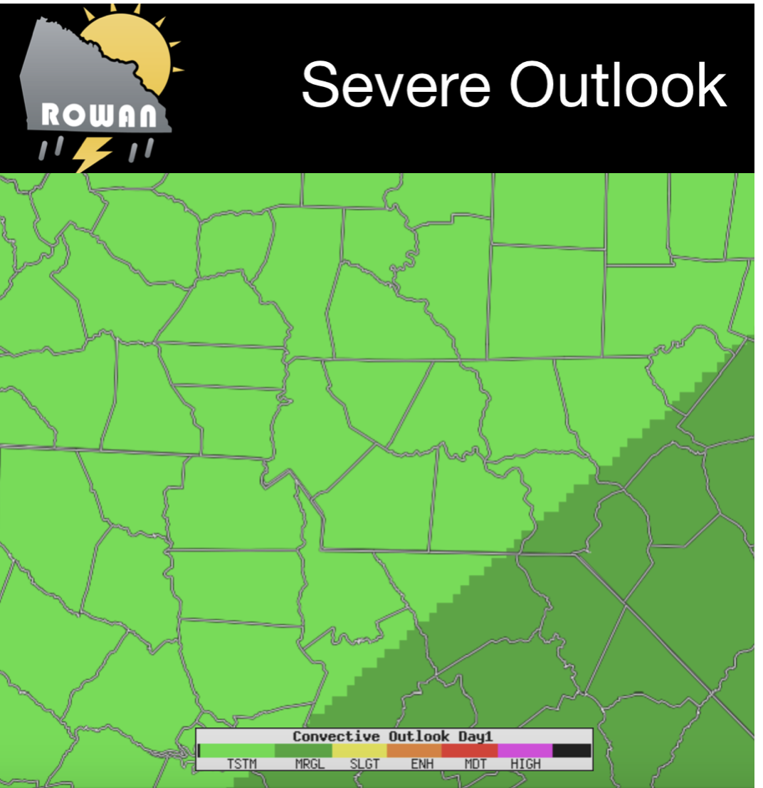
Good Wednesday Morning everyone! I know Irma is the story on everyone's mind but lets take a look at today's weather first then we will shift our attention to Irma. The Storms Prediction Center has us with a General Thunderstorm risk today. I feel this is definitely what we are looking at. Mainly showers with a few rumbles of thunder possible. Nothing severe or strong.
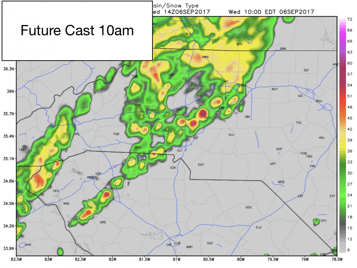
Rain showers and a chance of a rumble or two here and there should start rolling through the county around the 10am hour. Not looking for a washout today but we will see periods of rain throughout the day.
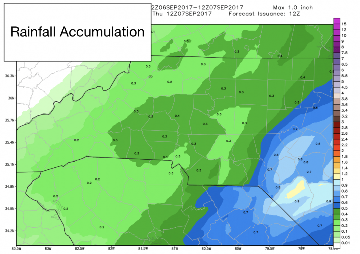
As far as accumulation goes we will see anywhere from a quarter to three quarters of an inch of rainfall around the county as showers move through.
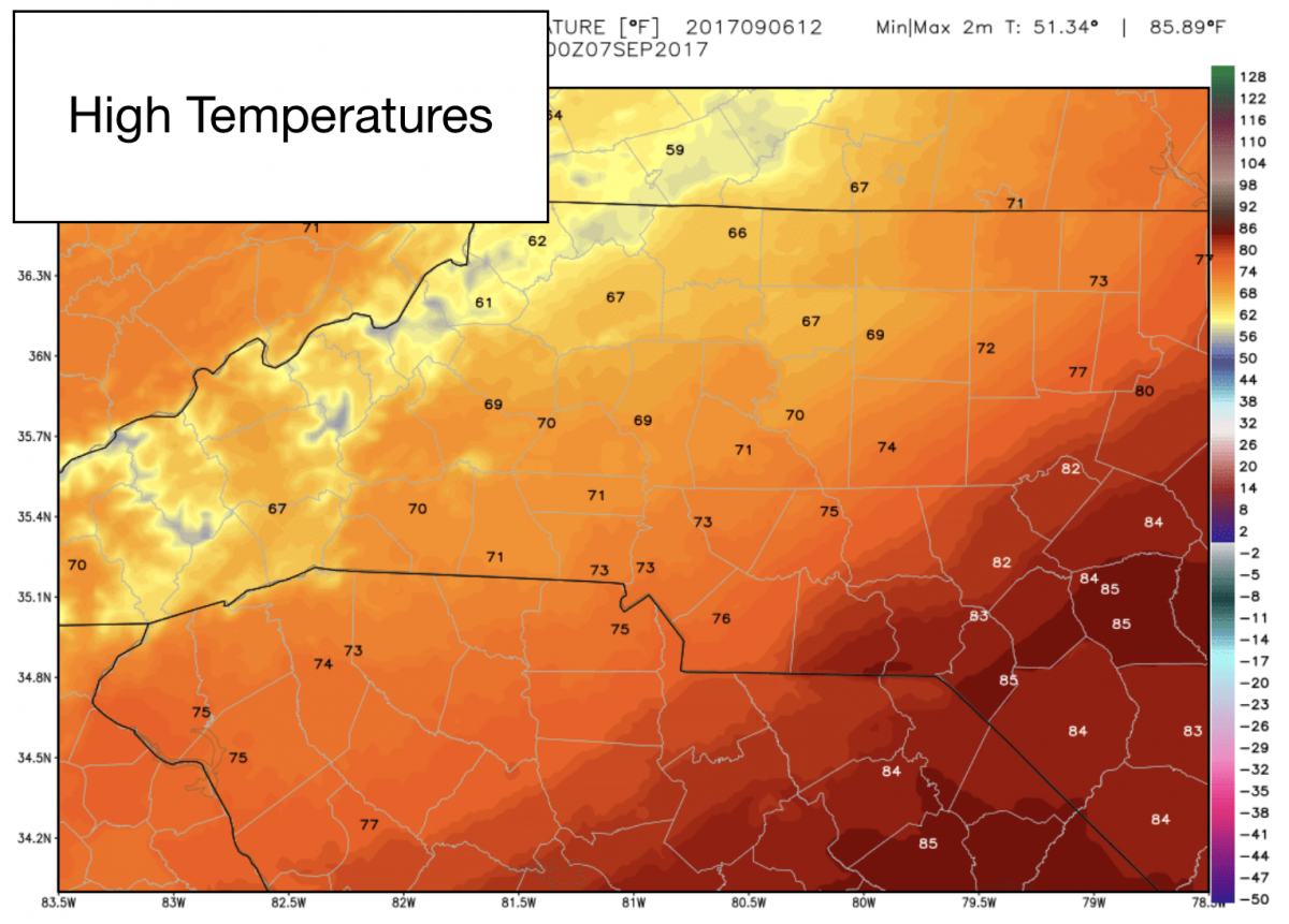
The high today will be unseasonably cool with us topping out at only around 71º
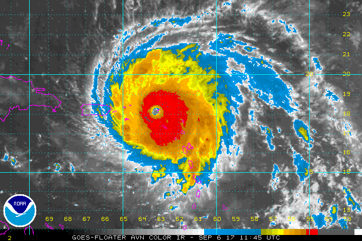
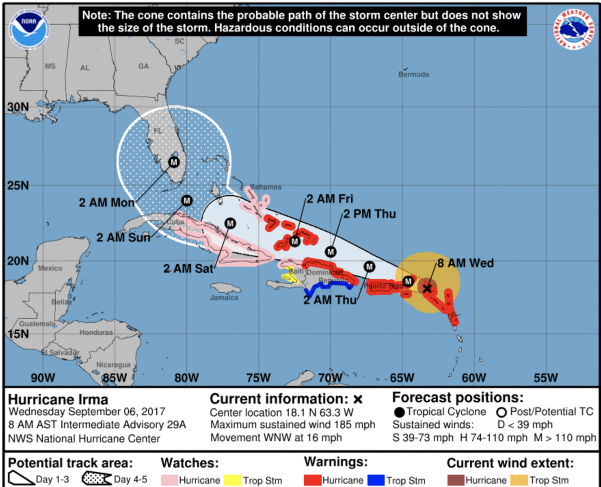
Now lets take a look at the latest on Hurricane Irma. The latest satellite imagery of Irma still has this storm looking strong as a Category 5 with Maximum winds of 185 miles per hour. Heres the latest satellite view and 8am advisory.
Now lets take a look at how the two big models are handling Irma this morning. There is some agreement with them. That is a trend I will be watching over the next 24 - 48 hours.
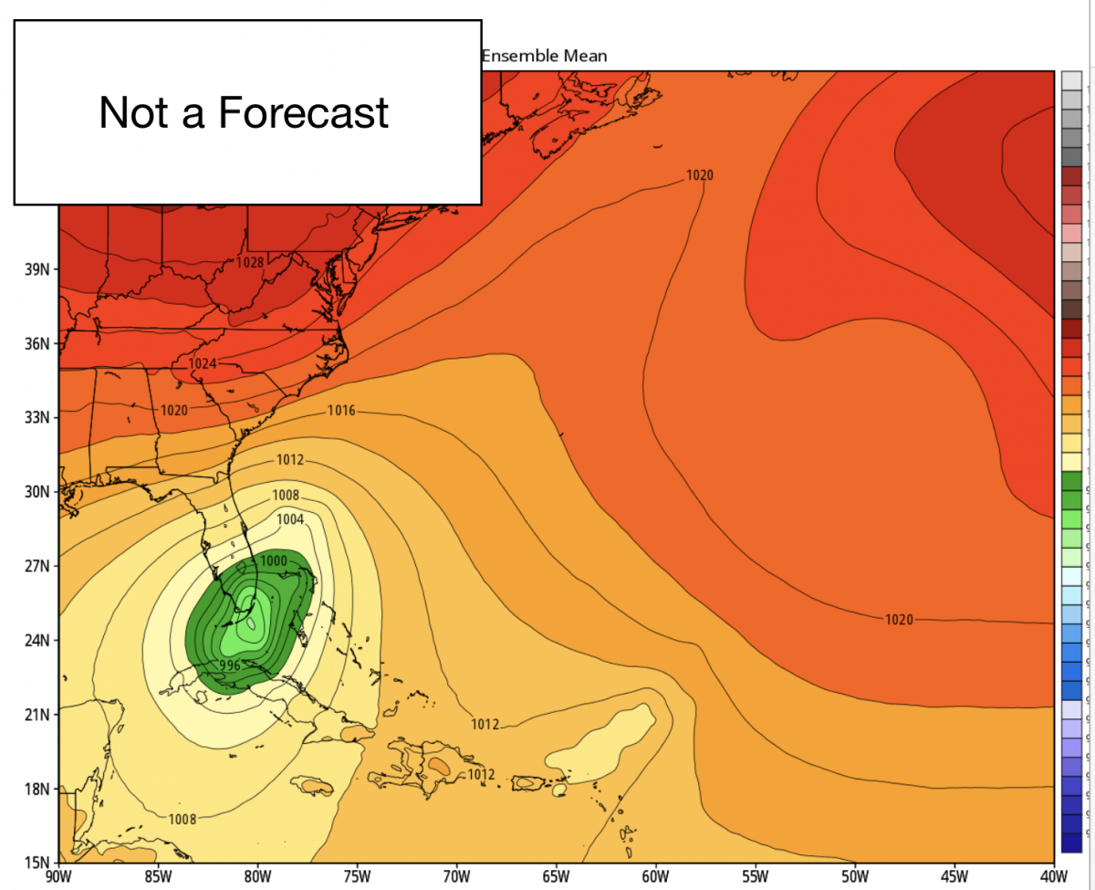
Let's start with the GFS
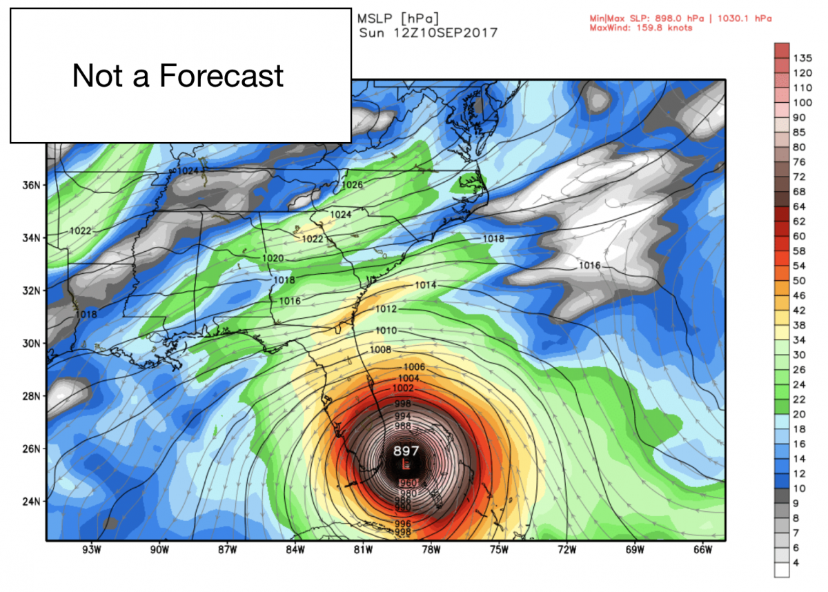
Sunday the GFS Model has Irma sliding east along the Florida Coast around Miami. This is slightly east of the track that the Hurricane Center is showing. Now watch what happens as we jump ahead a day.

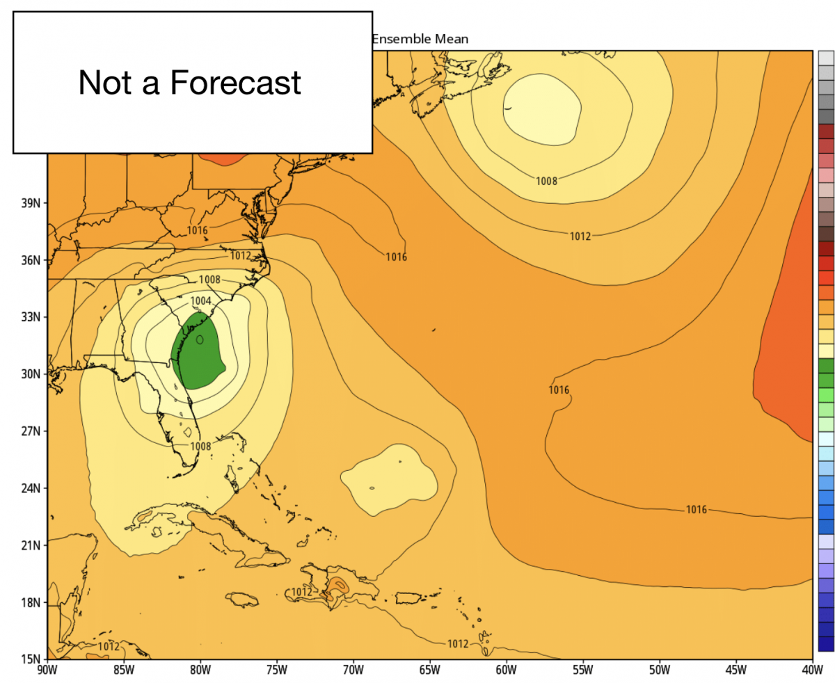
On Monday the GFS has Irma making landfall somewhere around the GA/SC coast. No keep in mind this is not a forecast just a model so this is not a definite at this point. Now watch what happens in the next model frame.
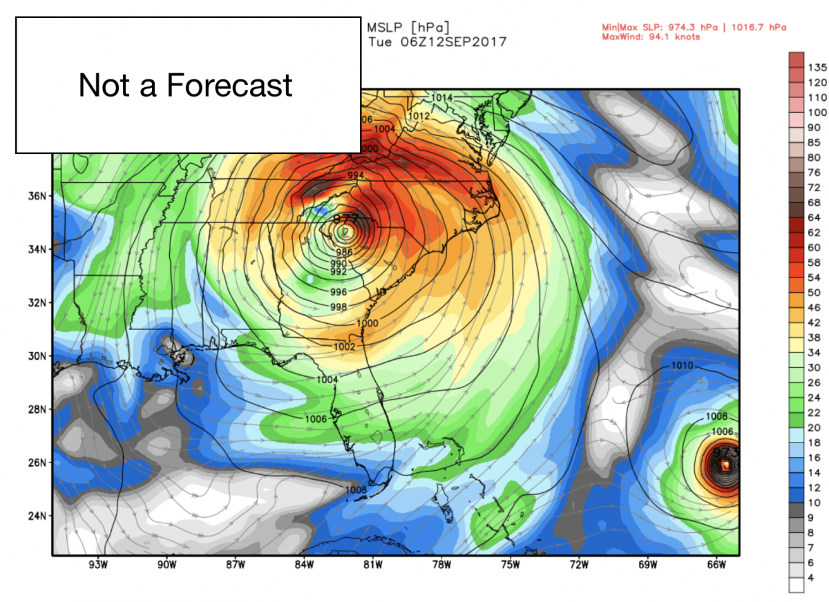
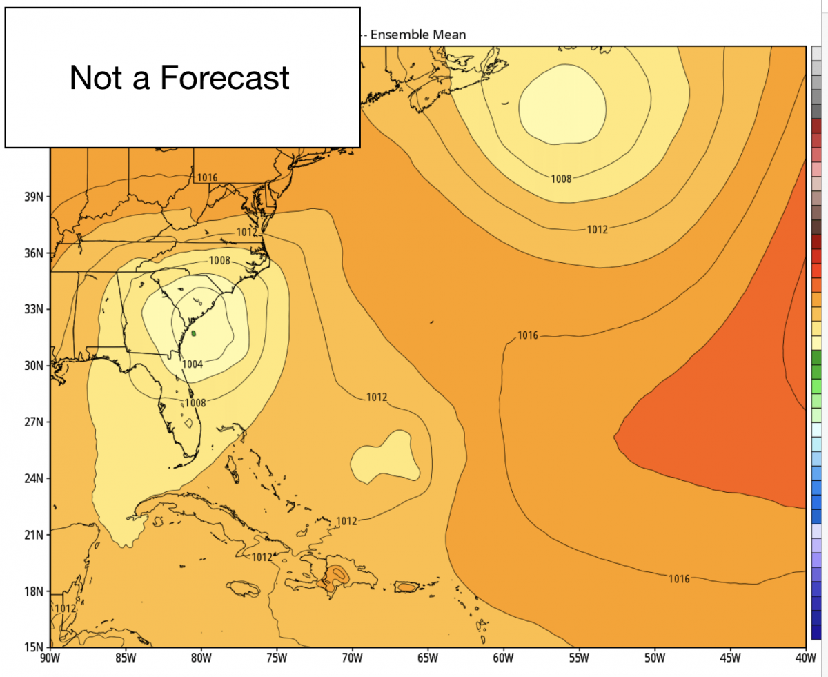
Irma has weakened and is over the upstate of SC. Giving us all rain from the storm. Now that is how the GFS sees the track of Irma going. Here is how the European sees it. There are some similarities. So now we have to watch for a trend to develop and remain between these models.
So much like the GFS the Euro has Irma along the Florida coast on Sunday. The only difference is the positioning is a little further southwest. Now lets take a look at where the Euro has Irma on Monday.
Right on the GA/SC coast just like the GFS. So that is something to keep an eye on as I said over the next 24-36 hours to see if the models stay consistent. Now lets look at the next frame for comparison.
Irma has weakened but is still along the SC coast. This is a farther spread than the GFS has the storm at this point. So you can see why there is so much uncertainty with where this storm will go after south Florida. Here is more reasons why.
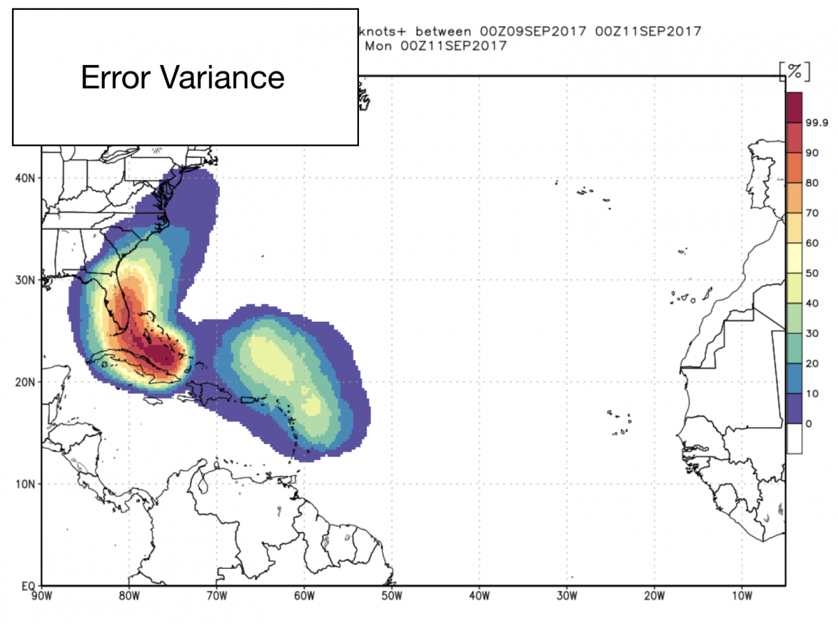
See how the colored area spreads out to a big range covering Florida up through the Mid-Atlantic? At this point my confidence is low that Irma has much of an impact on Rowan County. Now keep in mind that will change as new data continues to come in. I am pretty sure that confidence level will increase a bit in time.
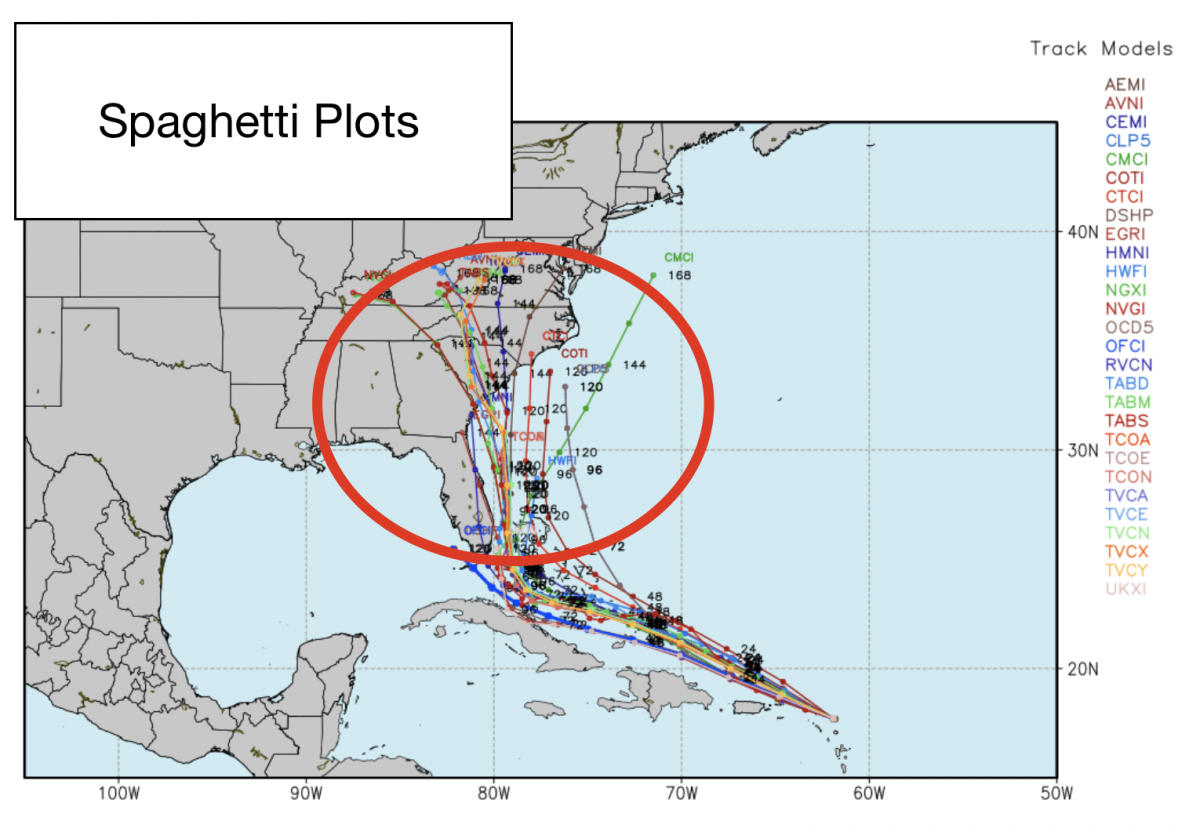
Finally the photo above are the spaghetti plots. This shows where all of the models feels the storm will go. If you like right before the northward turn the all spread out pretty far and the agreement becomes less obvious. The areas in the red circle show how far out of agreement all of the models are on the path of the storm after south Florida.
I will continue to keep you updated right here and on social media as information and model data continues to come in on Irma. As always thank you for following Rowan County Weather!