
Marginal Risk For Severe Weather and an update on Tropical Storm Irma
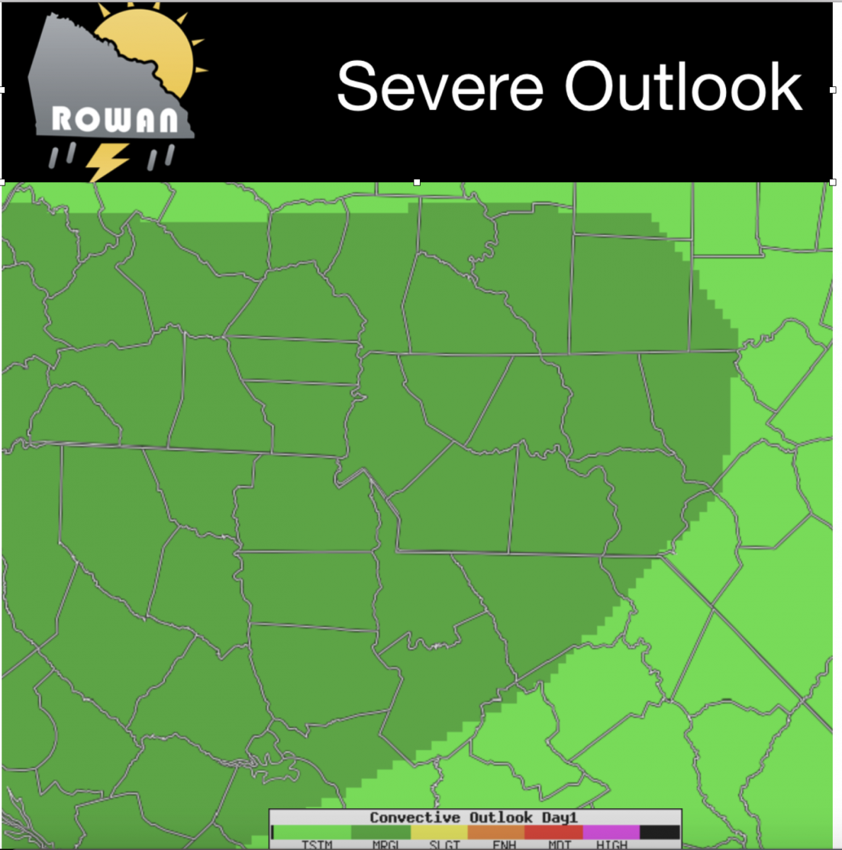
As we begin to close in on the Labor Day Weekend things are getting a little busy for us with the weather. Today the Storms Prediction Center has us under a Marginal Risk for Severe Weather here in the county. I think based on model data most of the severe weather will stay to our southwest for today.
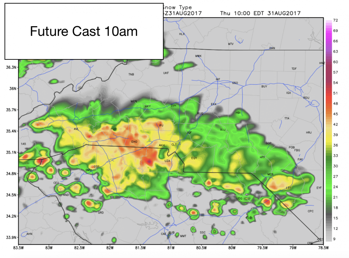
The Future Cast shows rain moving into the county around 10am this morning. We will continue to see rain showers off and on throughout the day as the remnants of Hurricane Harvey move through the area.
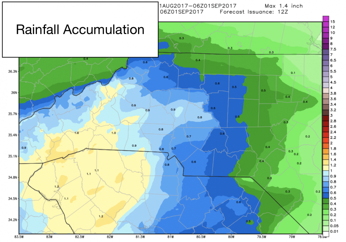
Accumulations between now and midnight look to be pretty decent with areas around the county getting anywhere from three quarters to an inch of rain fall depending on location and possible heavy rain bands.
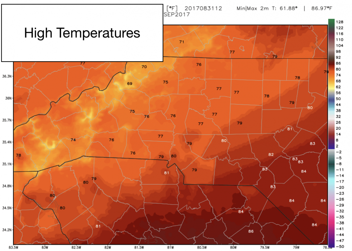
Temperatures will stay seasonably cool again today as we will only top out with a high of around 77º
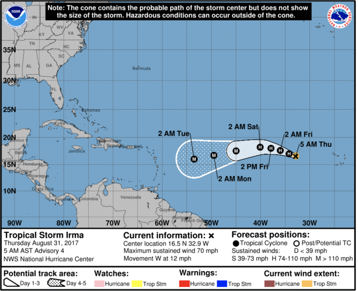
Tropical Storm Irma formed yesterday in the Atlantic Ocean. This is one we will have to keep an eye on as this storm could get pretty close to the east coast. The long range models this morning show the storm getting really close to the North Carolina Coastline by September 10th. Now we are still a long way out from that so we will have to keep an eye on it as things could change. As for the latest on Tropical Storm Irma. The storm is expected to become a Hurricane by late this evening. Here is the latest track information.
I will Corinne to keep you updated right here and on social media throughout the day. As weather conditions change. As always thank you for following Rowan County Weather!