
Strong to Severe storms possible this afternoon and evening
The storms prediction center has issued a slight risk for severe weather today. and Rowan County is inside of the area that is likely to see strong to severe storms.
I am expecting storms to start rolling into the county around 5pm this afternoon and take us into the evening hours. These storms do show likely hood of being strong to severe with data from the models.
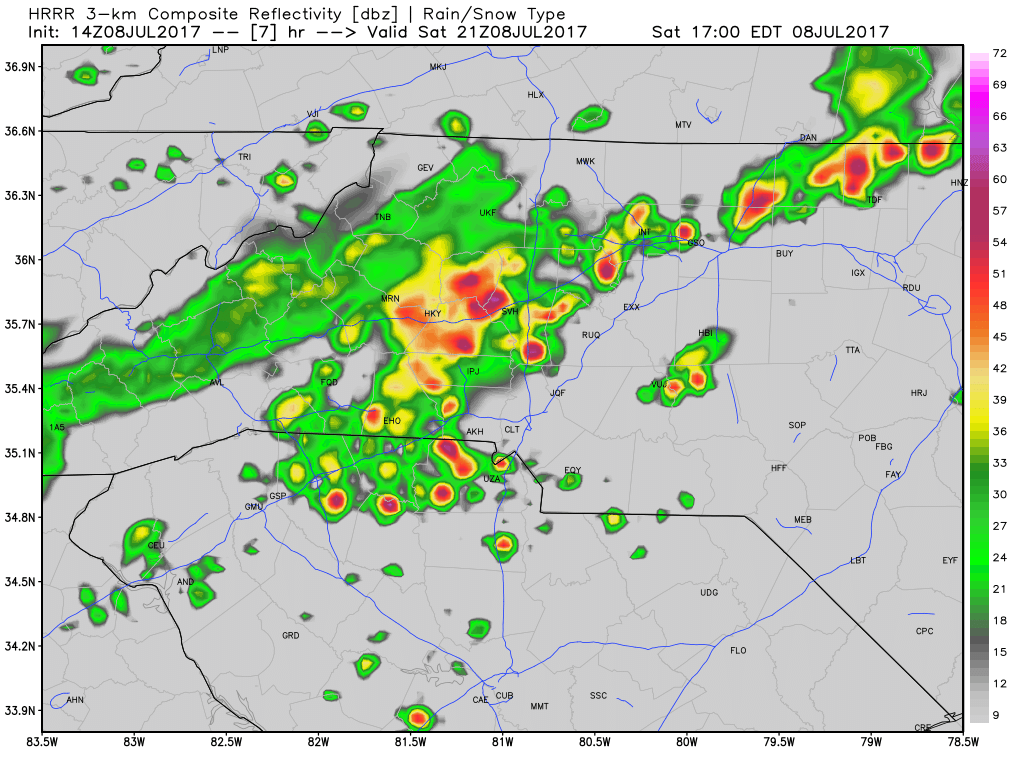
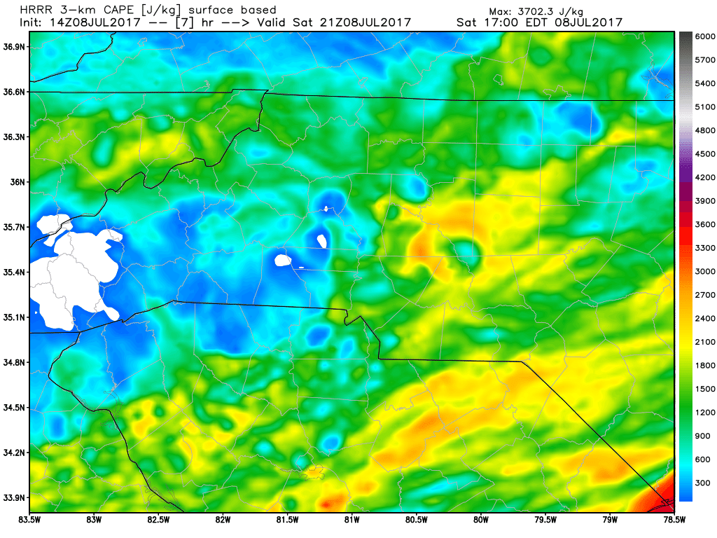
CAPE levels or Thunderstorm fuel look to be elevated just ahead of the storms as they arrive in the county. This will certainly help get them into a strong to severe state as they move through the county.
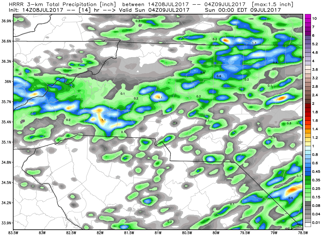
Looking for the main threats to be strong gusty winds, frequent thunder and lightning, Isolated localized flooding if a heavy downpour moves through. Accumulations will be around a quarter to a half of an inch around the county.
I will post updates right here and on social media throughout the day. As always thank you for following Rowan County Weather!