
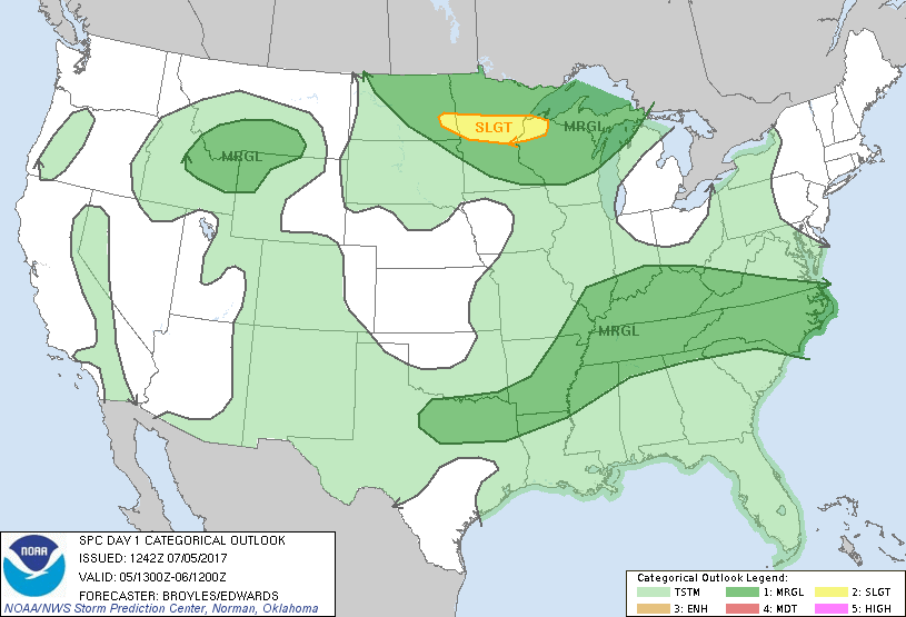
Marginal Risk for Severe Weather today
The Storm Predictions Center has us with a Marginal Risk for Severe Weather around the area today.
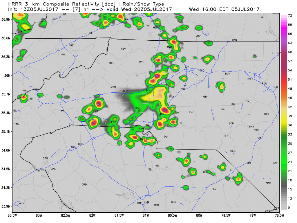
Thunderstorms are likely to move into the area and the county around the time of the evening commute. I am not expecting much at this point with these storms other than your typical garden variety summertime storms.
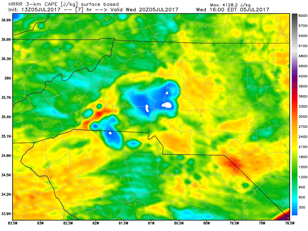
CAPE Levels or Thunderstorm Fuel are a little elevated with the models around the time storms start to move in. I think they are elevated just enough to get some thunder and lightning cooking but otherwise a heavy downpour with localized flooding seems to be the only real threat at this point.
Accumulations look to be fairly low with these showers and storms as they will be moving pretty fast as they move through the area this afternoon and evening.
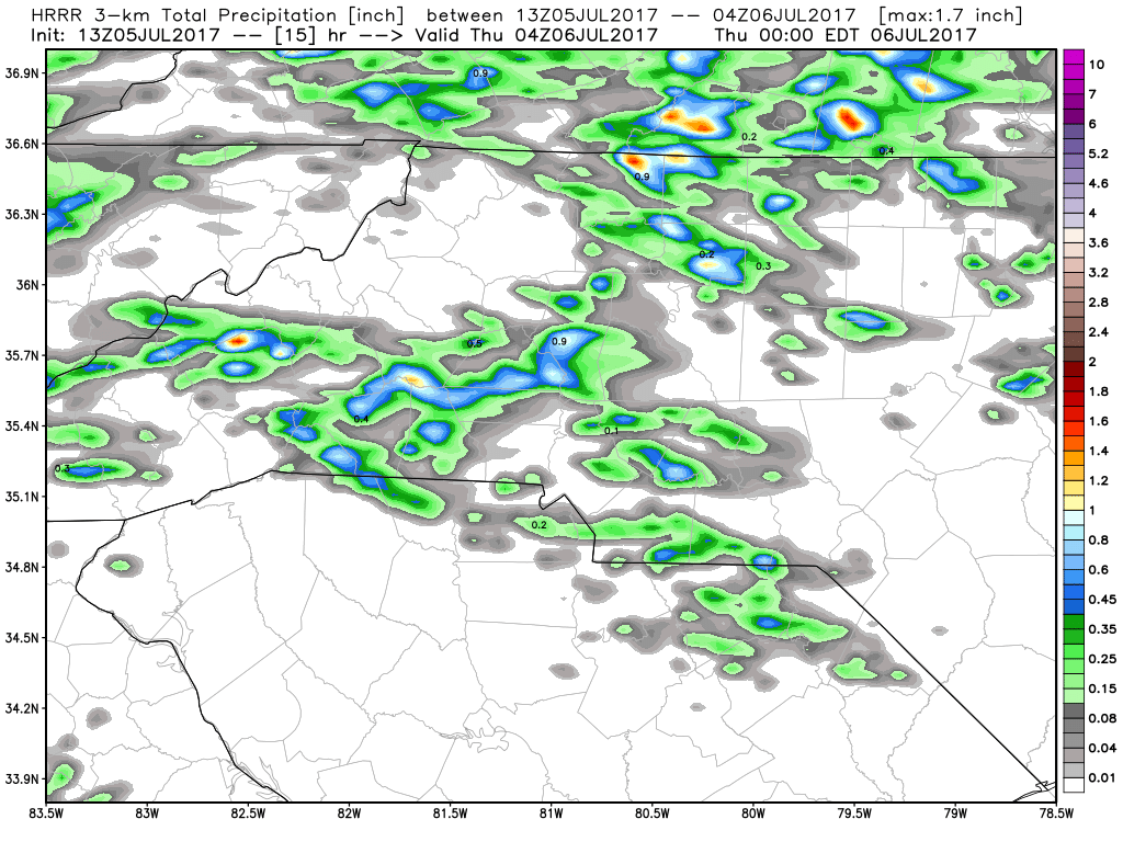
I would say anywhere form a half of an inch to an inch is possible if you get under a brief heavy downpour around the county. I will provide updates right here and on social media throughout the day as showers and storms approach and move through the county. As always thank you for following Rowan County Weather!