
Severe Weather Threat for late this evening and early Thursday
We will have all eyes on the sky throughout the day today as severe weather is approaching. The chances for severe weather are much stronger today in the county than they have been for sometime now. I would not be surprised for a Tornado Watch and Severe Thunderstorm Watch to e issued in a few hours for the county. Here my latest thinking on when the storms will become severe.
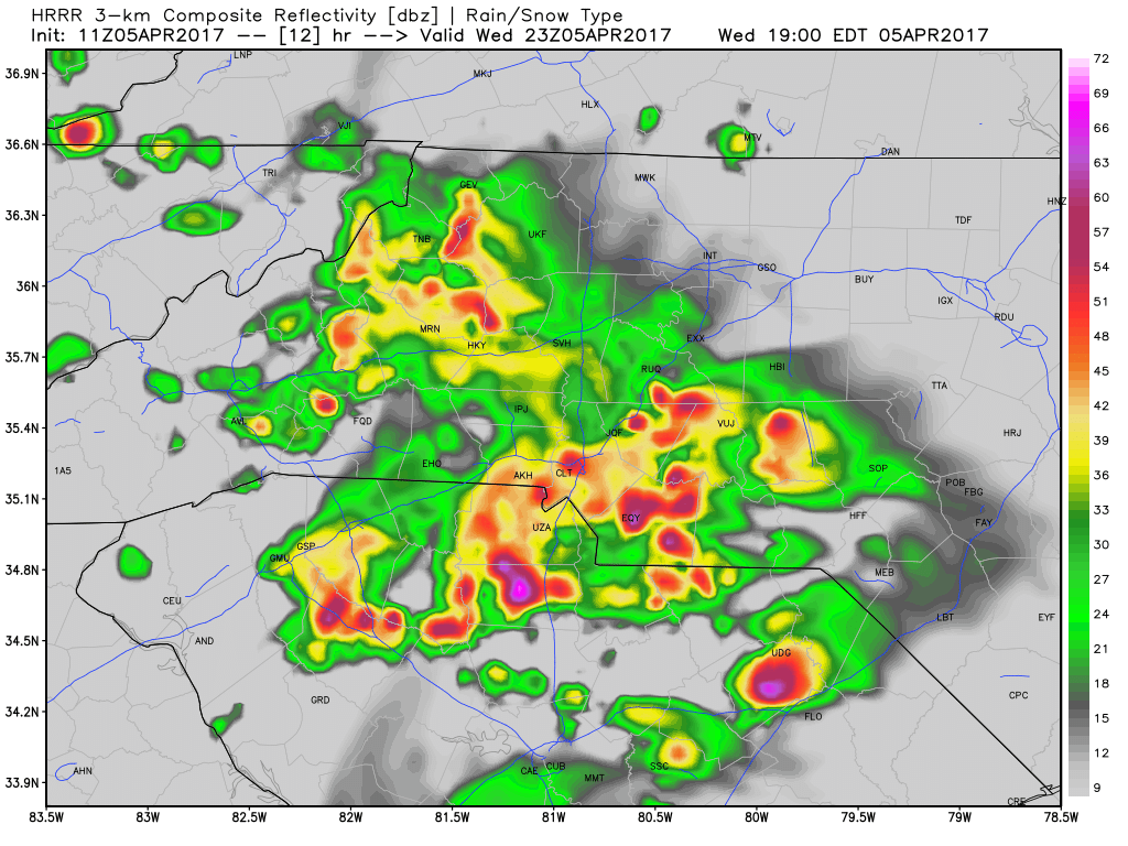
Severe storms are likely to move into the county between 6 & 7pm this evening bringing with them the threat for Isolated Flash Flooding, Hail up to 1 inch or more in diameter, Strong Winds of up to 60 miles per hour and isolated tornado chances.
 .
.
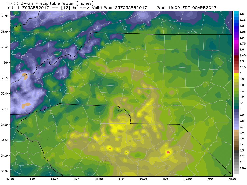
The atmosphere will be pretty ,moist later this evening with a chance of areas seeing 1 -2 inches of rainfall in a short period of time. The precipitable water levels are pretty high
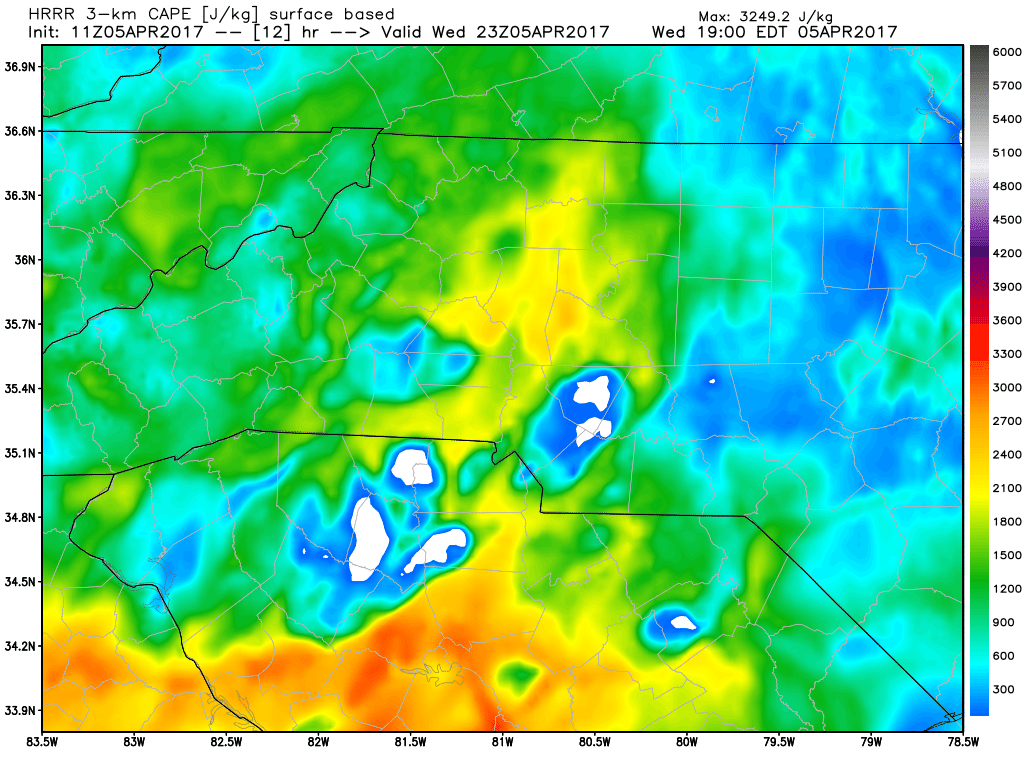
CAPE levels will be very high. This is concerning as this could help really boost some super cells. This is something I will continue to watch closely throughout the day.
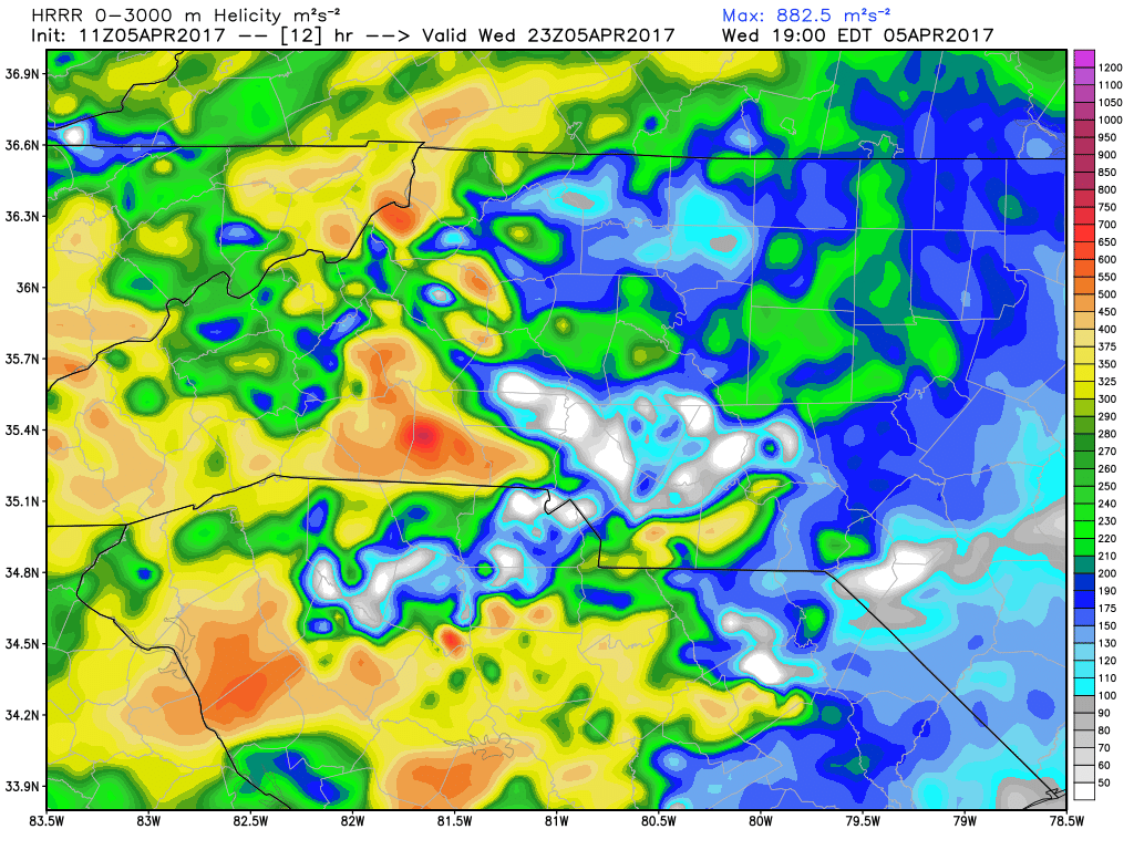
Helicity Values are elevated which will increase the amount of shear in the atmosphere so an isolated tornado is not out of the question.
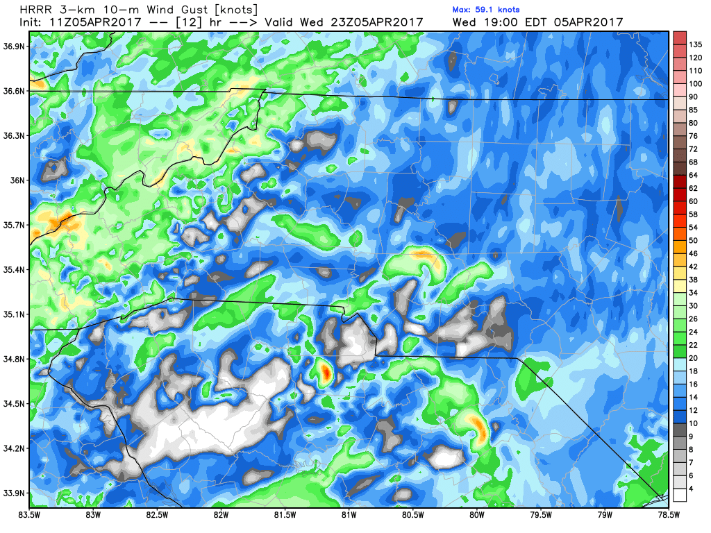
We could see strong winds later this evening as storms pass through with gust as high as 60 to 70 miles per hour. Winds this strong can cause widespread damage to an area.Charge your cell phones, tablets and laptops. Don't forget the batteries for the flashlights.
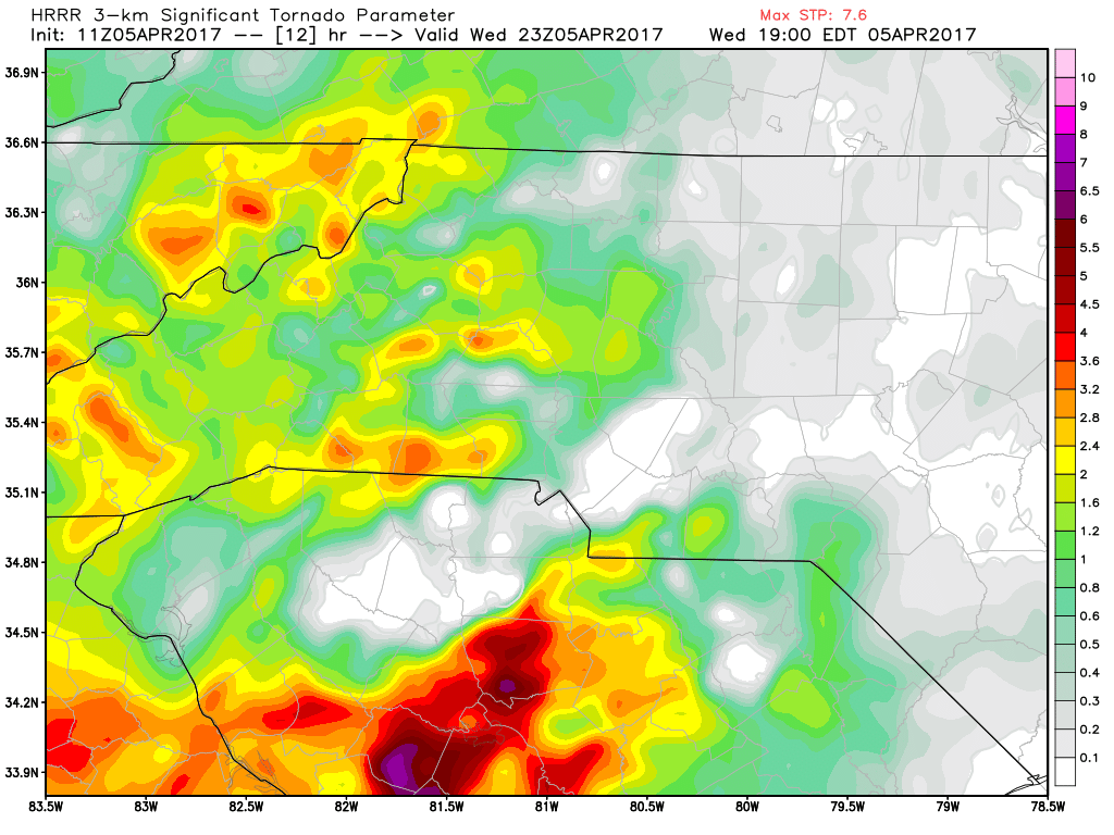
The Significant Tornado Threat Values are a little elevated but the biggest threat is well to our south in the upstate areas of South Carolina. This still bears watching.
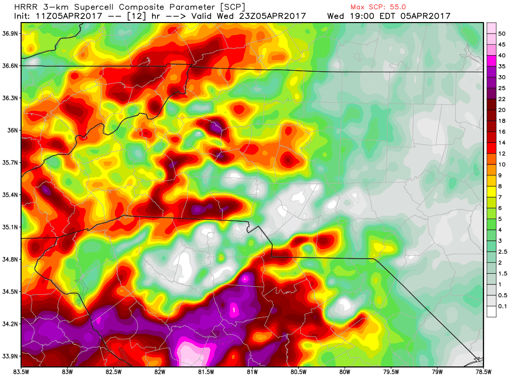
The chances for super cells moving through the area a elevated this would be the most severe storms that will move through and could be the ones that can get a quick spin up going for a brief tornado in the county and area.
I will continue to monitor these storms and models throughout the day and keep you updated right here and on social media. As always thank you for following Rowan County Weather!
Please let our local sponsors know that you appreciate their support of our blog. Take a moment to visit their website linked at the top of this post.
Share this:

Announcements & Events
Check back often for important announcements and events that I'll be involved in!