
Slight Risk for Severe Weather on Monday
As we begin the work week we will see a slight risk in the area for severe weather on Monday. I am expecting storms to enter the county around 2pm Monday afternoon.

There will be quite a bit of moisture in the air as these storms move in as the precipitable water values are pretty decent in the models for this one.

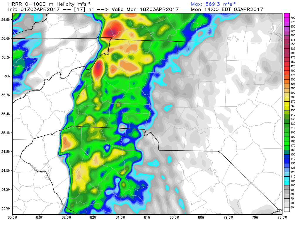
There is going to be a fair amount of helicity in the atmosphere as these storms move into the county as well. Those values will be important to keep an eye on as they represent the amount of wind shear and spin in the air.
The 0 - 30 meter winds are going to be pretty elevated as well so we will certainly have a concern for strong winds and the possibility of wind damage with these storms.

The wind will get very gusty at times and some of those gust could reach up to 40 miles per hour or more with these storms

For now I am not concerned with tornadoes around the county as I think the better chances for those are well to our south in the central to upstate areas of South Carolina. We will certainly have to keep an eye for any chances or shift in the track.
Here are my thoughts on what we can expect around the county for tomorrow afternoon.
- Isolated flash flooding. There is a lot of moisture associated with this system and it could dump a lot of water over an area in a very short period of time.
- Hail is possible with stones of up to 1 inch in diameter
- If we get any super cell thunderstorms in the county we could see winds with gust of 50-60 miles per hour.
- The tornado threat is possible with any super cell but I feel right now that the conditions are more favorable to our south for tornadoes and not as favorable here in the county. I will certainly not rule them out as the situation does bear watching.
I will continue to keep an eye on the models and provide updates tomorrow morning and throughout the the day on Monday. As always thank you for following Rowan County Weather!
Please let our local sponsors know that you appreciate their support of our blog. Take a moment to visit their website linked at the top of this post.
Share this:

Announcements & Events
Check back often for important announcements and events that I'll be involved in!