
Why Your Neighbor May Get More Rain Than You: Understanding Uneven Rainfall Across North Carolina
Weather 101 | Thursday, November 5, 2026 | 1:00 PM
Rowan County Weather & Regional Forecast
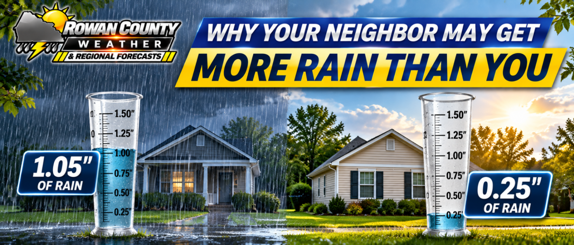
Have you ever checked your rain gauge after a storm and discovered that you received only a tenth of an inch of rain, while someone just a few miles away reported nearly an inch?
It happens more often than you might think.
Across Rowan, Davie, Davidson, and Cabarrus counties, rainfall totals can vary dramatically over surprisingly short distances. One neighborhood may experience a steady downpour while another, just down the road, barely gets its pavement wet.
With scattered showers already affecting our region Thursday and additional rainfall expected tonight into Friday, this is an excellent opportunity to explain why rainfall is rarely distributed evenly.
Rain Doesn't Fall in One Continuous Blanket
When a weather forecast calls for rain, it's easy to imagine one large area of precipitation covering an entire county.
But that's not always how the atmosphere works.
Rain often develops in individual showers, clusters of thunderstorms, or narrow bands of precipitation.
Each of these features can have its own intensity, movement, and duration.
For example, a shower moving across western Rowan County might produce a brief period of moderate rain around Cleveland or Woodleaf while areas closer to Salisbury experience only light precipitation.
Meanwhile, another shower could develop farther east toward Rockwell or Gold Hill.
All of these communities are experiencing the same general weather system, but their rainfall totals may be very different.
The Difference Between Steady Rain and Scattered Showers
One of the biggest factors influencing rainfall totals is the type of precipitation involved.
Steady, widespread rain generally develops over larger areas and can produce relatively consistent rainfall totals across neighboring communities.
Scattered showers, on the other hand, tend to be smaller and more irregular.
One community may experience several showers throughout the day while another receives only one.
Thunderstorms can create even greater differences because they often contain concentrated areas of heavy rainfall.
A slow-moving thunderstorm can produce significant rainfall over a small area while locations only a few miles away receive much less.
Why Storm Movement Matters
The speed and direction of a shower or thunderstorm can make a tremendous difference.
Consider two situations.
Scenario One: A Fast-Moving Shower
A shower moves across Salisbury in approximately 15 minutes. Rain falls at a moderate rate, but the shower moves through quickly.
The resulting rainfall total may be relatively small.
Scenario Two: A Slow-Moving Thunderstorm
A thunderstorm develops over the same area and moves slowly, allowing heavy rain to continue for 45 minutes or longer.
Even though both locations experienced rain, the slower storm could produce a much larger accumulation.
Another important factor is something meteorologists call training.
Training occurs when multiple showers or thunderstorms move repeatedly over the same area, much like train cars traveling along the same track.
This can produce significantly higher rainfall totals along a relatively narrow corridor.
Can Geography Make a Difference?
Absolutely.
Although our four-county coverage area doesn't have the dramatic elevation changes found in the North Carolina mountains, local geography can still influence precipitation.
Differences in terrain, wind direction, atmospheric moisture, and localized boundaries can help determine where showers develop or intensify.
However, the placement and movement of individual showers are usually much more important than county boundaries.
Weather systems don't recognize the line separating Rowan County from Cabarrus County or Davidson County from Davie County.
That means communities on opposite sides of a county line can experience nearly identical conditions, while two locations within the same county may have noticeably different rainfall totals.
What Does a 60% Chance of Rain Actually Mean?
This is one of the most frequently misunderstood parts of a weather forecast.
A 60% probability of precipitation means there is a 60% chance that a particular location within the forecast area will receive measurable precipitation during the specified forecast period.
It does not mean:
-
Rain will fall for 60% of the day.
-
Exactly 60% of the county will receive rain.
-
Rainfall will be heavy.
-
Every location will receive the same amount.
Rainfall probability and rainfall accumulation are two different things.
A location could have a high probability of receiving a brief, light shower but still finish the day with very little measurable rainfall.
Conversely, a lower-probability thunderstorm could produce substantial rainfall if it develops directly over your neighborhood.
Why Radar Doesn't Always Tell the Entire Story
Radar is one of our most valuable tools for tracking precipitation, but it has limitations.
Weather radar detects energy reflected by precipitation particles in the atmosphere.
Very light drizzle or mist may produce weak returns that aren't clearly visible on a standard radar image.
Radar also samples precipitation above the ground rather than measuring every drop that reaches the surface.
This helps explain why some communities report damp conditions even when radar appears relatively quiet.
It also explains why rainfall estimates derived from radar can differ from actual measurements collected by properly positioned rain gauges.
What This Means for Thursday and Friday
Our current weather pattern provides a good example of why rainfall totals may vary across the region.
Scattered, generally light showers are possible Thursday, with additional showers and thunderstorms expected Thursday night into Friday.
The approaching frontal system should increase opportunities for measurable rainfall.
However, the exact placement and intensity of individual showers and thunderstorms will determine which communities receive the most rain.
Some locations could experience repeated rounds of precipitation, while others receive lighter amounts.
Forecast guidance continues to show uncertainty in rainfall totals, with some scenarios producing broader beneficial rainfall and others concentrating heavier amounts in relatively narrow corridors.
That's why we avoid promising identical rainfall totals across all four counties.
Why This Matters During Dry Conditions
When a region is experiencing below-normal rainfall, scattered showers can create a frustrating situation.
One neighborhood may receive enough rain to temporarily improve soil moisture, while another community nearby receives very little.
Even a locally heavy downpour may not provide lasting relief from longer-term drought conditions.
Meaningful drought improvement generally requires sufficient rainfall over a broad area and an extended period.
A single round of scattered thunderstorms doesn't necessarily accomplish that.
How You Can Help Us Track Rainfall
One of the best ways to understand these differences is through local rainfall reports.
If you have a properly installed rain gauge, your measurements can help show how precipitation varies across our communities.
When sharing a rainfall report, include your general location, the amount measured, and the time period covered.
For example:
"Salisbury, near Jake Alexander Boulevard: 0.42 inches since midnight."
Reports from Rowan, Davie, Davidson, and Cabarrus counties are especially useful when comparing radar estimates with actual ground observations.
The Bottom Line
Rainfall is rarely distributed perfectly evenly.
The size, intensity, speed, and movement of individual showers and thunderstorms all influence how much rain reaches a particular location.
So the next time your neighbor reports an inch of rain while your gauge shows only a quarter-inch, remember that both measurements may be completely accurate.
You simply experienced different parts of the same weather system.
Rowan County Weather & Regional Forecast will continue tracking Thursday night's and Friday's showers, comparing rainfall reports, and providing updates as the weather system moves through our region.
Visit rowancountyweather.com for the latest forecasts, radar coverage, and weather information.