
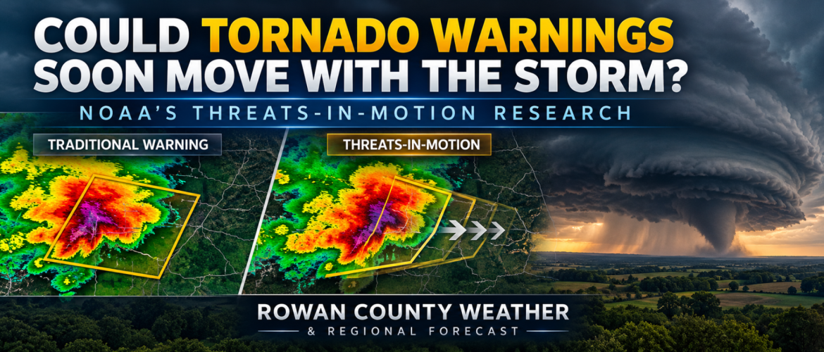
Could Tornado Warnings Soon Move With the Storm? NOAA Is Researching a Different Way to Warn You
Rowan County Weather | Tuesday, October 27, 2026
When severe weather threatens Rowan County and surrounding communities, every minute matters. Whether it's a tornado approaching Salisbury, a severe thunderstorm moving toward Mocksville, or damaging winds crossing Davidson and Cabarrus counties, getting a warning early enough to take action can make all the difference.
But what if the way tornado and severe thunderstorm warnings are issued could be improved?
That's exactly what researchers at the National Oceanic and Atmospheric Administration (NOAA) have been studying through a concept called Threats-in-Motion, or TIM.
Rather than keeping severe weather warning areas stationary while storms move through them, this proposed system would allow warning areas to continuously move with the storm itself.
It's an interesting development in severe weather research, and one that could eventually change how communities receive and understand dangerous weather warnings.
How Severe Weather Warnings Work Today
When the National Weather Service issues a Tornado Warning or Severe Thunderstorm Warning, meteorologists identify a geographic area where dangerous weather is occurring or expected.
That area is outlined on a map using what meteorologists call a warning polygon.
The polygon typically remains within its original geographic boundaries as the storm moves through the warned area. Forecasters can update or reduce the warning area, but extending the warning into new territory generally requires issuing another warning.
For example, imagine a severe thunderstorm moving northeast through Rowan County.
A warning might initially cover portions of western Rowan County, including communities near Cleveland and western Salisbury.
As the storm moves toward Spencer, East Spencer, and eventually Davidson County, meteorologists may need to issue additional warnings to cover communities farther along its path.
That system has served an important public safety purpose for decades, but NOAA researchers have identified opportunities to improve it.
One concern involves warning lead time.
Someone near the beginning of a warning area may have considerably less time to prepare than someone farther downstream. In certain situations, communities located close together could receive warnings at noticeably different times.
What Is Threats-in-Motion?
Threats-in-Motion takes a different approach.
Instead of creating a stationary warning polygon and waiting for the storm to move through it, the warning area would move along with the dangerous weather.
Under the concept NOAA is researching, warning polygons could update as frequently as once every minute.
As the storm advances, the warning advances.
As the storm changes direction, meteorologists could adjust the warning area.
And as dangerous conditions move away from a community, that location could be removed from the warning area more quickly.
The goal is to make warnings more closely reflect where dangerous weather actually is, where it's heading, and when the threat has passed.
What Would This Mean for Rowan County?
Let's imagine a hypothetical severe thunderstorm developing near Mooresville and moving northeast toward China Grove, Landis, and Salisbury.
Under the traditional warning system, a warning polygon would cover a designated area for a specified period. As the storm advances, additional warnings might become necessary.
With Threats-in-Motion, the warning area could continuously follow the storm's projected movement.
Residents in China Grove might see the warning area approaching their community before the most dangerous part of the storm arrives.
As the storm moves toward Salisbury, the warning would advance with it.
Meanwhile, locations farther behind the storm, where the dangerous weather has passed, could be removed from the warning area.
The same concept could apply to a tornado moving from Rowan County into Davidson County or a severe thunderstorm tracking through Cabarrus County.
These are hypothetical examples, but they demonstrate why the research could be particularly valuable during fast-moving severe weather events.
One of the Biggest Benefits: Knowing When the Danger Has Passed
One of the most interesting aspects of Threats-in-Motion isn't just how warnings begin.
It's how they end.
During a tornado warning, residents understandably want to know when it's safe to leave their shelter.
With the current warning system, a community may remain inside a warning polygon even after the most dangerous portion of the storm has moved away.
NOAA researchers believe moving warning polygons could eventually support more precise information about when dangerous conditions have passed a particular location.
That could reduce unnecessary time spent under a warning while improving communication about when protective action is still needed.
However, it's important to emphasize that this does not mean residents should automatically leave shelter as soon as a storm appears to have passed on radar.
Always follow official National Weather Service warnings and instructions before leaving a safe location.
Could It Give People More Time to Prepare?
Potentially, yes.
One of the primary goals of Threats-in-Motion is to provide more consistent warning lead times to communities along a storm's path.
Consider a long-lived supercell thunderstorm capable of producing tornadoes across multiple counties.
With the existing warning system, meteorologists may issue a series of warning polygons as the storm progresses.
With a continuously moving warning, the threat could remain tracked and represented throughout its journey, reducing the potential for gaps between warning areas.
NOAA's research suggests this approach could improve average warning lead times, particularly for long-lasting storms.
For residents, those additional minutes could be valuable when moving family members into a safe room, helping someone with mobility limitations reach shelter, or making other emergency preparations.
Why Isn't This Already Being Used Everywhere?
Developing a new warning system involves much more than changing the shapes displayed on a radar map.
The National Weather Service must also consider how rapidly updating warnings would work with existing emergency notification systems.
That includes Wireless Emergency Alerts sent to cell phones, NOAA Weather Radio, weather applications, and other systems used to distribute urgent weather information.
A warning that updates every minute creates important questions.
How should notifications be delivered without overwhelming the public?
How can emergency systems recognize that an existing warning has moved rather than treating every update as a completely new warning?
How should communities be notified when the danger has passed?
These are among the challenges researchers must address before a system like Threats-in-Motion could be widely implemented.
NOAA has conducted multiple experiments with the concept, including testing with National Weather Service forecasters.
The research continues to explore how more dynamic warnings could improve severe weather communication.
What About Probabilities?
Threats-in-Motion is also connected to a broader NOAA research initiative called Forecasting a Continuum of Environmental Threats, or FACETs.
One part of that research involves Probabilistic Hazard Information.
Instead of simply identifying whether a location is inside or outside a warning polygon, probabilistic information could help communicate how the likelihood of a particular hazard varies across an area and changes over time.
For example, researchers are exploring ways to represent changing probabilities of severe winds, large hail, and tornadoes.
This could eventually provide meteorologists and emergency managers with more detailed information when making decisions.
However, probabilities must be communicated carefully. A lower probability of a tornado does not mean a location is safe, particularly when a dangerous storm is approaching.
My Thoughts on Threats-in-Motion
As Chief Forecaster for Rowan County Weather, one of my biggest priorities during severe weather is helping people understand not just what is happening, but what it means for their specific community.
That's why I find this research particularly interesting.
When severe thunderstorms move through Rowan, Davie, Davidson, and Cabarrus counties, the situation can change quickly.
Storms can strengthen, weaken, accelerate, or change direction. Warning information needs to communicate those changes as clearly as possible.
I especially like the potential for more consistent lead times and better communication about when a threat has passed.
But the technology must also be practical for the people receiving the warnings.
A rapidly updating warning system will only be effective if residents understand the information and know what action to take.
More information isn't automatically better information. Clarity matters.
The Bottom Line
Threats-in-Motion represents a potentially important step toward the future of severe weather warnings.
Instead of relying entirely on stationary warning areas, NOAA researchers are investigating ways to make warnings move with the storms themselves.
The potential benefits include more consistent warning lead times, improved tracking of long-lasting severe storms, and better communication about when dangerous conditions have passed.
There are still technical and communication challenges to overcome, and the research should not be confused with a nationwide operational change.
For now, the most important advice remains the same.
Know where to shelter, have multiple ways to receive weather warnings, and never wait until you can see a tornado before taking action.
Rowan County Weather will continue following developments in severe weather research and explaining how future improvements could benefit our communities.
Because when dangerous weather threatens, every minute matters.
Sources and Additional Reading
NOAA National Severe Storms Laboratory — Threats-in-Motion Research
https://inside.nssl.noaa.gov/facets/2021/03/threats-in-motion/
NOAA Global Systems Laboratory — Threats in Motion
https://gsl.noaa.gov/tim/
Stumpf, G. J., and A. E. Gerard (2021), National Weather Service Severe Weather Warnings as Threats-in-Motion, Weather and Forecasting.
https://doi.org/10.1175/WAF-D-20-0159.1