
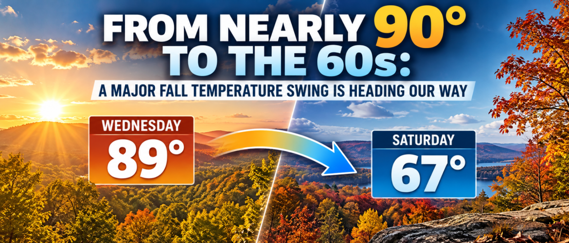
From Nearly 90° to the 60s: A Major Fall Temperature Swing Is Heading Our Way
October 12, 2026 | Rowan County Weather Regional Forecasts
After a stretch of unsettled weather, our region is preparing for a remarkable temperature turnaround. But before fall makes its comeback this weekend, we have several days of summerlike warmth to get through.
Residents across Rowan, Davie, Davidson, and Cabarrus Counties can expect a significant warming trend this week, with afternoon temperatures climbing into the middle and upper 80s. Some of the warmest locations could approach 90 degrees by Wednesday.
However, the warmth won't last.
A strong cold front is expected to move through the Carolinas late Friday, October 16, bringing a dramatic drop in temperatures just in time for the weekend. By Saturday afternoon, highs could struggle to climb much beyond the middle 60s across much of our region.
That's a temperature swing of more than 20 degrees in approximately 24 hours.
First, We Have to Get Through the Warmth
The first half of the week will feature an increasingly familiar pattern of sunshine, limited rainfall opportunities, and temperatures more typical of late summer than the middle of October.
High pressure and a strengthening ridge of warmer air over the southeastern United States will help push temperatures upward through Wednesday.
Monday afternoon temperatures should reach the lower 80s across the region. Tuesday brings additional warming, with most locations reaching the middle 80s.
By Wednesday, afternoon highs could approach the upper 80s, with Cabarrus County potentially reaching 89 degrees.
Thursday and Friday should remain unusually warm, although increasing cloud cover may limit temperatures somewhat in portions of the region.
For residents waiting for more traditional October weather, patience will be required for a few more days.
What's Causing This Unusual Warmth?
The atmosphere over the southeastern United States will be dominated by an upper-level ridge during much of the workweek.
Think of this ridge as a large northward bulge in the jet stream that allows warmer air to expand across the region.
At the surface, high pressure and a generally favorable wind pattern will reinforce the warming trend.
Meanwhile, the main storm track will remain displaced farther north, limiting opportunities for widespread rainfall.
This combination will produce several days of sunshine, above-normal temperatures, and relatively quiet weather.
Although temperatures approaching 90 degrees are unusual for the middle of October, they are not unprecedented. Strong autumn ridges can occasionally produce brief periods of summerlike warmth before colder air arrives.
And colder air is exactly what's expected next.
A Strong Cold Front Changes Everything Friday
The pattern is expected to undergo a significant transition late in the workweek.
A developing upper-level trough across the Great Lakes and northeastern United States will help drive a strong cold front southward toward the Carolinas.
As the front approaches Friday, winds will begin shifting and a much cooler air mass will start moving into the region.
The most noticeable temperature changes are expected behind the front, particularly from Friday afternoon into Saturday.
Unlike some cold fronts that bring widespread thunderstorms or soaking rainfall, this system may have relatively little moisture available.
That means the front could move through with only isolated showers, or even without measurable rainfall in many communities.
The temperature change, rather than precipitation, appears to be the primary weather story.
How Much Will Temperatures Drop?
Current forecast projections illustrate just how dramatic the transition could become.
| County | Friday High | Saturday High | Temperature Drop |
|---|---|---|---|
| Rowan | 85° | 64° | 21° |
| Davie | 85° | 63° | 22° |
| Davidson | 86° | 65° | 21° |
| Cabarrus | 88° | 67° | 21° |
These are current forecast estimates and will be refined as the approaching front gets closer.
The numbers are impressive, but the difference in how the air feels may be even more noticeable.
Friday afternoon could feel like an extension of summer, while Saturday afternoon may require a light jacket for anyone spending extended periods outdoors.
The cooler air will also be accompanied by lower humidity, adding to the more traditional fall feeling.
Sunday Morning Could Be Especially Chilly
The weekend cooldown won't stop with afternoon temperatures.
As Canadian high pressure settles into the region behind the front, clearing skies and lighter winds could allow temperatures to fall significantly Saturday night into Sunday morning.
Current projections suggest many locations could experience lows in the upper 30s to lower 40s.
Some typically colder rural communities, particularly sheltered valleys and low-lying areas, could fall a little lower.
That raises the possibility of patchy frost in isolated locations if temperatures fall sufficiently and atmospheric conditions become favorable.
However, widespread frost or freezing temperatures are not currently the expectation across our four-county forecast area.
It's also important to remember that frost can occasionally develop when the official air temperature remains slightly above freezing, especially on clear, calm nights.
For now, the potential for a chilly Sunday morning deserves attention, but it is too early to determine exactly which communities might experience frost.
Will the Cold Front Bring Much Rain?
At this point, widespread rainfall does not appear likely with Friday's approaching cold front.
The atmosphere is expected to have limited moisture available, and the strongest upper-level support for precipitation should remain well north of our region.
A few isolated showers cannot be ruled out Thursday or Friday, but the overall pattern favors relatively limited rainfall.
This is an important distinction: a strong cold front does not necessarily mean strong storms or heavy precipitation.
Sometimes the most significant impact is simply the arrival of a very different air mass.
That appears to be the more likely scenario this weekend.
What Could Still Change?
Confidence is increasing that a substantial cooldown will arrive this weekend, but several details still need to be resolved.
The exact timing of the front will determine how quickly temperatures fall Friday evening and how much cooling occurs by Saturday afternoon.
Cloud cover could also influence daytime temperatures, while wind speeds and overnight sky conditions will play important roles in determining Sunday morning lows.
If the colder air arrives more aggressively than currently anticipated, Saturday's highs and Sunday morning's lows could trend downward.
On the other hand, a slightly slower frontal passage could delay the arrival of the coolest temperatures.
These are the details I'll be watching closely throughout the week.
The Bottom Line
Our region is preparing for two very different weather patterns in the span of just a few days.
The first will bring summerlike warmth, abundant sunshine, and afternoon temperatures climbing into the middle and upper 80s.
The second will arrive behind a strong cold front late Friday, replacing that warmth with afternoon temperatures in the 60s and potentially chilly mornings in the upper 30s.
For Rowan, Davie, Davidson, and Cabarrus Counties, the most significant weather development this week may not be a storm at all.
It may simply be the return of fall.
I'll continue evaluating the latest forecast guidance throughout the week, particularly the timing of the cold front, the magnitude of the temperature drop, and the possibility of frost in colder locations Sunday morning.
Rowan County Weather | Regional Forecasts
Serving Rowan, Davie, Davidson, and Cabarrus Counties.