
Nor’easter Off the Coast: How a Distant Storm Is Affecting Our Regional Weather
There is a powerful coastal storm taking shape off the East Coast, and while Rowan, Davie, Davidson and Cabarrus counties are far removed from its worst weather, the system is still playing a role in what we are experiencing here at home.
A nor’easter is strengthening off the Mid-Atlantic coast and is expected to produce significant impacts farther north along portions of the Mid-Atlantic and New England coast through the weekend. Coastal flooding, strong winds, high surf and heavy rain are among the concerns closer to the storm.
Here in our region, however, the story is very different.
We are looking at sunshine, increasingly dry air, cool nights and a beautiful weekend.
So how can a storm hundreds of miles away affect our weather when it isn't raining here?
It Starts With the Pressure Pattern
Weather systems don't operate in isolation.
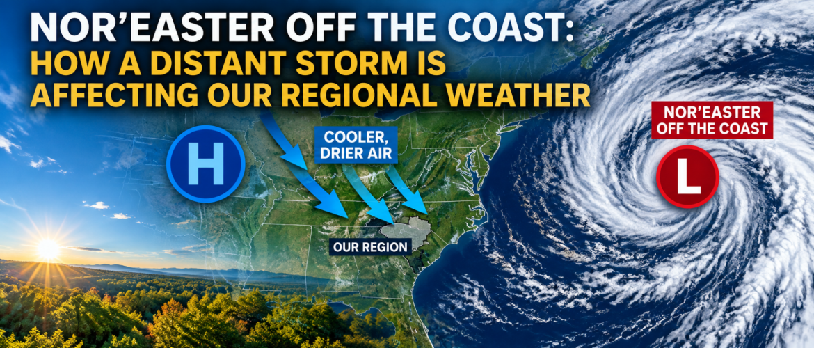
As low pressure strengthens offshore and high pressure builds across a large portion of the eastern United States, air is being directed from north to south across the Carolinas.
That northerly flow is important.
It is helping transport cooler and much drier air into our region while the moisture and significant precipitation associated with the coastal storm remain well to our east.
That is why Friday will be sunny across Rowan, Davie, Davidson and Cabarrus counties but still cooler than normal for late September.
High temperatures will generally reach only the lower 70s despite abundant sunshine.
Why Is It Breezy?
You may also notice the wind Friday.
The strengthening low pressure offshore and higher pressure inland create a difference in atmospheric pressure across the region. Air responds to that pressure difference, resulting in the northerly breeze we're experiencing.
Winds won't be anything like what areas closer to the nor’easter will experience, but occasional gusts around 15 to 20 mph are possible across portions of our region Friday.
Davidson and Cabarrus counties could notice some of the stronger gusts during the day.
The Nor’easter Is Helping Deliver Much Drier Air
Perhaps the biggest effect we'll notice isn't the wind. It's the air mass arriving behind this week's chilly and damp weather.
Dew points are falling as much drier air pours into the Piedmont.
That becomes especially important after sunset Friday.
With clear skies, increasingly dry air and winds becoming light or calm, conditions will become favorable for temperatures to fall quickly overnight.
Davidson County currently appears likely to be the coldest of the four counties, with temperatures around 43 degrees by Saturday morning.
Rowan and Davie counties are forecast to fall to around 46 degrees, while Cabarrus County should reach approximately 47 degrees.
For some locations, it will be one of the chilliest mornings we've experienced in several months.
Will the Nor’easter Bring Us Rain?
No.
The significant precipitation associated with this system will remain well east and northeast of our four-county region.
In fact, our forecast is almost the opposite of what areas closer to the storm will experience.
While portions of the East Coast deal with heavy rain, strong winds, high surf and coastal flooding, high pressure will increasingly dominate our weather.
Rowan, Davie, Davidson and Cabarrus counties are expected to remain dry through the weekend and well into next week.
A Beautiful Weekend Follows
As the coastal storm moves farther north and its influence on our local pressure pattern gradually decreases, temperatures will begin climbing.
Saturday should feature abundant sunshine with afternoon highs generally in the upper 70s.
Sunday becomes warmer, with temperatures reaching around 80 to 82 degrees across the region.
The mornings will continue to have an early-fall feel, particularly Saturday morning, while the afternoons become increasingly warm.
By Monday and Tuesday, most of the region should be back in the lower to middle 80s.
From a Wedge to a Nor’easter
It has been an interesting several days of weather across our region.
Earlier this week, cold-air damming — often called "the wedge" — kept cool air trapped against the Appalachians and helped produce persistent clouds, rain and temperatures stuck in the 60s.
Now that pattern is breaking down.
The strengthening coastal storm and building high pressure are helping establish a northerly flow that is replacing the damp air with a much drier air mass.
The result is a dramatic change: clouds and rain earlier this week are giving way to sunshine, crisp nights and increasingly warmer afternoons.
The Bottom Line
The nor’easter off the East Coast is not a storm threat for Rowan, Davie, Davidson or Cabarrus counties.
But that doesn't mean it has nothing to do with our weather.
Its interaction with high pressure across the eastern United States is helping produce our northerly winds and usher cooler, much drier air into the Piedmont.
So while communities closer to the coast and farther north contend with a significant coastal storm, our part of North Carolina gets the quieter side of the same large-scale weather pattern.
For us, that means sunshine Friday, a crisp night with temperatures falling into the 40s, and a beautiful weekend ahead with temperatures climbing back toward 80 degrees and above.
Sometimes a storm doesn't have to be overhead to change our weather.