
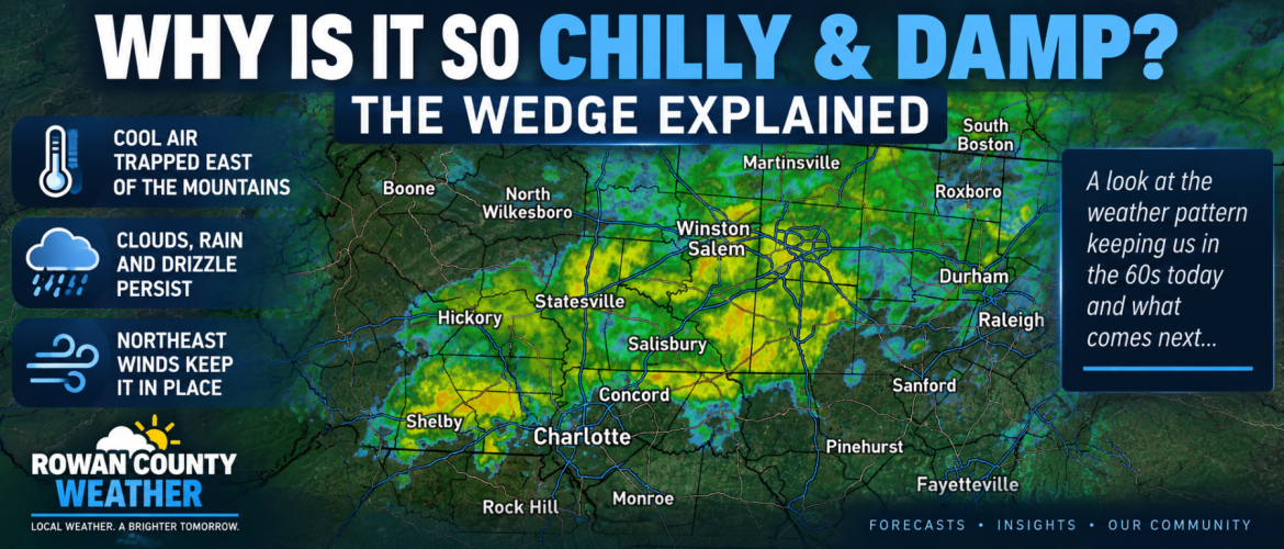
Why Is It So Chilly and Damp? The Weather Setup Keeping the Region Stuck in the 60s
If you stepped outside Wednesday morning and wondered what happened to summer, you probably weren't alone.
Just a few days after temperatures climbed into the 90s across the region, Rowan, Davie, Davidson and Cabarrus counties are now dealing with clouds, rain, a persistent northeast breeze and afternoon temperatures struggling through the 60s.
This isn't simply a cold front passing through.
A classic weather pattern known as cold-air damming, often called "the wedge," has settled across the Piedmont.
WHAT IS THE WEDGE?
Cold-air damming occurs when a shallow layer of cool, dense air becomes established east of the Appalachian Mountains.
High pressure to our north helps funnel cooler air southward along the eastern side of the mountains. Because that cool air is dense and shallow, the Appalachians act somewhat like a barrier, making it difficult for the air mass to move west.
Instead, the cool air becomes wedged against the mountains and spreads southward through the Piedmont.
That's exactly the kind of setup affecting our region Wednesday.
WHY ARE THE CLOUDS AND RAIN SO STUBBORN?
The wedge isn't just responsible for the cooler temperatures.
Northeast winds continue feeding cool air into the region near the surface while moisture remains trapped across the Carolinas.
The result is a combination of:
• Low clouds
• Areas of fog
• Drizzle
• Periods of light to moderate rain
• Breezy northeast winds
• Temperatures well below where we've been recently
Cloud cover also prevents much help from the September sun. Without sunshine warming the ground, temperatures have very little opportunity to climb during the afternoon.
That's why highs Wednesday are expected to remain only in the lower to middle 60s across much of the Rowan County Weather coverage area.
THIS ISN'T A THUNDERSTORM-DRIVEN RAIN
Another noticeable difference from the weather earlier this week is the type of rain we're seeing.
Most of Wednesday's precipitation across Rowan, Davie, Davidson and Cabarrus counties is expected to be non-convective.
Instead of scattered thunderstorms producing brief downpours, much of what we're seeing is a steadier area of light to moderate rain and drizzle associated with the cool, moist air trapped within the wedge.
That doesn't mean it will rain continuously everywhere all day. There will be breaks and variations in coverage, but the overall damp and cloudy pattern isn't going anywhere quickly.
TONIGHT BRINGS ANOTHER ROUND OF RAIN
Even where rain becomes lighter or more scattered Wednesday afternoon, don't assume we're finished.
Rain is expected to become more widespread again Wednesday night across portions of the region.
Davie County could be one of the wetter locations overnight, while Rowan, Davidson and Cabarrus counties will also have another opportunity for measurable rainfall.
Temperatures tonight remain in the middle 50s.
THURSDAY STARTS DAMP, TOO
The wedge remains firmly in control heading into Thursday morning.
Additional showers are expected, especially during the morning, with highs once again struggling in the lower to middle 60s.
Some lingering drizzle or low clouds could hang around even after the more organized rain begins moving away.
Eventually, though, the atmosphere begins changing.
Drier air starts working into the region and the wedge begins to weaken Thursday night.
THEN COMES THE PAYOFF
Friday should look dramatically different.
Sunshine returns across Rowan, Davie, Davidson and Cabarrus counties, beginning what currently looks like a beautiful stretch of early fall weather.
Friday afternoon temperatures should generally reach around 70 to the lower 70s before climbing into the middle and upper 70s Saturday and Sunday.
Humidity will be lower, skies should remain mostly clear and overnight temperatures will provide another reminder that the seasons are changing.
Some locations could fall into the upper 40s Thursday night and again Friday night.
FROM THE 90S TO SWEATER WEATHER
The speed of this transition is probably what makes the current weather feel so dramatic.
We've gone from summerlike heat to a pattern featuring 60-degree afternoons, northeast winds, rain and nighttime temperatures headed toward the 40s.
The wedge is responsible for making the transition feel even more pronounced.
So if Wednesday feels unusually chilly, gray and damp, there is a meteorological reason.
Cool air has become trapped against the Appalachians, northeast winds are reinforcing it and clouds and rain are helping prevent temperatures from recovering.
We'll have to deal with the wedge through Thursday.
After that, though, the reward should be worth it.
Sunshine, lower humidity, cool nights and temperatures in the 70s are waiting for us Friday and through the weekend.