
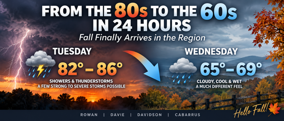
From the 80s to the 60s in 24 Hours: Fall Finally Arrives in the Region
After weeks of September heat, summerlike temperatures and seemingly endless thunderstorm chances, fall is finally ready to make an appearance across the region.
And the change is going to happen quickly.
Rowan, Davie, Davidson and Cabarrus counties will spend Tuesday on the warm side of an approaching cold front, with afternoon highs ranging from the lower to middle 80s. By Wednesday afternoon, many locations will struggle to get out of the 60s.
That means temperatures could be nearly 20 degrees cooler in just 24 hours.
One More Warm and Stormy Day
Tuesday is the transition day.
High temperatures are expected to reach around 84° in Rowan County, 82° in Davie County, 83° in Davidson County and 86° in Cabarrus County.
Showers and thunderstorms will become increasingly likely during the afternoon and evening as a cold front moves through the region.
A few storms could become strong to severe. Damaging wind gusts will be the primary severe-weather concern, while locally heavy rainfall could also create isolated flooding problems.
The greatest increase in thunderstorm coverage should come during the afternoon and early evening. The timing may be somewhat later toward Davidson County, where the better storm chances are expected late in the afternoon.
Once the front moves through, everything changes.
Wednesday Will Feel Like a Different Season
You won't need a calendar to tell you fall has arrived Wednesday morning.
Much cooler air will pour into the region behind the front while northeast winds become established.
Wednesday's forecast highs tell the story:
Rowan County: 67°
Davie County: 66°
Davidson County: 65°
Cabarrus County: 69°
Compare those numbers with Tuesday's highs in the 80s.
Davidson County, for example, goes from around 83° Tuesday to just 65° Wednesday — an 18-degree drop in the daytime high.
Cabarrus County falls from around 86° to 69°, while Rowan drops from 84° to 67°.
But the cold front isn't the only reason Wednesday will feel so dramatically different.
The Wedge Moves In
A classic cold-air-damming setup — often called "the wedge" — will develop across the Carolinas behind the front.
Cool air will become trapped against the eastern side of the Appalachian Mountains while northeast winds continue feeding cooler air into the Piedmont.
That setup is particularly good at producing the kind of weather expected Wednesday and Thursday: low clouds, periods of rain, a cool northeast breeze and temperatures that have a difficult time climbing during the afternoon.
So instead of the sunshine and rapidly warming temperatures we've grown accustomed to this September, Wednesday should remain cloudy and damp for much of the day.
Northeast winds may also become breezy at times, with some gusts around 20 to 25 mph.
The combination of temperatures in the 60s, clouds, rain and northeast winds will make it feel considerably cooler than anything we've experienced recently.
The Cool Weather Sticks Around Thursday
Don't expect temperatures to rebound immediately.
Thursday remains cool across the region, with forecast highs generally in the middle to upper 60s.
Morning showers will remain possible before rain chances gradually decrease.
Overnight temperatures will also begin looking much more like fall. By Thursday night into Friday morning, lows should fall to around 50° across much of the region, with some upper 40s possible.
That's quite a change from the warm and humid nights we've experienced through much of September.
Sunshine Returns for Friday and Saturday
There is good news for anyone who wants fall temperatures without the rain.
The wedge begins breaking down and drier air takes over by Friday.
Sunshine returns with afternoon highs generally in the lower 70s.
Saturday looks similarly pleasant, with plenty of sunshine, morning temperatures around 50° and afternoon highs reaching the middle 70s.
After Tuesday's thunderstorms and the chilly rain Wednesday and Thursday, Friday and Saturday should provide the kind of weather many people have been waiting for.
Has Summer Finally Lost Its Grip?
This week's change doesn't necessarily mean we've seen our final warm day of the year.
Warm spells can certainly return during late September and October in the Carolinas.
But this is one of the clearest signs yet that the seasonal transition is underway.
For weeks, the region has dealt with temperatures running well above normal and repeated stretches of summerlike heat.
Now we're about to experience the opposite.
From thunderstorms and temperatures in the 80s Tuesday to clouds, rain, northeast winds and highs in the 60s Wednesday and Thursday — followed by sunny afternoons in the 70s and mornings near 50°.
Fall officially arrived this week.
Now, for the first time this season, the weather is going to feel like it.