
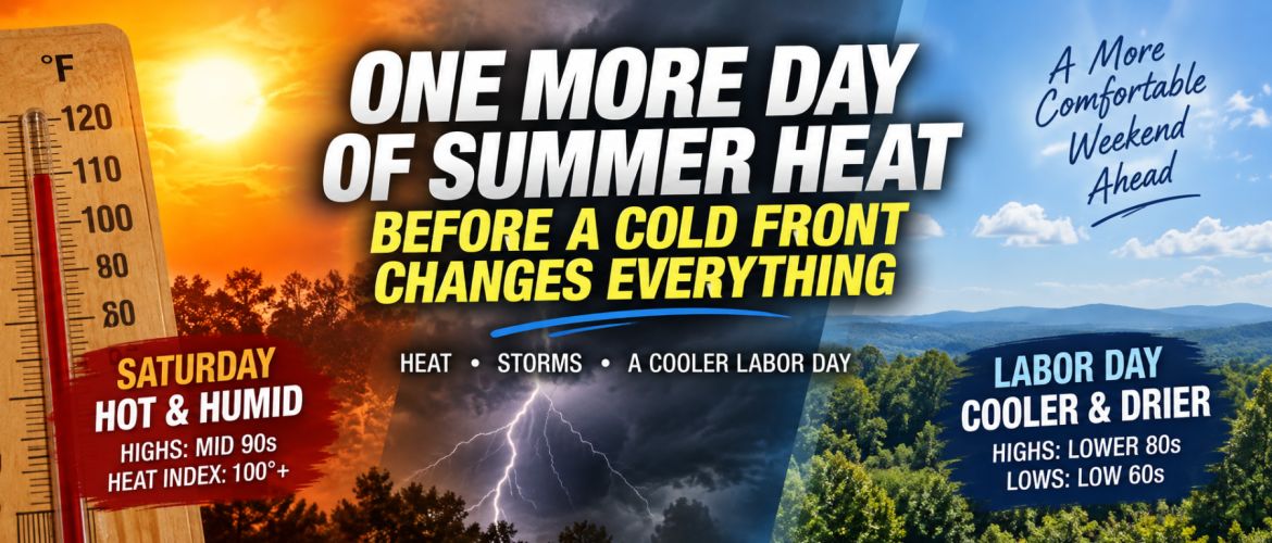
One More Day of Summer Heat Before a Cold Front Changes Everything
Summer is going to make its presence known one more time across the region Saturday, but a significant change is already on the way.
Temperatures will climb well into the 90s this afternoon, with the combination of heat and humidity pushing heat index values into the triple digits in some locations. By Labor Day, however, afternoon temperatures will struggle to get much beyond the lower to middle 80s.
Between the heat and the cooler air will come a cold front — and the potential for thunderstorms.
One More Hot Saturday
Saturday will begin quietly across much of the region, with plenty of sunshine allowing temperatures to climb quickly.
Rowan and Davie counties are forecast to reach around 95 degrees, while Davidson County should also reach around 95. Cabarrus County could climb to around 96.
The humidity will make it feel even hotter.
Heat index values could reach around 102 degrees in Rowan and Davie counties and around 103 degrees in Cabarrus County.
For anyone spending Saturday outdoors, especially with Labor Day weekend activities underway, heat precautions will remain important. Drink plenty of water, take breaks from the heat and remember that the hottest part of the afternoon will occur just before our weather begins to change.
A Cold Front Approaches
The front responsible for the upcoming cooldown will approach from the north Saturday afternoon and evening.
Ahead of it, thunderstorms are expected to develop across portions of North Carolina.
Storm coverage may initially be scattered, meaning not everyone will necessarily see a thunderstorm. However, the atmosphere will contain enough instability for some storms to become strong or severe.
Damaging wind gusts will be the primary concern with the strongest storms. Large hail around one inch in diameter will also be possible.
The timing will be important.
Across Rowan, Davie and Davidson counties, the better opportunity for thunderstorms appears to come late Saturday afternoon and into the evening. Cabarrus County may have to wait somewhat longer, with the better rain and storm opportunity continuing into Saturday night.
Anyone with outdoor plans Saturday afternoon or evening should keep an eye on the weather and have multiple ways to receive warnings.
Temperatures Tumble Sunday
The difference behind the front will become obvious Sunday.
Instead of another afternoon in the middle 90s, highs will generally remain in the middle 80s.
Rowan County is forecast to reach around 85 degrees Sunday. Davie County should reach around 84, Davidson County around 85 and Cabarrus County around 86.
That's roughly a 10-degree drop in afternoon temperatures in about 24 hours.
The humidity will also begin decreasing as cooler air works into the region.
But the frontal passage won't immediately mean completely dry weather.
Another Round of Showers and Storms Sunday
Enough moisture will remain behind and near the front for additional showers and thunderstorms Sunday.
Rain chances increase during the afternoon and evening, with Rowan, Davie and Davidson counties currently carrying around a 60 percent chance of precipitation. Cabarrus County has around a 40 percent chance during the day, increasing Sunday night.
There is also a risk for a few stronger storms across portions of the region Sunday.
The environment does not appear as favorable for widespread severe weather as Saturday, but damaging wind gusts could occur with stronger storms. Isolated hail cannot completely be ruled out.
Sunday therefore looks considerably cooler than Saturday, but it may not be the best day for uninterrupted outdoor activities.
Labor Day Looks Like the Payoff
By Monday, the front will be well south of the region and noticeably cooler and less humid air will have settled across the Carolinas.
And right now, Labor Day looks like the best weather day of the holiday weekend.
Mostly sunny skies are expected across Rowan, Davie, Davidson and Cabarrus counties.
Forecast highs are only around:
- 82 degrees in Davie County
- 83 degrees in Rowan County
- 84 degrees in Davidson County
- 84 degrees in Cabarrus County
That's quite a change from Saturday's middle 90s and triple-digit heat indices.
Monday night may feel even more impressive.
Temperatures are forecast to fall to around 62 degrees in Rowan, Davie and Davidson counties and around 63 in Cabarrus County.
After the heat we've experienced recently, opening the door to temperatures in the lower 60s will feel dramatically different.
Is the Summer Heat Finished?
Not completely.
Temperatures will begin climbing again Tuesday and Wednesday as high pressure builds across the southern and eastern United States.
Tuesday's highs should generally reach the middle 80s, followed by upper 80s Wednesday. Some locations could approach 90 degrees again later in the week.
There is an important difference, though.
The next area of high pressure currently does not look as hot or humid as what we've experienced recently, meaning another prolonged stretch of triple-digit heat indices is not currently evident.
Another cold front may also approach toward the end of next week, potentially bringing another opportunity for rain followed by another modest drop in temperatures.
A Weekend of Transition
Saturday and Labor Day will almost feel like they belong to different seasons.
Saturday brings middle 90s, oppressive humidity and heat indices potentially exceeding 100 degrees.
Then comes the cold front and thunderstorms.
By Labor Day, we're looking at sunshine, lower humidity, highs in the lower to middle 80s and nighttime temperatures falling into the lower 60s.
It's not the beginning of permanent fall weather — September will almost certainly have more warm days ahead.
But after weeks of summer heat, this weekend's cold front will provide the first substantial taste of the more comfortable weather many people have been waiting for.
Before we get there, however, we'll need to get through the thunderstorms.
I'll be watching radar trends throughout Saturday and Sunday and will have updates as storms develop and move across the region.