
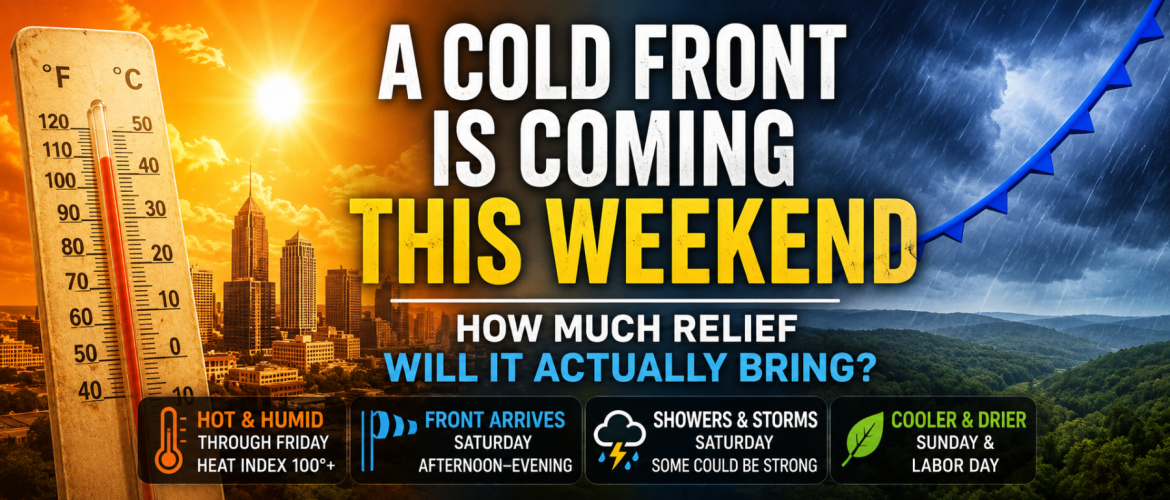
A Cold Front Is Coming This Weekend — How Much Relief Will It Actually Bring?
After several days of intense September heat, there is finally a change showing up in the forecast for this weekend.
A cold front is expected to move through the Carolinas as the strong ridge of high pressure responsible for this week's heat begins to weaken and shift west.
The front should eventually bring some relief to Rowan County and the surrounding region.
But don't expect fall to suddenly arrive the moment the front passes.
The first and potentially most noticeable change may not be the temperature at all.
It may be the humidity.
First, We Have to Get Through the Heat
Before the front arrives, we're facing several very hot days.
Temperatures across Rowan, Davie, Davidson and Cabarrus counties will climb well into the 90s through Friday, with some locations approaching the upper 90s.
Humidity will make it feel even hotter.
Heat index values could climb above 100 degrees in portions of the region, particularly Wednesday and Thursday.
That heat is being driven by a strong upper-level ridge positioned across the Southeast. Sinking air beneath that ridge suppresses widespread thunderstorm development while allowing temperatures to climb each afternoon.
For most of the workweek, there simply isn't much around to disrupt that pattern.
That begins to change this weekend.
What's Changing Saturday?
The upper-level ridge responsible for our heat is expected to weaken and retreat westward.
At the same time, an upper-level disturbance will move out of the Ohio Valley and across the Carolinas.
That disturbance will help push a cold front through the region.
Current guidance favors the front moving through the western Piedmont sometime Saturday afternoon or evening, although the exact timing can still change several days out.
Ahead of the front, temperatures will remain hot.
Highs Saturday are currently forecast to remain in the lower to middle 90s across much of the area.
So if you're expecting Saturday morning to suddenly feel like October, that's not what the forecast is showing.
The bigger changes should occur behind the front.
The Dewpoint May Tell the Story
One of the most important things I'll be watching is the dewpoint.
Dewpoint tells us how much moisture is actually present in the atmosphere and is one of the best ways to describe how humid the air feels.
When dewpoints climb into the upper 60s and 70s, conditions feel increasingly muggy and uncomfortable.
That's part of what makes this week's heat particularly difficult.
But behind this weekend's front, drier air should begin filtering into the region.
That means even if temperatures don't immediately plunge, it could feel considerably more comfortable.
For example, an afternoon temperature in the upper 80s with substantially lower humidity can feel completely different from a day in the mid-90s accompanied by oppressive humidity.
That's why this front could provide meaningful relief even if it doesn't immediately deliver dramatically cooler temperatures.
What About Temperatures?
There should eventually be some cooling as well.
The timing and magnitude will depend on exactly how quickly the front moves through and how much cooler air becomes established behind it.
The strongest temperature change currently appears more likely after Saturday rather than during the day Saturday itself.
Areas farther east across central North Carolina are increasingly expected to see highs fall into the 80s Sunday and Labor Day as high pressure builds behind the front.
For Rowan County and surrounding portions of the western Piedmont, the initial change may be more noticeable in the humidity before we see the full effect on temperatures.
That's an important distinction.
This isn't necessarily a dramatic fall cold front where temperatures instantly tumble 20 degrees.
Instead, it looks more like the beginning of a transition away from the oppressive combination of heat and humidity we've experienced this week.
Thunderstorms Could Accompany the Front
There's another part of this setup that I'll be watching closely.
As the ridge weakens and the upper-level disturbance approaches, the atmosphere should become more favorable for thunderstorms Saturday.
That's different from much of this week.
Through Thursday, strong sinking air associated with the ridge should suppress most thunderstorm development across our area.
By Saturday, that suppression begins to weaken.
The approaching front provides another mechanism for lifting warm, humid air and producing showers and thunderstorms.
Current forecasts already include increasing rain and storm chances across portions of the region Saturday afternoon and Saturday night.
Could Any Storms Become Severe?
It's possible, but we're not at the point where I would call severe weather a significant threat.
The environment Saturday should be more favorable for organized thunderstorms than what we'll have during the middle of the week.
However, there are still several important details that need to come into focus.
The exact timing of the front will matter.
If the front arrives during peak afternoon heating, the atmosphere could have more instability available for thunderstorms.
If it arrives later Saturday night, instability could be considerably weaker.
We'll also need to watch wind shear, moisture, cloud cover and the strength of the upper-level disturbance.
At this point, the appropriate message is simply that Saturday deserves watching.
As we get closer, we'll have a much better idea of whether we're dealing with ordinary summertime thunderstorms or something potentially stronger.
Is This the Beginning of Fall Weather?
Not necessarily.
September is a transition month in North Carolina, and temperatures can still climb well into the 90s even after a cold front moves through.
Meteorological fall may have started September 1, but our atmosphere doesn't follow the calendar.
What this front could do is temporarily break the pattern responsible for this week's extreme heat.
Lower humidity, somewhat cooler temperatures and more comfortable mornings would certainly make it feel more like September.
But that doesn't mean we're finished with hot weather for the year.
There is still plenty of time for additional warm or even hot stretches during September.
What I'm Watching
There are three things I'll be paying particularly close attention to as we move through the week.
First is the timing of the front. Right now, Saturday afternoon into Saturday evening appears to be the favored window across the western Carolinas.
Second is the thunderstorm environment. As the ridge breaks down, conditions should become more supportive of storms, but it's too early to determine whether severe weather will become a meaningful concern.
Third is the air behind the front.
How far temperatures fall will certainly matter, but I'll be paying just as much attention to dewpoints. If significantly drier air arrives behind the front, the difference could be immediately noticeable even before temperatures fall dramatically.
The Bottom Line
We still have several days of significant heat to get through first.
Wednesday through Friday will bring temperatures well into the 90s, along with potentially dangerous heat index values across portions of the region.
Saturday remains hot, but the weather pattern begins changing as a cold front approaches.
Showers and thunderstorms become possible with the front, and I'll be monitoring the potential for stronger storms as the setup becomes clearer.
Then comes the part many people are waiting for.
Behind the front, humidity should begin dropping and temperatures should eventually follow.
It probably won't feel like a crisp October afternoon.
But after several days of temperatures in the mid and upper 90s and heat index values over 100 degrees, even a drop in humidity could make a substantial difference.
And for the first weekend of meteorological fall, we'll take it.
Rowan County Weather and Regional Forecast