
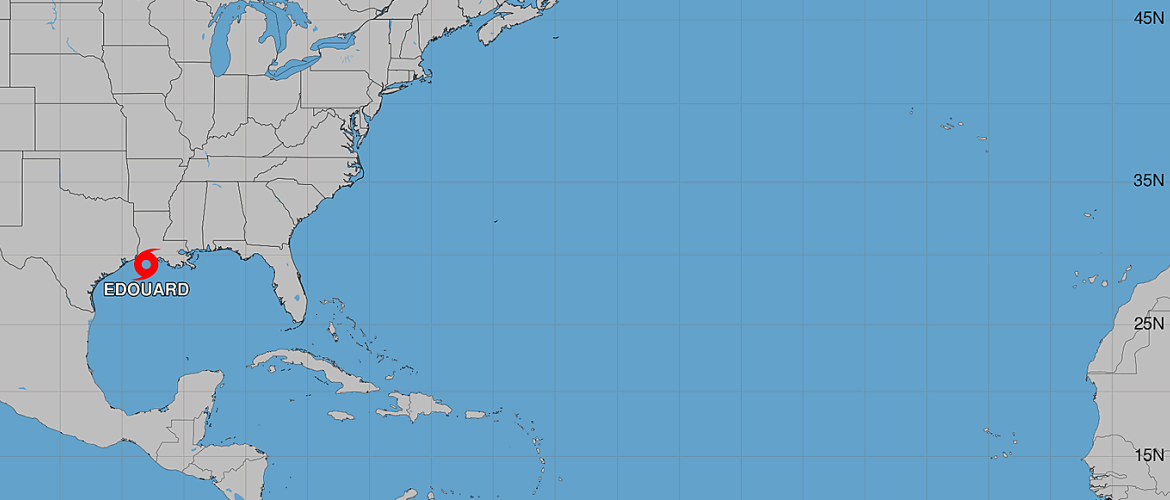
Tropical Storm Edouard Could Rapidly Strengthen Before Gulf Coast Landfall Today
Tropical Storm Edouard is approaching the northwestern Gulf Coast this morning, and forecasters are becoming increasingly concerned that the storm could strengthen rapidly before making landfall near the Louisiana-Texas border later today.
As of the 4 AM CDT advisory Tuesday, September 1, Edouard had maximum sustained winds of 40 mph and was moving west-northwest at approximately 8 mph.
While Edouard remains a tropical storm, its organization and the environment surrounding it have raised the possibility of significant strengthening during the remaining hours before landfall.
A Small Core Could Allow Edouard to Strengthen Quickly
Edouard's center has become relatively easy to identify on satellite and radar imagery this morning. Reconnaissance aircraft investigating the storm also found indications that a small inner core may be developing.
That could become particularly important today.
Small tropical cyclones with a well-defined inner core can sometimes experience very rapid changes in intensity. Edouard is also moving through an environment that is highly favorable for strengthening.
Sea-surface temperatures are around 31°C, or approximately 88°F, while vertical wind shear is very low. Those conditions provide Edouard with plenty of warm ocean energy and relatively little atmospheric resistance to strengthening.
Some hurricane models indicate that Edouard could become a hurricane before reaching the coast.
The National Hurricane Center's official forecast is somewhat more conservative but still calls for Edouard to strengthen considerably before landfall, potentially reaching sustained winds around 65 mph.
Because of Edouard's small and developing core, forecasters caution that short-term intensity changes could occur quickly.
Another Air Force Reserve reconnaissance aircraft is scheduled to investigate the storm this morning, providing additional information about Edouard's strength and structure.
Landfall Expected Later Today
Edouard continues moving west-northwest and is expected to gradually turn toward the northwest as it moves around an area of high pressure positioned over the southeastern United States.
The current forecast brings the center of Edouard ashore later today near the Louisiana-Texas border.
The storm should then move inland across eastern Texas tonight.
Once the center moves over land, rapid weakening is expected. Edouard could become post-tropical within approximately 36 hours and dissipate within about 48 hours.
Hurricane Conditions Are Possible
Tropical storm conditions are expected along portions of the northwestern Gulf Coast today.
However, because Edouard could strengthen rapidly immediately before landfall, hurricane conditions are possible from High Island, Texas, eastward to Cameron, Louisiana.
Anyone within or near the warning areas should be prepared for conditions to deteriorate quickly as Edouard approaches.
Dangerous Storm Surge Expected
Storm surge will also be a significant concern near and east of where Edouard reaches the coast.
A Storm Surge Warning is in effect from High Island, Texas, to the Vermilion/Cameron Parish Line in Louisiana.
Water levels could reach approximately 3 to 5 feet above ground level along portions of the immediate coastline within the warning area.
The exact magnitude of the surge at individual locations will depend on Edouard's track, intensity, coastline configuration and the timing of the surge relative to the normal tidal cycle.
Flash Flooding Likely
Heavy rainfall will accompany Edouard well beyond the immediate coastline.
Parts of the Upper Texas Coast, east-central Texas and far southwestern Louisiana are expected to receive heavy rainfall today and Wednesday as Edouard moves inland.
Flash flooding is likely in portions of this region, with urban areas particularly vulnerable to rapidly developing flooding.
River flooding may also become a concern depending on how much rain falls and where the heaviest bands become established.
What I'm Watching Today
The biggest question over the next several hours will be how quickly Edouard strengthens before reaching the coastline.
Conditions over the Gulf are favorable enough for significant intensification, and Edouard appears to be developing the type of small inner core that can sometimes support rapid changes in strength.
The window for strengthening is short because landfall is expected later today, but it may be enough time for Edouard to become a considerably stronger tropical storm. Some hurricane models even bring the system to hurricane strength before landfall.
The next reconnaissance mission will be especially important. Aircraft observations should give forecasters a much better look at whether Edouard's inner core continues organizing and how quickly its central pressure and winds are changing.
For residents along the northwestern Gulf Coast, this is not a storm to judge solely by its current classification. Edouard could be considerably stronger when it reaches the coastline than it is early this morning.
I'll continue tracking Tropical Storm Edouard and provide updates as new reconnaissance data, forecast information and warnings become available.
Rowan County Weather and Regional Forecast