
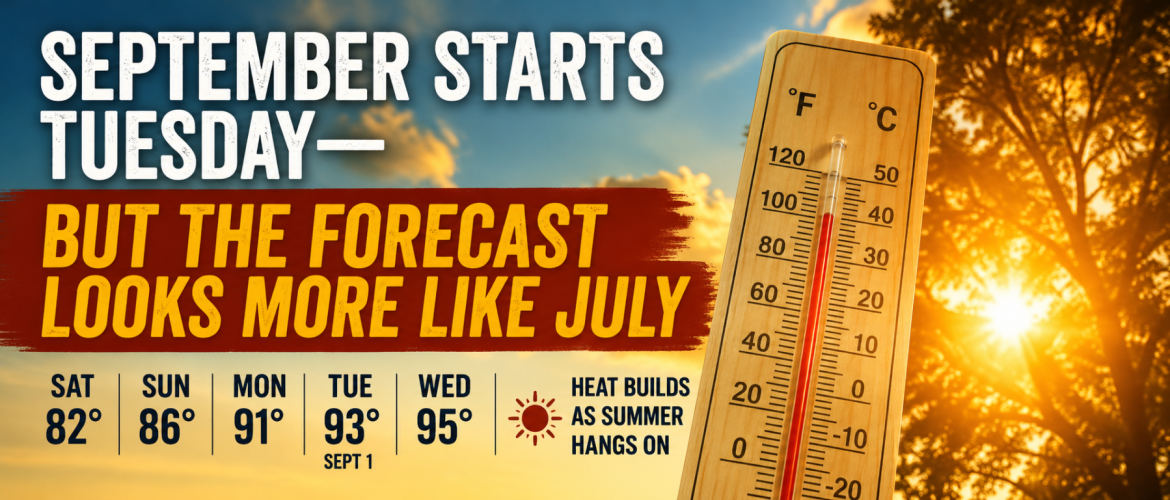
September Starts Tuesday — But the Forecast Looks More Like July
September arrives Tuesday, but you probably won’t know it by stepping outside.
Instead of cooler mornings, comfortable afternoons and an early hint of fall, Rowan County is heading into a stretch of weather that will look and feel much more like the middle of summer.
After a relatively cool and cloudy Saturday with a high around 82 degrees, temperatures will begin climbing Sunday. By Monday, Rowan County should reach around 91 degrees. Tuesday — the first day of September — is forecast to reach around 93 degrees, followed by a high near 95 degrees Wednesday.
And the actual temperature may only tell part of the story.
Meteorological Fall Begins, but Summer Heat Doesn't Follow the Calendar
September 1 marks the beginning of meteorological fall.
Meteorologists divide the seasons into three-month periods for record keeping and climate comparisons. Meteorological summer consists of June, July and August, while meteorological fall includes September, October and November.
But the atmosphere doesn't flip a switch when the calendar changes.
North Carolina can still experience significant summer heat during September, and that appears to be exactly what will happen as we begin the new month.
Why Is It Getting So Hot Again?
The change begins high above us.
A strong ridge of high pressure is expected to become established across the southeastern United States as we move into the new workweek.
Under a strong ridge, air sinks through the atmosphere. Sinking air generally discourages clouds and thunderstorms while allowing more sunshine to reach the ground.
At the same time, a Bermuda High-like pattern over the western Atlantic will help bring warmer and increasingly humid air into the region.
The result will be fewer afternoon thunderstorms, more sunshine and rapidly increasing temperatures.
It's essentially a return to a classic summertime weather pattern just as meteorological summer officially comes to an end.
From 82 Degrees to the Middle 90s
The temperature change over just a few days will be noticeable.
Saturday's high in Rowan County is expected to be around 82 degrees.
Sunday climbs to around 86.
Monday reaches approximately 91.
Tuesday reaches around 93.
By Wednesday, the forecast high is near 95 degrees.
That's an increase of roughly 13 degrees between Saturday and Wednesday.
And depending on exactly how strong the ridge becomes, the hottest weather may not arrive until the second half of the week.
The Heat Index Could Become the Bigger Concern
Temperatures in the middle 90s are hot enough on their own, but humidity will play an important role in how conditions actually feel.
As temperatures rise and moisture remains in the lower atmosphere, heat index values could climb into the upper 90s or potentially reach the lower 100s across portions of the region by the middle of next week.
By the second half of the week, conditions could potentially reach Heat Advisory criteria.
We're still several days away, so exactly how high heat index values climb will depend heavily on afternoon dewpoints. Small changes in humidity can make a significant difference when temperatures are already in the middle or upper 90s.
That's something I'll be watching closely as we get closer.
September Can Still Bring Serious Heat
It's easy to associate September with cooler temperatures, football, pumpkin spice and the beginning of fall.
In reality, September can still produce some very hot days across North Carolina.
The sun angle is gradually decreasing and daylight is getting shorter, but there's still plenty of energy available to produce significant heat — particularly when a strong ridge develops over the Southeast.
True fall weather usually arrives through a series of increasingly strong cold fronts later in the season rather than simply because we've reached September on the calendar.
That means a September afternoon can occasionally feel every bit as hot as one in July or August.
Storm Chances Are Also Disappearing
Another noticeable change will be the lack of our familiar afternoon thunderstorms.
We've spent the past several days dealing with scattered showers and thunderstorms across the region. There is another 30 percent chance in Rowan County Saturday afternoon, mainly between 2 PM and 4 PM.
After that, opportunities for rain decrease considerably.
As high pressure strengthens, the atmosphere becomes less favorable for the daily development of thunderstorms.
Sunday should be mainly dry, and sunshine becomes increasingly dominant beginning Monday.
That lack of afternoon cloud cover and rainfall will also help temperatures climb.
Don't Put Away the Summer Weather Habits Yet
Even though September begins Tuesday, this is not the week to start treating the weather like fall.
If you're working outside, practicing sports, attending outdoor events or spending extended periods in the heat next week, continue following the same precautions you would during the middle of summer.
Drink plenty of water, take breaks in air conditioning or shade when possible, and pay attention to how you're feeling during prolonged exposure to the heat.
Also remember that vehicles can become dangerously hot very quickly. Never leave children or pets unattended inside a parked vehicle.
The Bottom Line
Meteorological fall begins Tuesday.
The weather apparently didn't get the memo.
Rowan County goes from a high around 82 degrees Saturday to around 91 Monday, 93 Tuesday and 95 Wednesday.
Increasing humidity could push heat index values toward or above 100 degrees as we move deeper into the week, and Heat Advisory-level conditions could eventually become possible.
So while the calendar is about to say September, the atmosphere has one more significant stretch of summer weather in store for us.
I'll continue tracking the heat over the next several days and will have updates as confidence increases on just how hot the first week of September could become.