
Winter Storm Chatter for this weekend
I mentioned yesterday that buzz was generating over the possibility of winter weather this weekend. The chances of the winter weather occurring are pretty slim even to this point. I would give it about a 10% chance at this point. The one thing I will say for sure is we will get rain and most likely a very cold rain. The residents who have a better chance of seeing snowfall this weekend are residents who live north along the NC/VA border. As I have done in the past I am going to show you two models that I use when tracking winter weather and these models are pretty good for looking a few days out on a potential storm. I watch for trends in the models and see how they continue to fluctuate as we get closer to the potential for winter weather. Let's take a look at those models.
The GFS Model is pretty good at giving you indications that something is likely to occur where it struggles is with the actual amount of precipitation you could get. The GFS overshoots the totals most of the times.
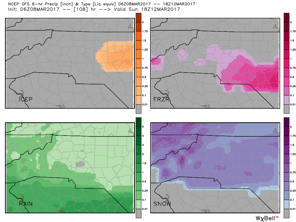
The image above is from the GFS and shows the different types of precipitation that is likely to occur during a given timeframe. Based on the current information in this model we have a chance of seeing a rain/snow mix during the overnight hours from Saturday night into Sunday morning. Please note this would be a very brief period of rain/snow mix. I think there will be too much warm air aloft and most of the precipitation will be rain.
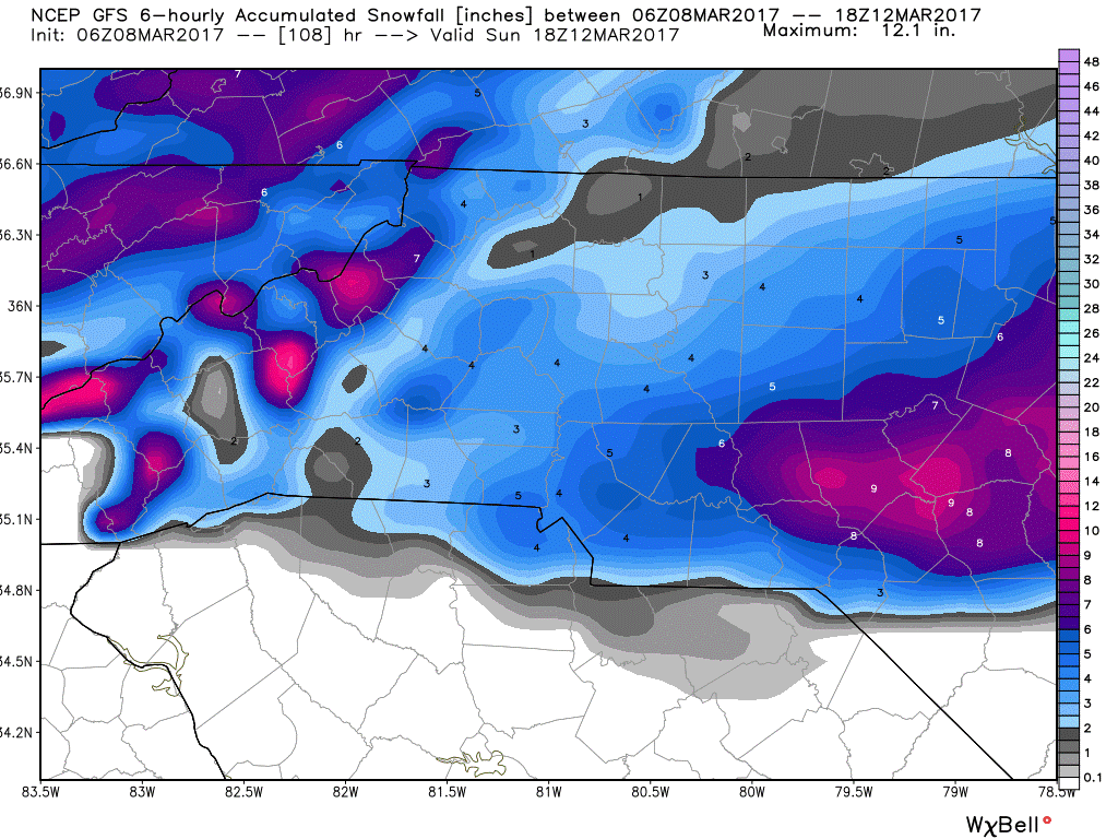
The image above shows the total amount of accumulated snowfall the GFS is predicting for our county and area. As I mentioned above the GFS always overshoots the total for accumulation. The models do a bad job of differentiating between liquid and solid precipitation and totals tend to be very inflated. I think soil temps are going to really chew away at these forecasted totals by the GFS
The European Model
The European Model does a much better job in winter storm situations and provides a little clearer picture when taking the information it has to offer into account.

The model data above form the European Model shows the possibility of a brief period of all snow very early Sunday Morning. Very brief being the keywords! The data out there still tends to point to a rain snow mix with most of the precipitation being all rain.
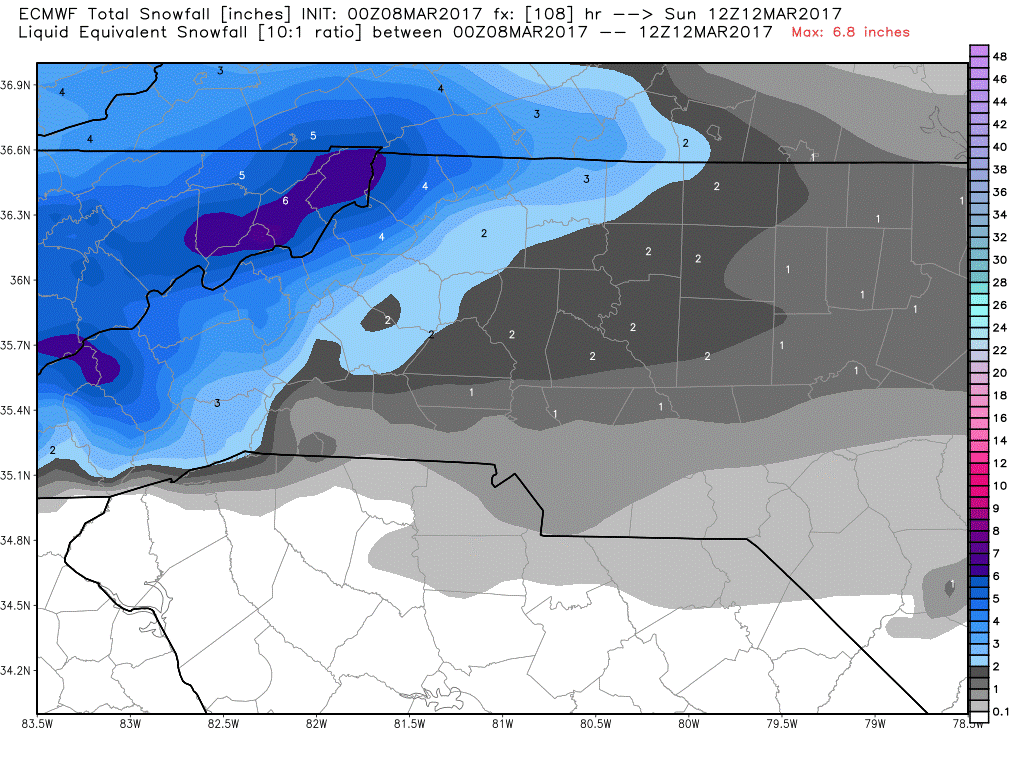
The totals of possible accumulation in snowfall on the European Model shows a chance for 1-2 inches of snow around the county. Again remember the models have a difficult time differentiating between liquid and solid precipitation so totals get inflated.
So lets break down my thoughts at this time.
- Saturday Night into Sunday Morning 70% Chance we see all rain through around 4am.
- From 4am to around 8am it is possible we could see a rain/snow mix with the majority of the precipitation being all rain.
- Accumulations I am not calling for any at this time. The window is too brief for all snow to occur and the soil temperatures are very warm.
- Preparedness: Just continue to pay attention to my forecast updates but I would not rush to the grocery store and raid the bread and milk aisles in a mad panic.
I will continue to provide updates right here and on my social media outlets as new information and model data come in. As always thank you for following Rowan County Weather!
Please let our local sponsors know that you appreciate their support of our blog. Take a moment to visit their website linked at the top of this post.
Share this:

Announcements & Events
Check back often for important announcements and events that I'll be involved in!