
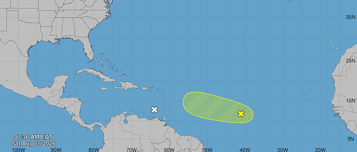
AL94 Being Monitored in Central Tropical Atlantic With 10% Development Chance
A tropical wave designated AL94 continues to be monitored across the central tropical Atlantic Saturday morning, but its chances for development remain low.
As of 8:00 AM Saturday, August 15, AL94 was located approximately midway between the Cabo Verde Islands and the Lesser Antilles and was producing disorganized showers and thunderstorms.
Limited Development Possible
Some limited development of AL94 is possible during the next day or two as the tropical wave continues moving across the central Atlantic.
However, the environment is expected to become increasingly unfavorable as the system approaches the area east of the Lesser Antilles.
Strong upper-level winds are expected to interfere with the system's organization, significantly limiting its opportunity for further development.
The tropical development chances for AL94 currently stand at:
- Through 48 hours: 10%
- Through 7 days: 10%
No Immediate Threat to North Carolina
AL94 remains far out in the central tropical Atlantic and does not currently represent an immediate threat to North Carolina.
With development chances remaining low and increasingly hostile atmospheric conditions expected ahead of the system, there is currently little indication that AL94 will become a significant tropical cyclone.
Still, tropical systems can evolve, and August marks a time of year when activity across the Atlantic typically begins increasing.
Rowan County Weather will continue monitoring AL94 and the rest of the Atlantic basin for any changes that could eventually become relevant to the Carolinas.
AL94 Development Chances as of 8 AM Saturday:
48 Hours: 10%
7 Days: 10%
Continue following Rowan County Weather for updates throughout the 2026 Atlantic hurricane season.