
Two Tropical Waves Being Monitored Across the Atlantic
The Atlantic tropics are showing signs of increased activity as two tropical waves are being monitored for possible development during the upcoming week.
As of Sunday morning, August 9, neither system poses an immediate threat to the United States, and development is not expected during the next 48 hours. However, one of the waves has a medium chance of becoming a tropical depression later this week.
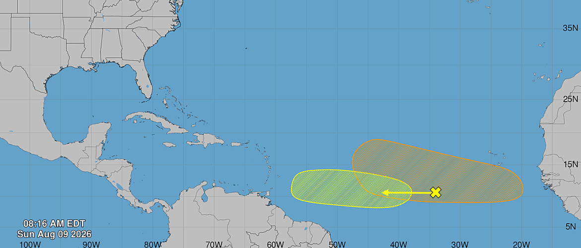
Central Tropical Atlantic
A broad area of showers and thunderstorms associated with a tropical wave is located several hundred miles west-southwest of the Cabo Verde Islands.
Gradual development of this system is possible during the early to middle part of the week as it moves westward across the central tropical Atlantic.
Environmental conditions are expected to become less favorable for development later in the week as the system approaches the Lesser Antilles.
The chance of tropical cyclone formation is near 0 percent during the next 48 hours and 20 percent during the next seven days.
Eastern and Central Tropical Atlantic
A second tropical wave is expected to move off the west coast of Africa early this week.
Unlike the first system, environmental conditions are expected to become favorable for gradual development after the wave enters the Atlantic. A tropical depression could form during the latter half of the week as the system moves generally westward across the eastern and central tropical Atlantic.
The chance of formation is near 0 percent during the next 48 hours but increases to 40 percent during the next seven days.
What to Watch This Week
The second tropical wave will be the system to watch most closely over the next several days because conditions appear more favorable for organization once it moves off Africa.
However, both systems remain a long way from the United States, and it is far too early to determine whether either will eventually affect the Southeast or any other part of the United States.
There are currently no immediate tropical threats to North Carolina from these systems.
This is the time of year when tropical activity across the Atlantic typically begins increasing as we move closer to the climatological peak of hurricane season in September.
Rowan County Weather will continue monitoring both tropical waves and provide updates if either system becomes better organized or if there are indications of a potential impact to the United States.