Rowan County Forecast: Dangerous Heat Builds Through the Fourth of July Weekend
Summer is about to turn up the heat across Rowan County, with a prolonged stretch of hot and mostly dry weather expected through the Independence Day holiday weekend. Temperatures will climb into the upper 90s to around 100 degrees by the end of the week, while heat index values will regularly exceed 100 degrees during the afternoon.
Although Heat Advisories have not been issued at this time, the combination of several consecutive hot days and holiday outdoor activities will create an elevated risk for heat-related illnesses. If you have plans outside, make sure you're taking the heat seriously.
Forecast
Tuesday
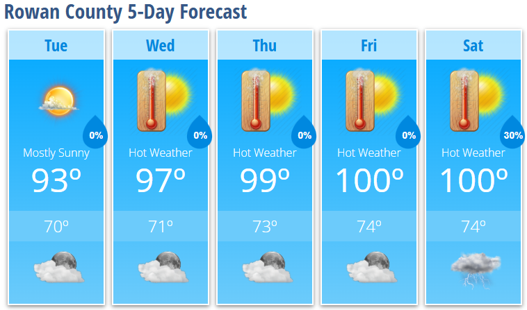
Mostly sunny with a high near 93°. Light and variable wind.
Tuesday Night
Mostly clear with a low around 70°.
Wednesday
Sunny and hot with a high near 97°. Heat index values as high as 102°.
Wednesday Night
Mostly clear with a low around 71°.
Thursday
Sunny and very hot with a high near 99°.
Thursday Night
Mostly clear with a low around 73°.
Friday
Sunny and dangerously hot with a high near 100°.
Friday Night
Mostly clear with a low around 74°.
Independence Day (Saturday)
Sunny and hot with a high near 100°.
Saturday Night
A 30% chance of showers and thunderstorms before 2:00 AM. Partly cloudy with a low around 74°.
Heat Becomes the Main Weather Story
A strong ridge of high pressure will settle over the Southeast through the remainder of the week, allowing temperatures to steadily climb. Afternoon highs will reach the upper 90s Wednesday and Thursday before peaking around 100 degrees Friday and Saturday.
Even though afternoon humidity may mix out somewhat during the hottest part of the day, heat index values are still expected to top 100 degrees. Multiple days of extreme heat can place added stress on the body, especially for those working or spending extended time outdoors.
If you're attending Fourth of July celebrations, cookouts, sporting events, or fireworks displays, remember to:
- Drink plenty of water throughout the day.
- Take frequent breaks in the shade or air conditioning.
- Wear lightweight, light-colored clothing.
- Check on elderly neighbors and those without adequate cooling.
- Never leave children or pets inside parked vehicles—even for a few minutes.
Rain Chances Stay Low
Most of the daily thunderstorm activity will remain confined to the North Carolina mountains through the week. Rowan County is expected to stay dry through Saturday, although a few isolated showers or thunderstorms could develop Saturday night as the ridge begins to weaken.
Looking ahead, rain and thunderstorm chances are expected to become more common late in the holiday weekend and early next week.
Record Heat Could Be Challenged
The upcoming stretch of heat will bring temperatures close to long-standing records in the Carolinas.
For comparison, Charlotte's record highs are:
- July 2: 101°
- July 3: 99°
- July 4: 99°
While Rowan County may not officially tie those records, afternoon temperatures near 100° will make this one of the hottest stretches of weather so far this summer.
Stay weather aware, stay hydrated, and have a safe Independence Day holiday as dangerous heat settles across Rowan County.