Davidson County Forecast: Significant Heat Wave Expected Through the Holiday Week
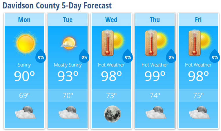
A prolonged stretch of dangerous summer heat is expected to develop across Davidson County this week. Following a pleasant Monday and Tuesday, a strengthening upper-level ridge will allow temperatures to surge into the upper 90s from Wednesday through Friday, with heat index values climbing above 100 degrees and little relief at night.
Monday
Sunny skies will dominate with a high near 90°. A light northeast breeze develops during the afternoon. Monday night will be partly cloudy with a low around 69°.
Tuesday
Mostly sunny and a bit warmer with a high near 93°. Tuesday night will be mostly clear with a low around 70°.
Wednesday
The heat wave begins to take hold. Expect sunny skies with a high near 98°. Wednesday night will remain clear and warm with a low around 73°.
Thursday
Another hot and sunny day is expected with a high near 99°. Overnight temperatures will only fall to around 74°, providing little relief from the daytime heat.
Friday
Very hot conditions continue with abundant sunshine and a high near 98°. Friday night will be mostly clear with a low around 75°.
What Has Changed?
There are no significant changes to the overall forecast. Confidence remains high that a prolonged period of dangerous heat will develop across central North Carolina through the holiday week.
Significant Heat Wave Ahead
The primary weather story this week will be the increasing heat. A strong upper-level ridge will strengthen over the eastern United States, allowing temperatures to climb well above normal through the end of the week.
By Wednesday through Friday:
- Afternoon highs will reach the upper 90s.
- Heat index values are expected to exceed 100 degrees in many areas.
- Overnight lows will remain in the lower to middle 70s, limiting overnight cooling.
Several daily temperature records could be challenged across central North Carolina during this stretch.
If you have outdoor plans this week or are preparing for Fourth of July celebrations:
- Drink plenty of water throughout the day.
- Take frequent breaks in the shade or air conditioning.
- Wear lightweight, light-colored clothing.
- Never leave children or pets inside a parked vehicle.
- Check on elderly neighbors, friends, and relatives who may be more vulnerable to the heat.
Looking Ahead
The hottest weather is expected to continue into the Independence Day holiday. There are signs that temperatures may ease slightly over the weekend as the upper ridge weakens and the chance for afternoon showers and thunderstorms gradually increases. Until then, expect a hot, mainly dry weather pattern to dominate Davidson County.