

Strong Thunderstorm Moving Across Davidson County Through 5:45 PM
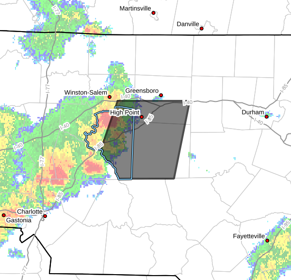
The National Weather Service has issued a Special Weather Statement for Davidson County as a strong thunderstorm moves east across the area through 5:45 PM.
At 5:01 PM, Doppler radar indicated a strong thunderstorm located near Thomasville, or about 8 miles west of High Point, moving east at 40 mph.
The storm is capable of producing:
- Wind gusts up to 50 mph
- Pea-size hail
- Frequent cloud-to-ground lightning
- Heavy rainfall that could briefly reduce visibility
Communities that may be impacted include Lexington, Thomasville, and Linwood, along with other portions of Davidson County. The storm will also affect parts of Forsyth, Guilford and Randolph counties as it continues moving east.
While this storm is below severe warning criteria, wind gusts up to 50 mph can still break tree limbs, blow around unsecured outdoor objects and lead to isolated power outages. Small hail may also cause minor damage to vegetation.
The greatest hazard with this storm may be the lightning. Frequent cloud-to-ground lightning is occurring, and lightning can strike well away from the heaviest rain. If you hear thunder, move indoors immediately and remain inside a sturdy building or vehicle until the storm passes.
I will continue monitoring this storm and provide additional updates if it strengthens or if warnings are issued for Davidson County.