

Strong Thunderstorms Moving Into Davidson County Through 5:00 PM
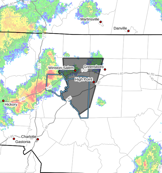
The National Weather Service has issued a Special Weather Statement for Davidson County as a line of strong thunderstorms moves east across the area through 5:00 PM.
At 4:13 PM, Doppler radar showed a line of strong thunderstorms extending from Enon to near Cooleemee to near Cleveland, moving east at 35 mph.
The strongest storms are capable of producing:
- Wind gusts up to 50 mph
- Pea-size hail
- Frequent cloud-to-ground lightning
- Heavy downpours that could briefly reduce visibility
Communities that may be impacted include Lexington, Thomasville, Linwood, along with other portions of Davidson County. The storms will also affect parts of Forsyth, Guilford and Randolph counties as they continue moving east.
While these storms are not currently severe warned, wind gusts of 50 mph can still break tree limbs, blow around unsecured outdoor objects and produce isolated power outages. Pea-size hail may cause minor damage to gardens and other vegetation.
If you are outdoors, move inside a sturdy building as the storms approach. Lightning can strike well away from the heaviest rain, so don't wait until the storm is directly overhead to seek shelter.
I will continue monitoring these storms and will provide updates if stronger storms develop or if any warnings are issued for Davidson County.